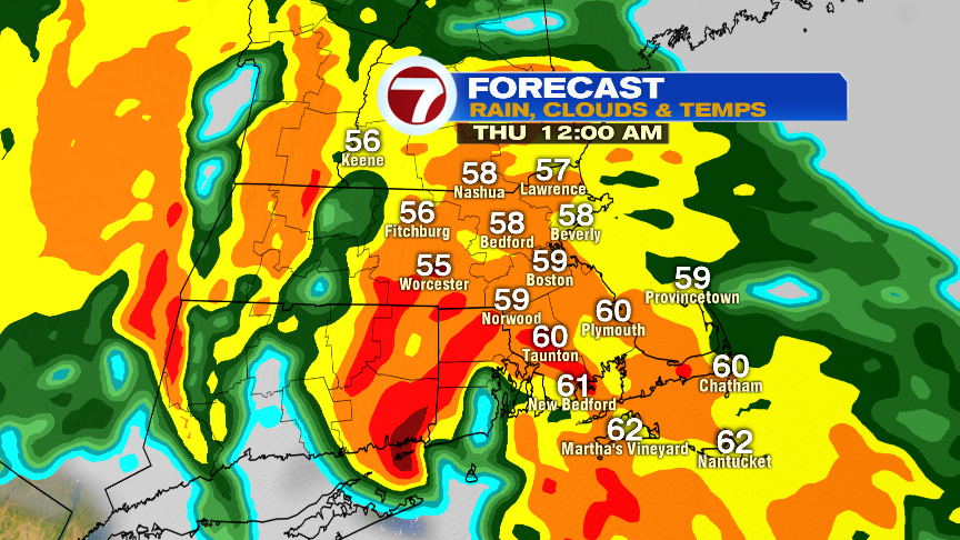
A clear and chilly start kicks off this Wednesday morning as many of the suburbs start off in the low to mid 30s. With morning sunshine, the recovery will be nice, into the lower 60s. Clouds do thicken this afternoon, foreshadowing the incoming storm ahead. Showers likely start breaking out near the tail end of the evening commute as moisture arrives from our west.

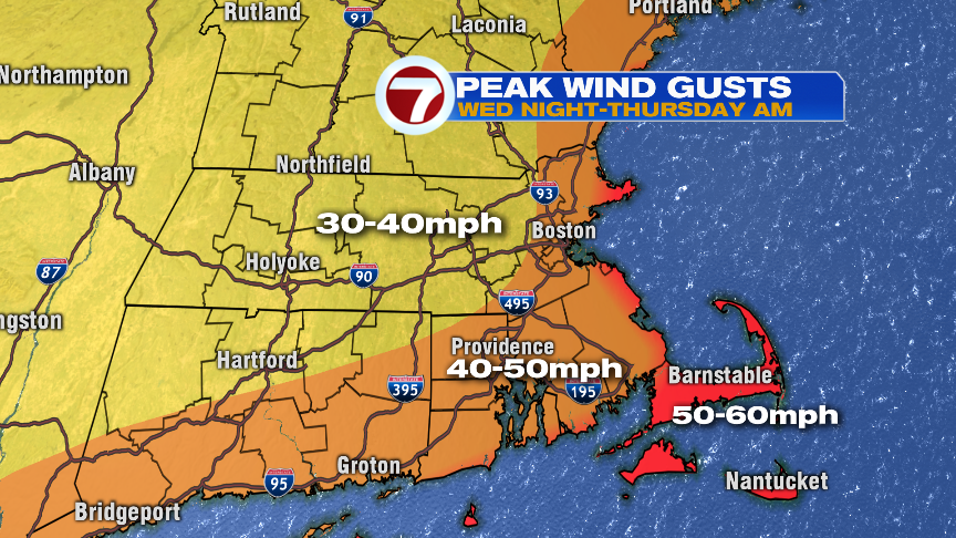
The weather will go downhill quickly this evening with heavy rain likely widespread by 10pm. As a storm rapidly develops (undergoes bombogenesis which is at least a 24mb drop in 24hrs) just to our south and then right over New England, not only will downpours be a threat, but we’ll also contend with strong wind gusts. As a low level jet roars overnight (wind a couple thousand feet above the surface), the concern is that occasionally, a thunderstorm or tropical downpour can tap into that wind and create damaging wind gusts. Wind gusts peak near the coast, 50-60mph, with an isolated higher gusts possible if some of the low level jet wind can mix down. Inland, gusts will be around 40mph give or take.
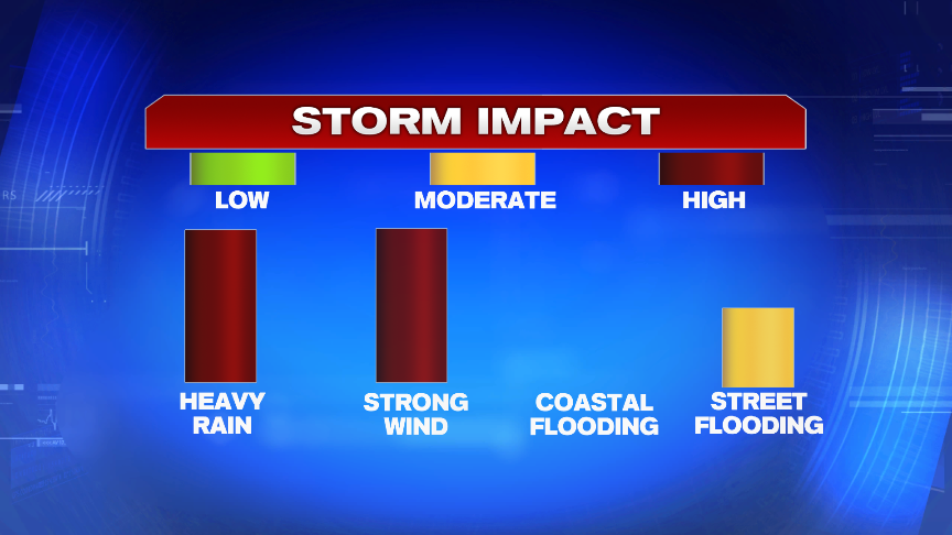
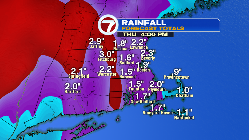
Rain totals average 1-2″ across much of eastern Mass with a few 3″ totals possible in the Worcester Hills. River flooding is not a concern, but localized street flooding/poor drainage flooding overnight is likely.
The strongest winds will be at the coast and with a lot of leaves still on the trees, pockets of scattered tree damage/power outages is certainly possible.
By tomorrow morning’s commute, a dry patch of air punches through, but I’d expect a slow go with lots of puddles/standing water on the roads as well as some tree branches and lots of wet leaves on some of the secondary roads.
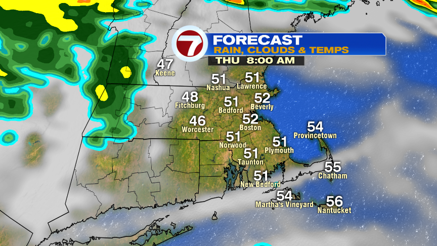
Tomorrow afternoon features a few showers and gusty winds out of the west to southwest. Most of us see gusts tomorrow afternoon near 40mph, but a few 50mph gusts will be felt across the south coast, including the Cape and Islands.