
Today? Dreary. Tomorrow? Dreary. This weekend? Helllooooooo, summer!
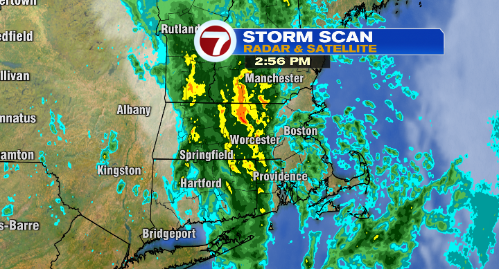
Let’s go chronologically– we’ll see clouds, rain (even a rumble of thunder) during the late afternoon and early evening. Be prepared for a slow, soggy commute home!
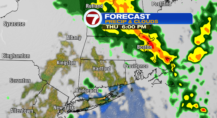
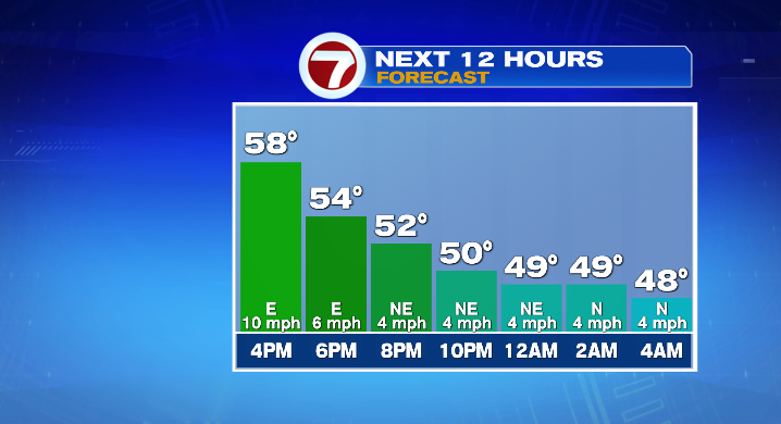
Then mist & drizzle as the heavy stuff moves on. Low temperatures will be in the upper 40s and low 50s– not bad for this time of year, but it will just feel damp and cool.
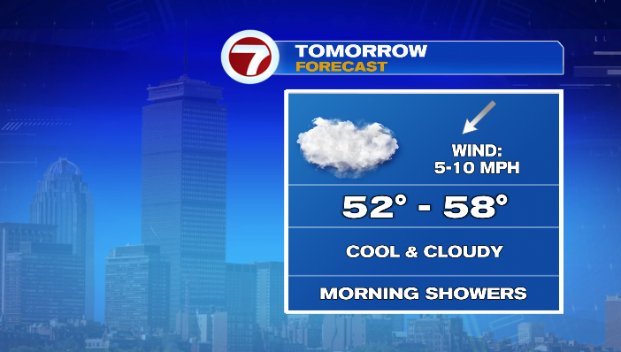
Even Friday, particularly Friday morning, it will be drizzly and showery at times as low pressure moves out of the area. The second half of Friday will be drier, but overall it’ll be a cool and breezy day, with highs only hitting the mid 50s.
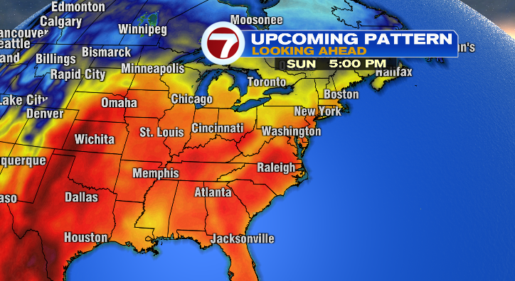
But, for those looking for a warm-up, high pressure will play the hero, settling over New England into the weekend and sending us into a totally new pattern. Warmer air will cruise into the region, building each day.
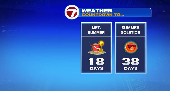
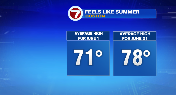
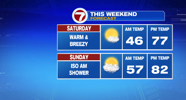
Saturday will be nice and dry with highs in the mid 70s –closer to our average highs for mid-June, rather than those of mid-May. In fact, the average high for June 1 (the start of meteorological summer) is 71, while the average high for June 21 (the summer solstice) is 78. We’ll be much closer to those temperatures!
Sunday will be in the upper 70s and low 80s! We have a chance of a brief shower mid-morning on Sunday. Otherwise, we’ll see a mix of sun & clouds, and wind gusts in the 20s.
We’ll keep the summerlike warmth rolling on Monday– with a breeze from the east, temperatures will be slightly cooler, especially for the coast. That said, we’ll still be in the 60s along the coast, and 70s inland. Still above average for many in the area!
Heat will build back in Tuesday and Wednesday! We’ll be in the mid to upper 80s both days! Tuesday looks dry, as does most of Wednesday during the daytime. However, rain returns by Wednesday night with a cold front that will help to bring temperatures back down.