It’s a Tuesday, so we must have a storm. What else is new? Rain and snow plague us this morning with mainly rain in Boston and mainly snow across northern Mass and Southern NH. The battle zone from 95 to 495 (north of the Pike) will see bursts of heavy, wet snow when precipitation is intense and rain/sleet in the mix when precipitation is lighter. Accumulations just north of Boston run around a coating-1″ with 1-3″ widespread in the light blue band you see of the map below. Rain and snow tapers off this afternoon and we’ll dry out tonight. Watch for areas of freeze up tonight as temps head back into the 20s and low 30s.

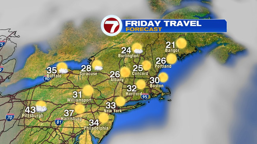
Tomorrow is great for travel, through the afternoon. However, near day’s end/early evening, we’ll have isolated snow squalls to track as an Arctic front blows through. Then… the deep freeze and near record cold pours on in.


It’ll be bright through Friday as a frigid start to Black Friday turns into a decent afternoon with a modest recovery. Temps jump in the 40s Saturday as sun fades behind clouds. Sunday offers the next chance for rain.
@clamberton7-twitter