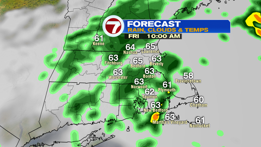
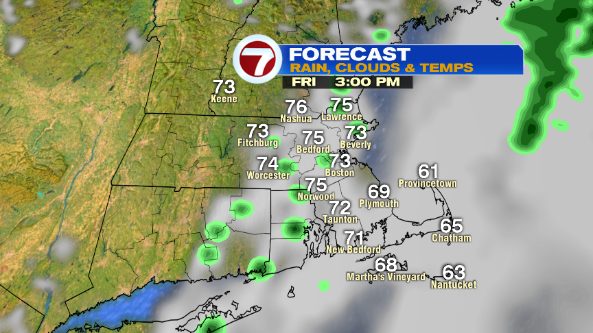
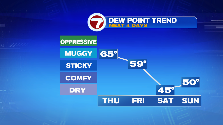
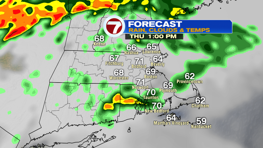
Scattered showers are in and out through the day and with the atmosphere loaded with quite a bit of water vapor, embedded downpours will be possible. With that said, it’s not an all-day washout as there will be some lulls in the action as highs run into the lower 70s. Humidity stays rather high with dew points into the mid top upper 60s. Those dew points crash into the 40s by the start of the weekend.
Showers and even some thunderstorms roll through overnight as temps hover in the 60s.
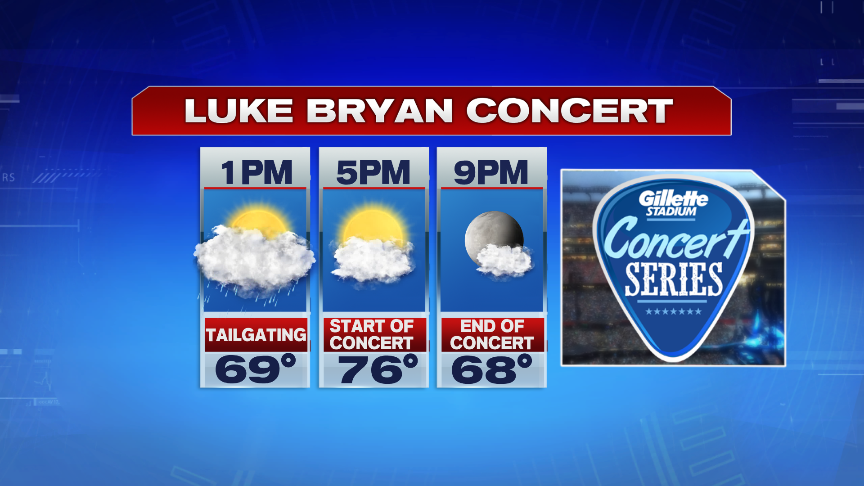
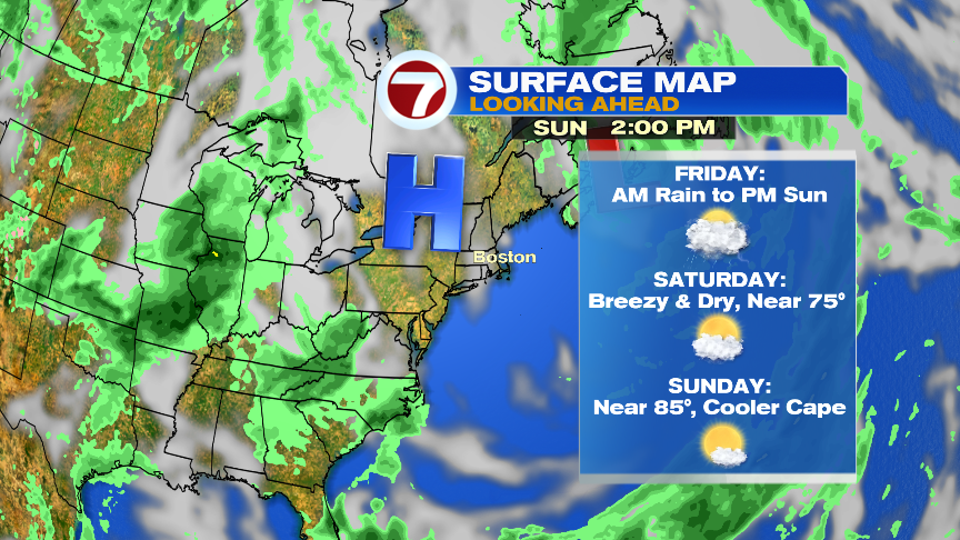
Showers are widespread tomorrow morning before becoming isolated in the early to mid afternoon hours. Humidity drops tomorrow as a busy breeze develops and sunshine returns late in the day. That’ll set us up for nice concert weather tomorrow evening at Gillette and set us up for a good looking weekend. Saturday will be the cooler of the 2 weekend days with highs in the 70s. While enough cold air aloft will create a bunch of cumulus clouds in the mix Saturday afternoon, the atmosphere won’t have much moisture to work with. Sure a spot shower can’t be ruled out, but 95+% of the day is dry. Sunday looks like a great beach day. Highs head for the 80s.