

As the storm reports continue to filter in, I have no doubt that many of us are breathing a sigh of relief that this storm is slowly, steadily winding down.
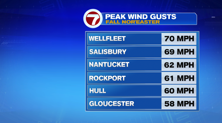
We’ve seen wind reports up into the 60s along the coast (especially the Cape and Islands). We even had a gust of 70mph in Wellfleet (though it is good to note their site is slightly elevated), and even had a daily record report of 58mph at the Blue Hill Observatory (the previous record was 54mph back in 1977).
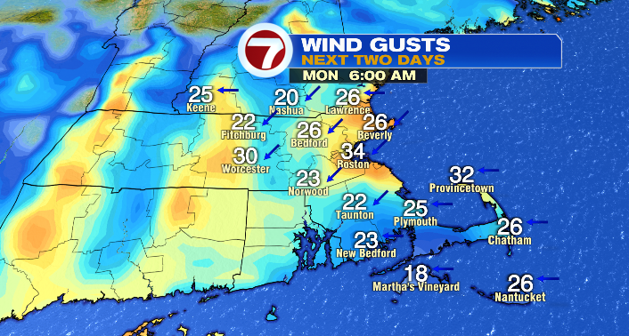
Now? The wind gusts have died down significantly, and will keep doing so throughout the night and into tomorrow. Monday morning we’ll have gusts largely in the 20s, with the highest gusts in the 30s. By the afternoon, we’ll see the numbers in the 20s and teens. With the wind retreating, the coastal threats retreat as well. Despite a relatively high high tide tomorrow afternoon, with the wave heights lessening, the coastal flood threat is all by gone by Monday.
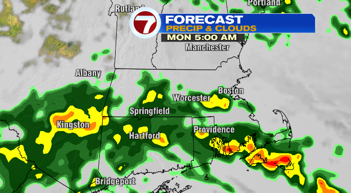
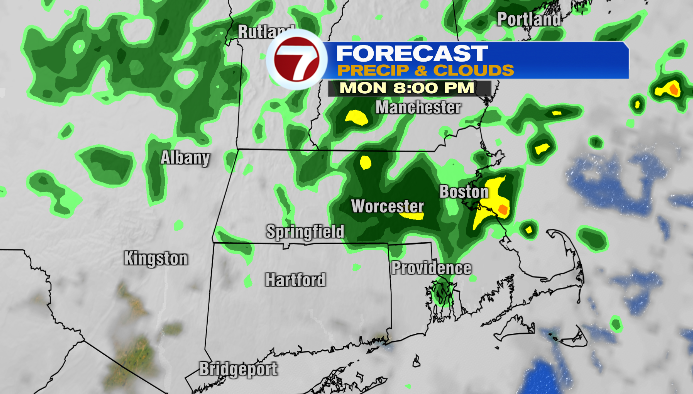
The one thing that takes a while to really disappear is the rain. We’ll see on-and-off showers and even some downpours as well through the rest of our night, and throughout the day Monday as our storm pulls away to the north.
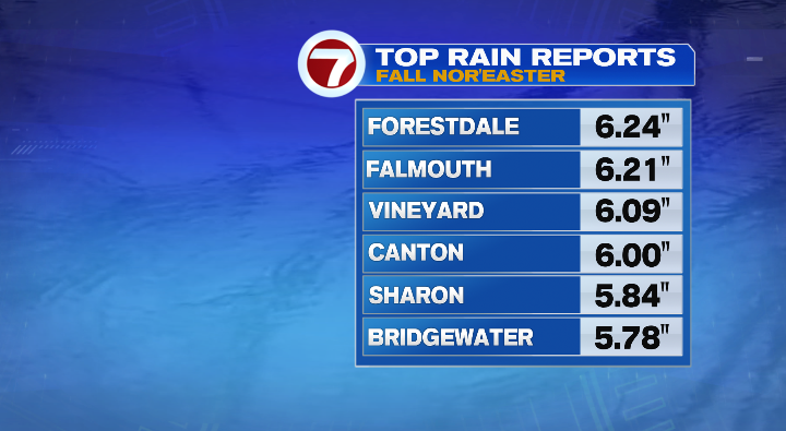
We’ve already seen a number of towns with rain reports of 4″+, and with the additional rainfall, flooding is still possible, especially in low-lying areas and areas of poor drainage.
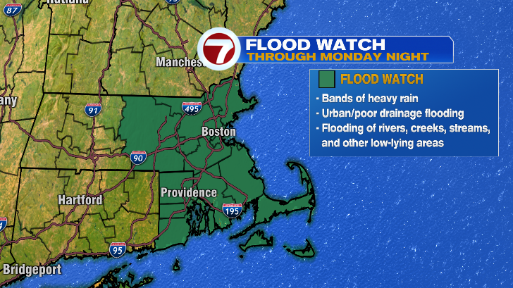
We have a Flood Watch in place from Worcester County east through Monday night.
Keep that in mind for your commutes tomorrow! Expect a slow go in the morning and in the afternoon. Otherwise, it’ll feel like a raw, blustery mid/late October day. Temperatures will be in the upper 50s and low 60s, and, as mentioned, while it won’t be as gusty as the weekend was, we’ll still have a stiff breeze at times.
Tuesday will be calmer, though the clouds will be pretty stubborn. We’ll be mostly cloudy, but milder, with temperatures in the low to mid 60s. We’ll also be less windy. Overall, not a bad day to get outside– whether it’s for storm cleanup, or just to enjoy the outdoors after a few soggy days.
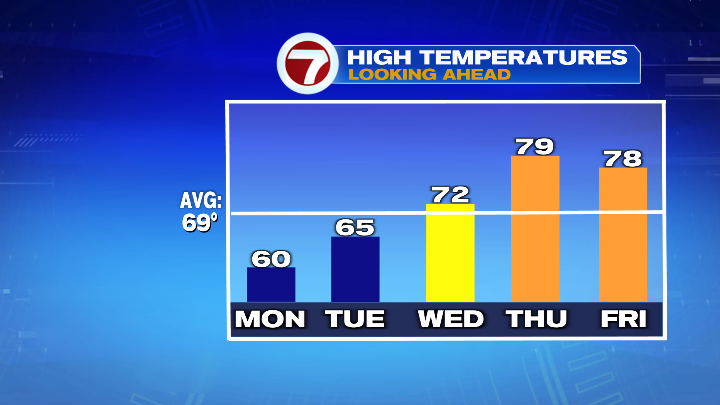
Wednesday will be even sunnier and milder. We’ll be partly sunny, with temperatures in the low 70s– back above average for the first time in days!
If you’re a fan of summer weather (and maybe haven’t been a fan of this cool stretch), you’ll love the numbers Thursday and Friday! We’ll have a brief stint in the upper 70s both days, before falling back to the 60s for the weekend.