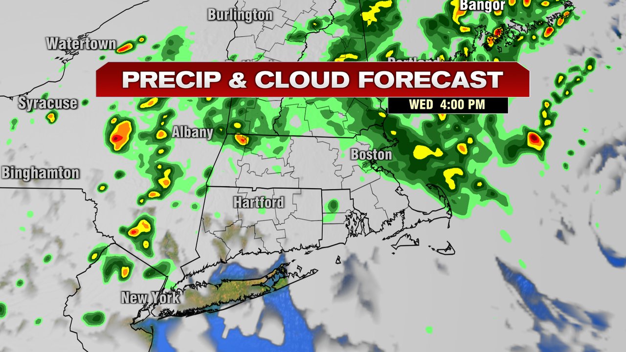
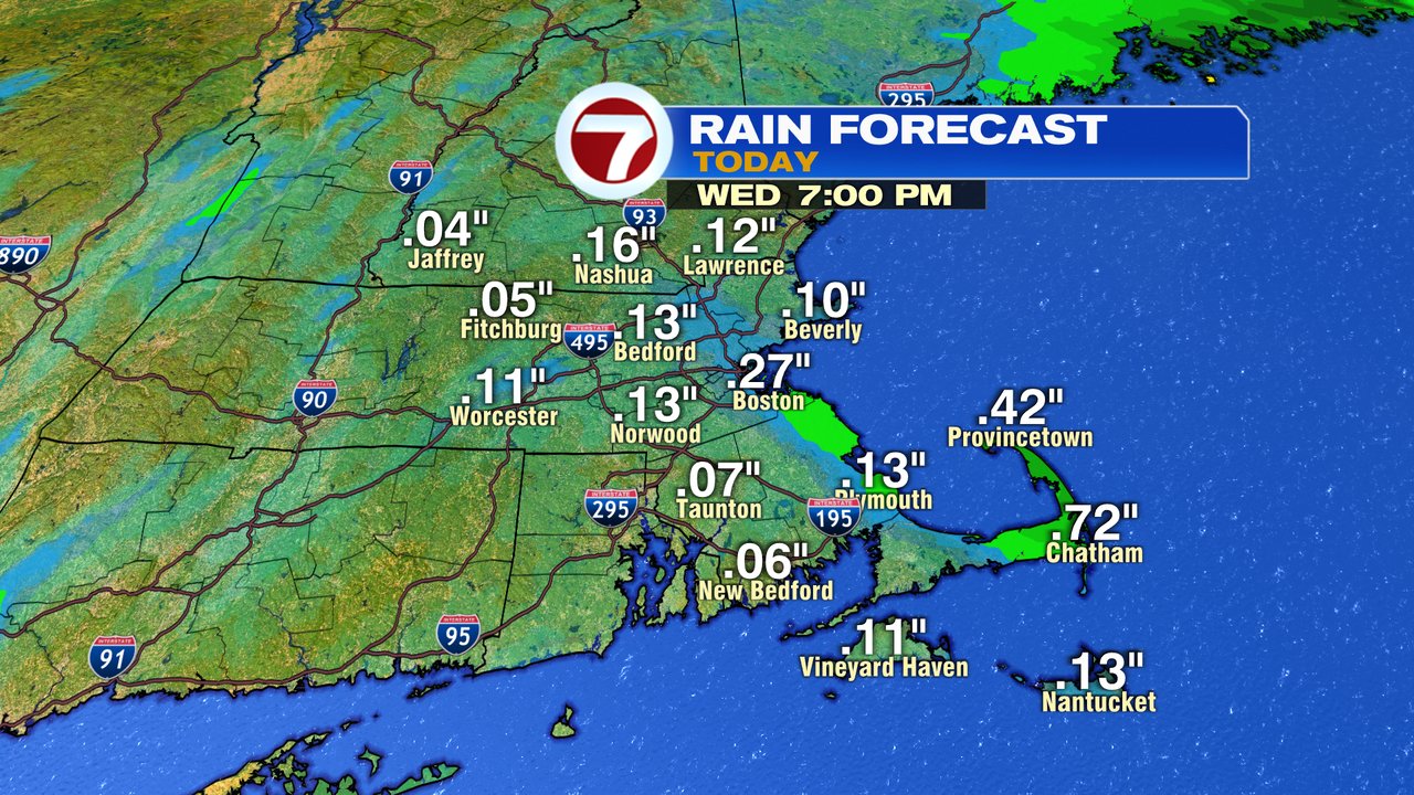
The radar finally showing some greens across the area this morning, indicating the batches of mainly light rain the has pivoted into the region. While most locations pick up less than 0.25″ of rain today, it will be a cloudy and cool day overall with highs stuck near 70. The highest rain totals will likely be near the coast today, with some towns/cities above 0.25″, especially across the outer Cape. Tonight, there could be a secondary batch of steadier/heavier rain across far northern Mass and NH as well. Overall, for most of us, it’s not a drought buster, but we’ll take any rain we can get at this point.

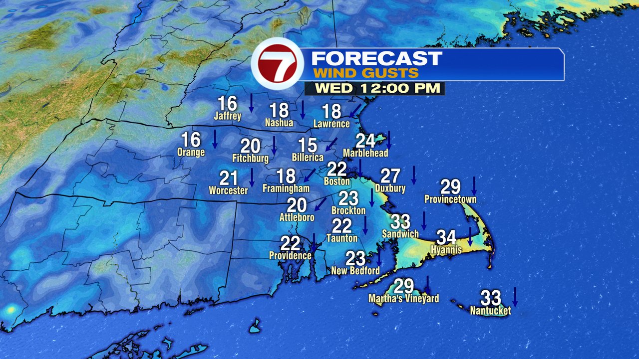
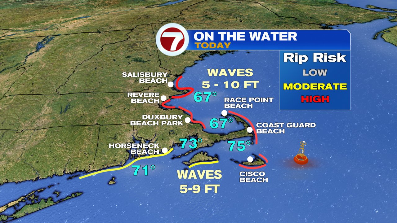
Winds do pick up out of the north to northeast today, especially at the coast, where gusts over 30mph are present across Cape Ann and Cape Cod. A few gusts past 40mph are possible across the Cape, which has prompted a wind advisory until 3pm there. The developing low with gusty winds will put the ocean in motion, and waves 5-10 feet are expected at the coast today. With that, the rip current risk goes high.
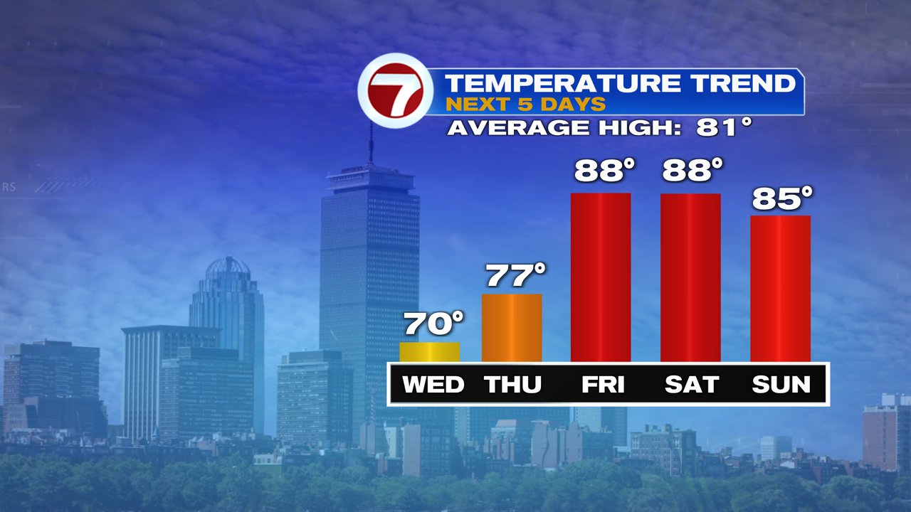
Any early morning showers taper off quick and clouds break for partly sunshine by the afternoon with highs in the 70s to near 80. Summer warmth and beach weather is back for Friday, into the weekend with highs well into the 80s to near 90 Friday and Saturday.