
Happy Saturday! So far it’s been it’s been a warm and quiet day but that will change later this evening.
We’re still tracking a line of thunderstorms that will track into central Massachusetts closer to 7-9 p.m., and into eastern MA between 8-11 p.m.

The Storm Prediction Center has most of the state in level 2 out of 5 risk for severe weather with Boston farther east in the level 1 out of 5 risk zone.
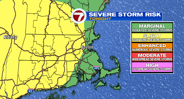
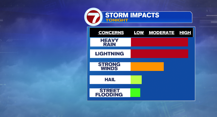
The greatest threats with these storms will be heavy rain and gusty winds, but the severe component could be some damaging wind gusts. Make sure loose objects outdoors are secured!
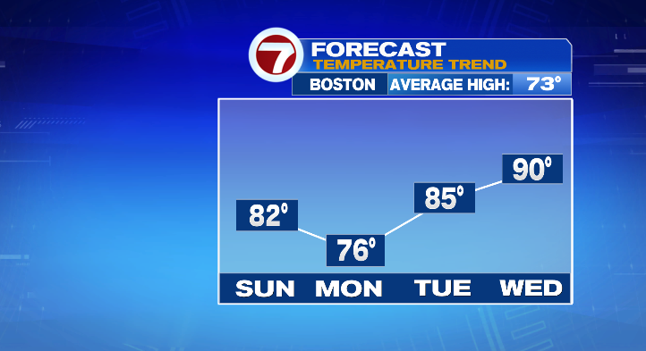
After midnight there will be just some spotty showers lingering on the Cape. Otherwise, clouds clear overnight and Sunday morning we’ll wake up to temperatures in the 60s. Sunday starts nice! The sun will be out for hours. In the early afternoon clouds will drop in and that’s when we can’t rule out some spotty showers.

There is the potential for a few isolated thunderstorms, too. That chance lingers into the evening — but it’s spotty! Otherwise, highs will reach the low 80s.

Monday the temperature will take a bit of a dip! Morning lows get down to the 50s with afternoon highs in the mid 70s. The sun will be out and about, too.
Tuesday: mid 50s to mid 80s with sun. Wednesday will be hot! Highs jump to near 90 degrees with partial sun and a chance for an isolated storm.
Thursday we could see another spot storm with highs in the upper 80s. Friday features a chance for a few storms with highs in the upper 80s again. Stay tuned!