Happy Tuesday! Today was finally a wonderful day from start to finish. Thankfully, we have more (mostly) dry and summer-like weather ahead the rest of this week.
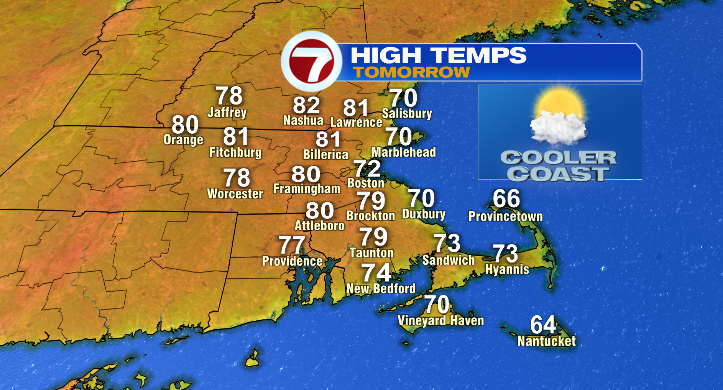
Temperatures this evening will cool from the 70s to the 60s with overnight lows near 50 degrees. Skies will be nice and bright, tomorrow, too! Just a heads up, though, it will be quite a bit cooler at the coastline. For some, even, it may be cooler than it was today! Some spots only in the low 70s (check the above graphic!)
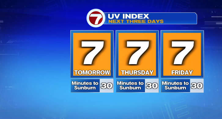
Thursday the real heat begins! Lows start in the 50s with highs in the upper 80s. Skies will be plentiful sunny as well, and the UV index is a 7. Get out and enjoy the summer-like weather!
Temperatures will continue to climb from there. Friday, lows start in the upper 50s with highs nearing the 90-degree mark. Skies look sunny again but there may be a few higher thinner clouds. Still, a summer-like day!
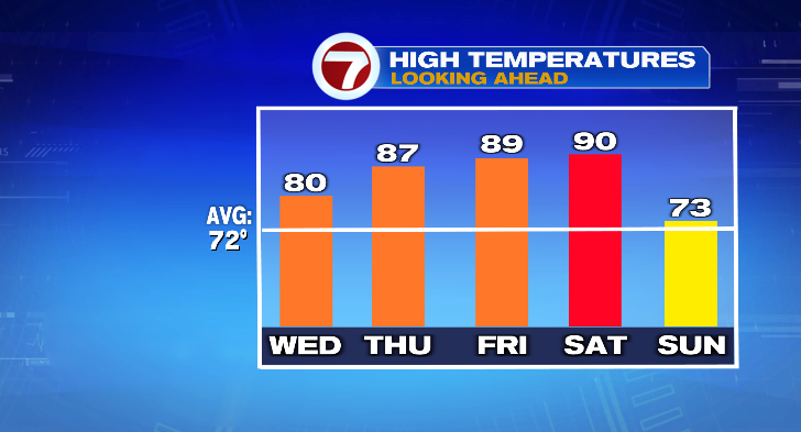
Now for the weekend!!! We do have rain and storm chances but don’t worry just yet. Saturday: near 90 with party sunny skies. We do have to watch for a chance of storms, but it’s not until the evening.
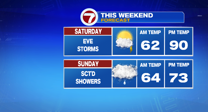
Sunday looks cloudy with spotty showers and highs in the low 70s — so that day, yes, may be more of an inside day. And of course….we get better on a MONDAY!
Monday looks partly sunny with a low-end chance for a spot shower. Otherwise, it will be cooler again in the low 50s to near 70 degrees. Tuesday: sun/clouds and in the mid 70s. Stay tuned!