

We’re more than a week into fall (and hours away from the start of October), but Mother Nature has decided she’s not ready to give up on summer… yet.
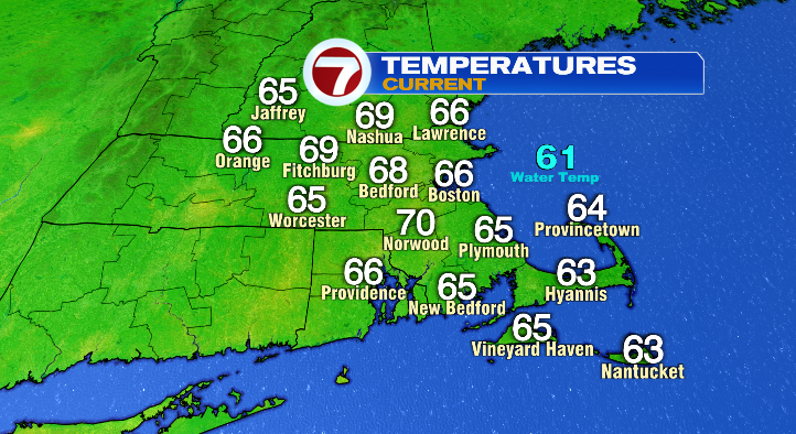
We’ll have a mild, slightly muggy, and slightly sunnier end to our day. Overnight, expect low temperatures to fall into the mid 50s: just a bit above average for this time of year.
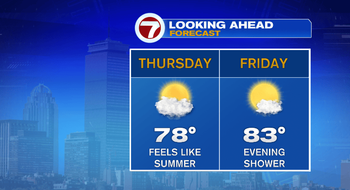
Tomorrow, however, the above-average, summerlike weather really takes hold! We’ll be partly sunny with highs climbing to the upper 70s, with the warmest spots at about 80 degrees. With the uptick in humidity, we’ll be feeling more like August than the first day of October! We’re even warmer on Friday, with highs in the low 80s by the end of the afternoon. Once again, the humidity will stick around as well, and we’ll be mostly sunny for the first half of the day, but clouds will increase during the second half.
All of the above is out ahead of our next chance of rain, which arrives ahead of a cold front Friday evening.
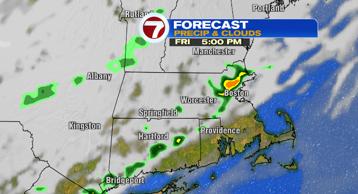
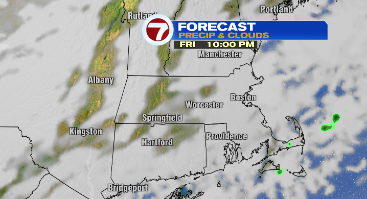
That front will be the catalyst for a few evening showers, and perhaps a downpour (though that chance looks limited).
The bigger impact of this front will be the cooler, drier air it introduces back to New England by the weekend.
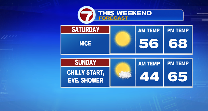
We’ll wake up to temps in the 40s on Saturday, and only hit the mid to upper 60s by the afternoon. We’ll be mostly sunny as well. All in all, it’s pretty on-the-nose for what an early October day should feel like around here.
Sunday, we cool down even more! We’ll wake up to the low/mid 40s Sunday morning, and highs will be in the mid 60s. We’ll be mostly sunny for most of the day as well.
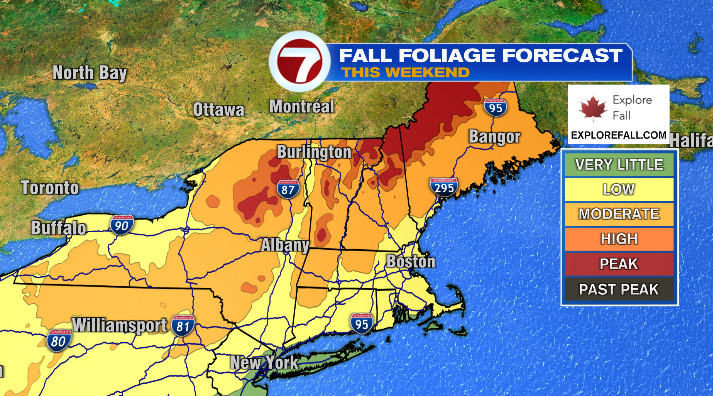
Considering how the weekend weather is shaping up, you might just want to take this weekend to enjoy all that fall in New England has to offer! We are really starting to see the leaves turn in northern New England, so whether you stay here at home, or take a joyride up to the White Mountains, you’ll certainly get the feel of the season.
Our next chance of rain arrives with another cold front Sunday evening/night. This won’t lead to a soaker by any stretch, but we could see a few showers during that time.
Monday we stay relatively average, with highs in the mid to upper 60s, but as the cool air after the front settles in, we’ll see highs plummet to the upper 50s on Tuesday!!