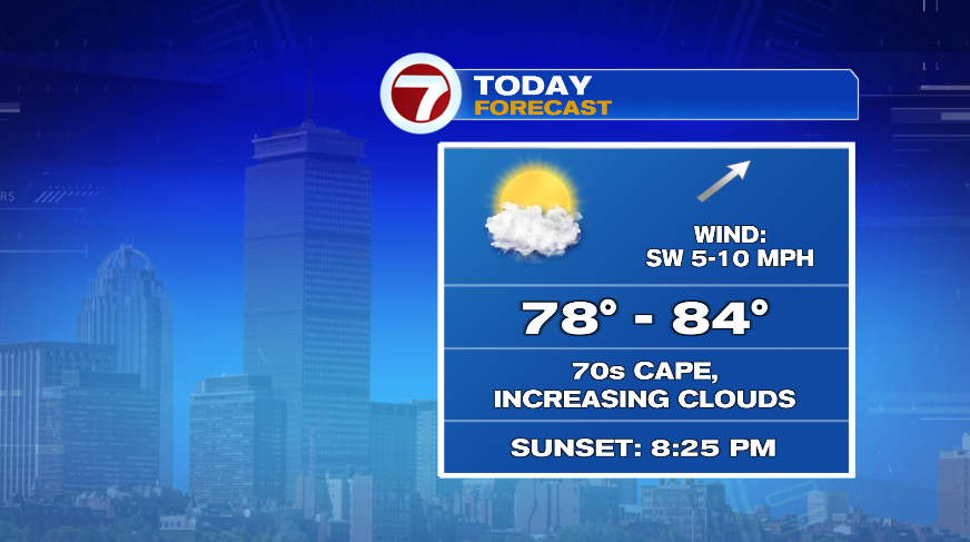
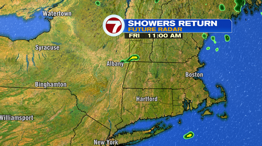
Another nice day is in store for today with comfortable humidity, comfortable temperatures, and a good amount of sunshine. We’ll increase the clouds this afternoon and evening ahead of our rain chances that will return overnight. The showers and a few storms will hold off until after midnight.
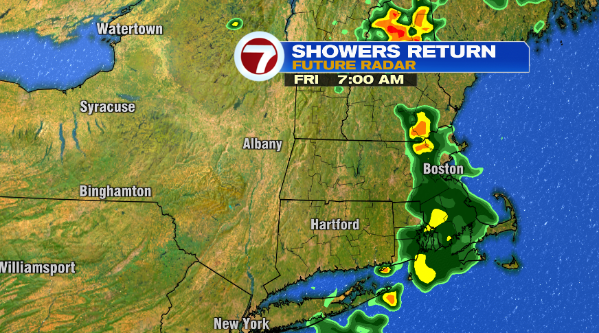
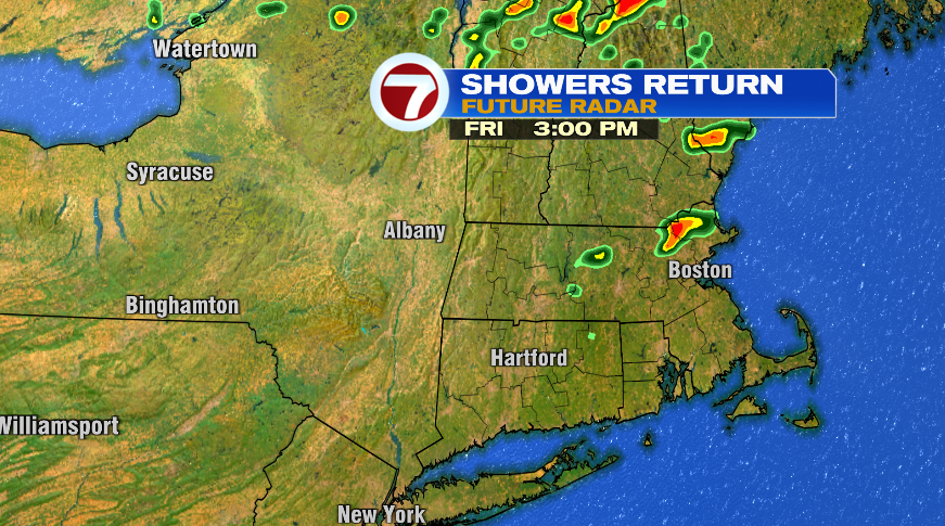
Tomorrow the humidity returns along with the chance of scattered showers and storms. Scattered is the key word here because this is not an all day rain. There will be plenty of dry hours tomorrow but you may have to dodge a shower or thunderstorm through the day. It looks like we’ll have a batch earlier in the morning, a lull through the midday hours, followed by a few more in the evening. Now, if you get underneath a storm, that doesn’t mean you won’t see heavy rain or a downpour, but this is not an all day rain tomorrow.
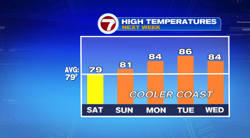
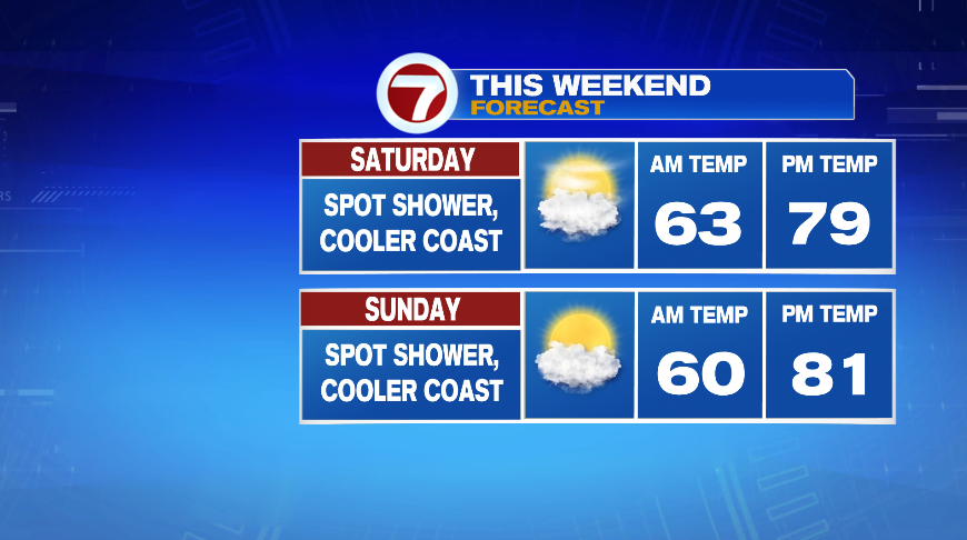
On the backside of these storms, a big area of high pressure will slide in for the weekend. Once that high moves in, it’s going to hang around for several days, Saturday through Tuesday. That means that four day stretch will all feature similar weather conditions, just warming a couple of degrees each day. High pressure, as it sits overhead, will keep our wind light through those four days — but without the wind we won’t hold off the sea breeze. So each day will be a bit cooler on the coast, but still a nice stretch of weather and temperatures moving forward.

While high pressure is overhead it will work to keep us *mostly* dry through that four day stretch. I say mostly because that sea breeze boundary could actually act as a catalyst for sparking a rogue shower each day. The chance is low, like 20%, but there is a chance of spot shower Saturday, Sunday, Monday, and Tuesday. If you look at your phone and see a bunch of rain icons, know that yes, there is a chance of a shower, but no it’s not four days of rain.
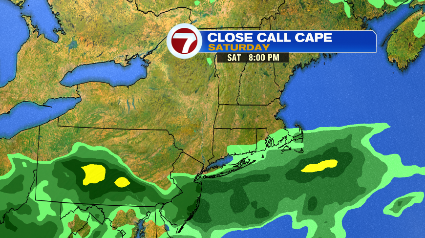
The one thing we’ll have to watch is the chance for something a little more steady across Cape Cod and the Islands on Saturday. High pressure is essentially a block for any storms to move in and will deflect them down to our south. The next storm will do just that, passing over Long Island and just south of us. That said, if high pressure would budge just a tiny bit, it may increase the rain chances down the Cape on Saturday. Right now, I’m hedging my bets it’s just a spot shower or two like everyone else, but something to keep an eye on if you have plans on the Cape for Saturday.