

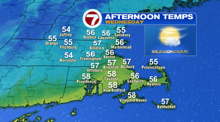
Good morning! We’re starting out seasonably cool this morning, and we’ll be right around, if not slightly above average this afternoon with highs in the mid 50s for most of the Bay State.
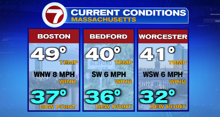
Otherwise, we’ll start the day mostly sunny, with a few more clouds creeping in in the afternoon and evening, as well as a breeze out of the west-northwest. It’ll be quite comfortable for any Veterans Day activities (thank you to all who’ve served)!
After today, this forecast gets a lot more active. We’ve been keeping a close eye on this next storm for days– it’s a bit of a conversation starter, considering it could bring us our first flakes of the season!
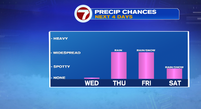
As this storm develops, it’ll tap into a bit of cold air from our neighbors to the north to turn what would otherwise be a chilly rain into a chilly rain and a little bit of snow. That said, precipitation with this system is VERY location dependent, so let’s go through the fine print.
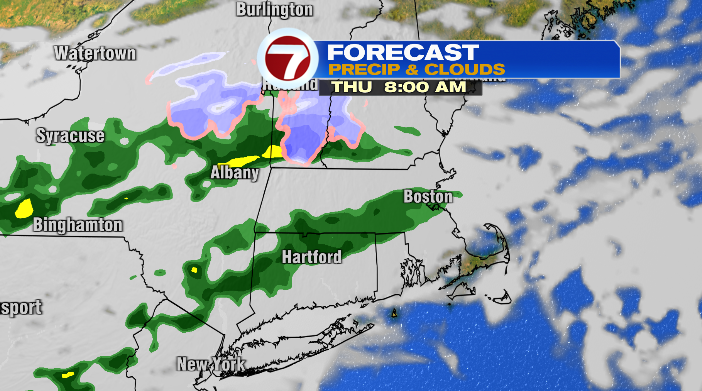
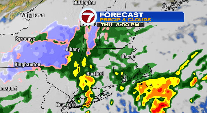
We’ll start clouds and some spotty showers Thursday morning/afternoon. Showers will become more widespread, and we’ll see some heavier rain as well by Thursday night.
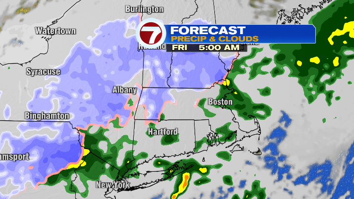
As the calendar turns from Thursday to Friday, the air will be cold enough that higher elevations will see the switch to some wet snow showers. This will mostly impact the Worcester Hills and the Berkshires in the Bay State, as well as the Wapack, the Whites and the Greens.
We’ll continue to see showers for most, and a few mixing snow showers for the higher elevations during the day on Friday, tapering off quickly on Saturday morning.
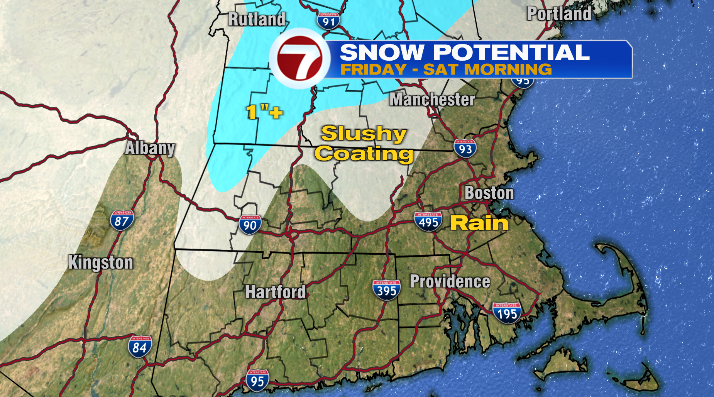
But here’s the thing about this snow. While it may be a headline-maker considering it’s really the first time we’re talking about snow this season, it’ll be here and gone in the blink of an eye. We don’t have bitter cold temperatures leading into this storm, and even during the storm it’ll only be so cold. The ground, in turn, is far too warm for anything to hang around outside of the mountains.
On that note, during this time, highs will be considerably cooler than the last few days. We’ll be in the low 50s Thursday and the mid 40s on Friday and Saturday. Even Sunday looks cool, with highs in the upper 40s and low 50s.
We’ll be closer to average, and brighter and sunnier by the start of this coming week.