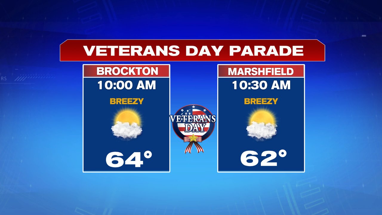
Milder air greets us this Friday morning as temperatures start in the 50s and end up near 70 this afternoon. Clouds will increase, as well as the breeze, with isolated showers arriving this afternoon. With that said, most of the wet weather will hold off until after sunset as rain overspreads the region this evening. That means it’ll be mainly dry for the Veterans’ Day parades that take place later this morning.

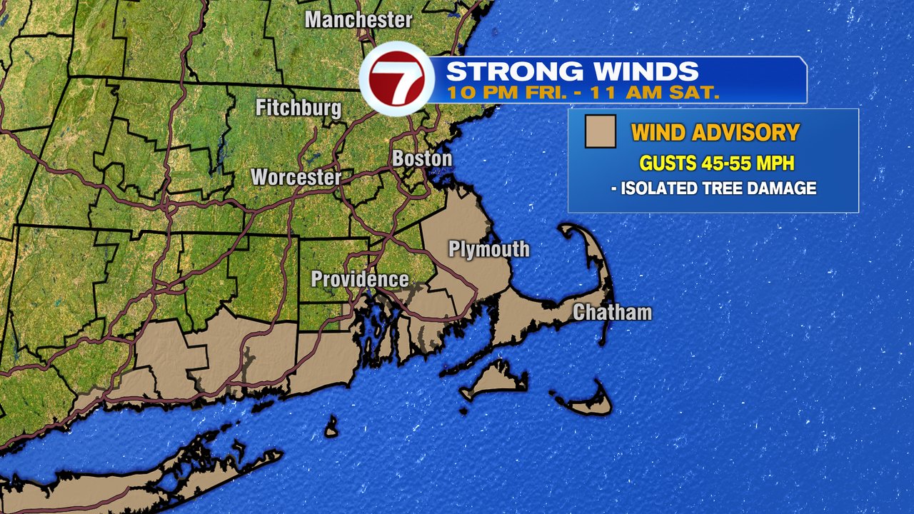
The remnants of Nicole that work in overnight today into tomorrow morning, as plenty of moisture and gusty winds settle in. The strongest winds will be across Southeast Mass, where gusts 45-55mph will be felt. A wind advisory is in place there.
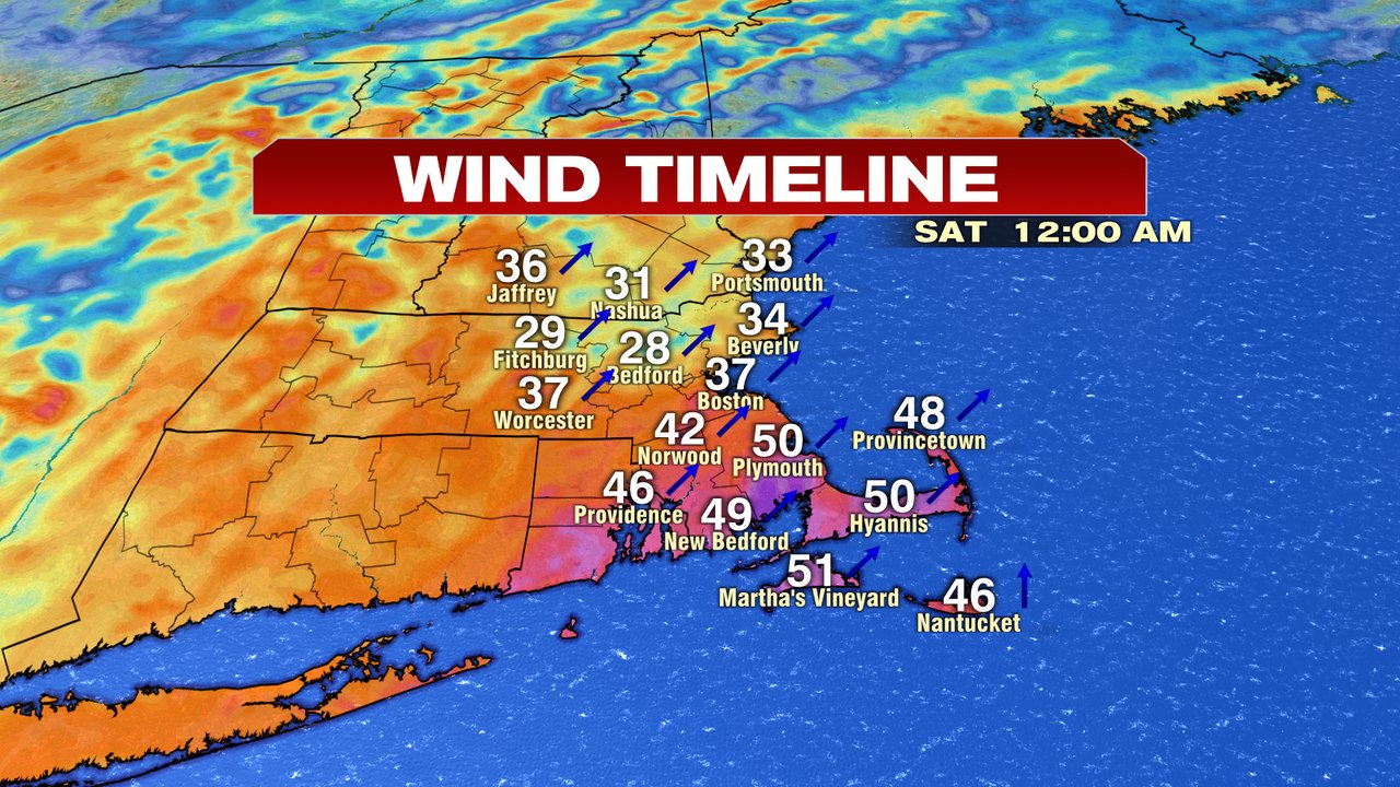
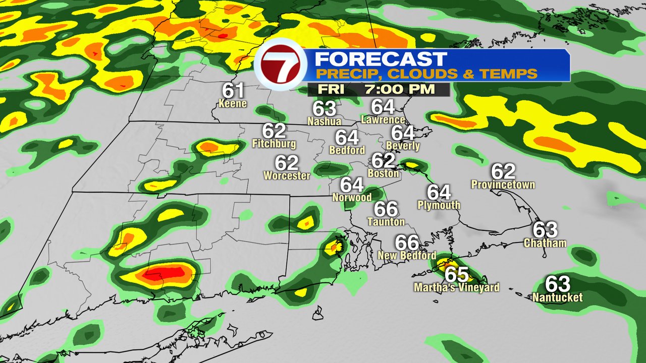
Around Boston, points north and west, gusts run 30-40mph. Batches of showers/rumbles of thunder move in , through tomorrow morning, yielding localized downpours.
Those downpours will be capable of producing localized street flooding/poor drainage area flooding where leaves have clogged up storm drains. Overall, rain amount stay under totals that would produce stream or river flooding as 0.5-1.5″ is expected.


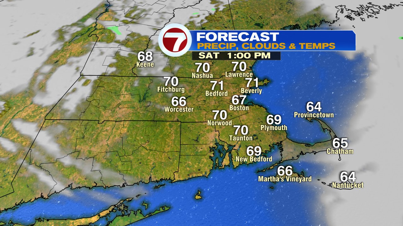
By midday tomorrow (noon), the rain is done, winds taper off, and some sun starts to break back out as highs run in the lower 70s.
The numbers fade fast in the evening, as chillier air moves in. Highs Sunday stay in the low to mid 50s as a few scattered showers are possible in the morning before a mainly dry afternoon.
It’s chilly Monday and Tuesday with highs in the 40s.