Sure was great to have the sun out there, if nothing else, it was there for moral support! Temps stayed in the upper 20s for much of the day (which isn’t that bad for January) but it was that dang wind! Northwest winds were feisty for much of the day, gusting over 30mph frequently. That created wind chills in the teens for the area. Brrrr.
We’re on to Wednesday! Unfortunately, more wind is on tap but at least the wind direction will be a southwest wind and that will warm us up by afternoon!
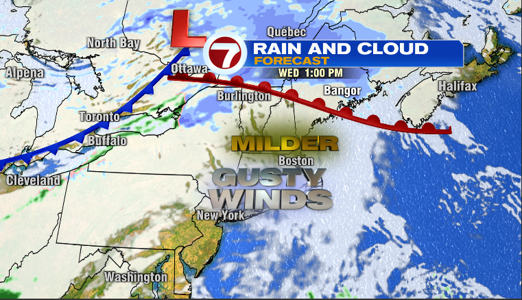
We’ll also have quite a few clouds around as a warm front moves from our part of the world during the morning hours up into northern New England by afternoon. Despite quite a few clouds and a gusty southwest wind between 15-30mph, temps will reach the 40s. Mild! Enjoy if you can, it’s the last mild day for the next week!

Here is what the remainder of the week looks like. A downward trend in temps…
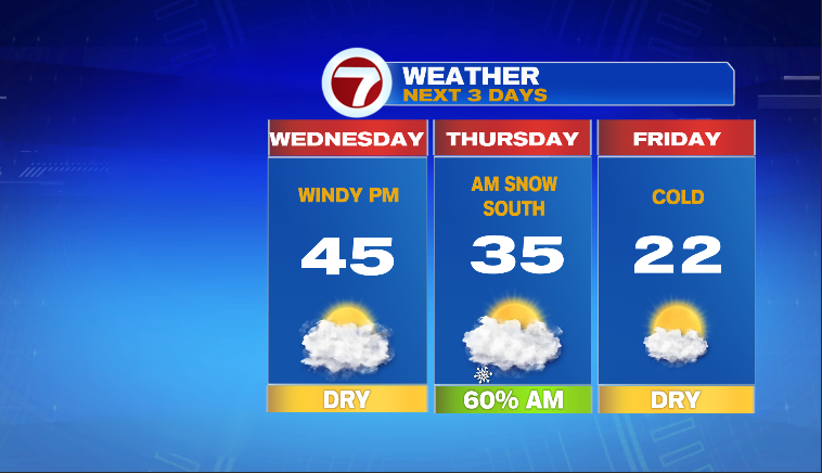
And yes, there is the chance of some light snow Thursday morning as a cold front presses south into southern New England. Shouldn’t be too much to contend with but the timing could be problematic as it is likely to fall during the Thursday morning commute. Here is our snowfall forecast for Thursday morning…
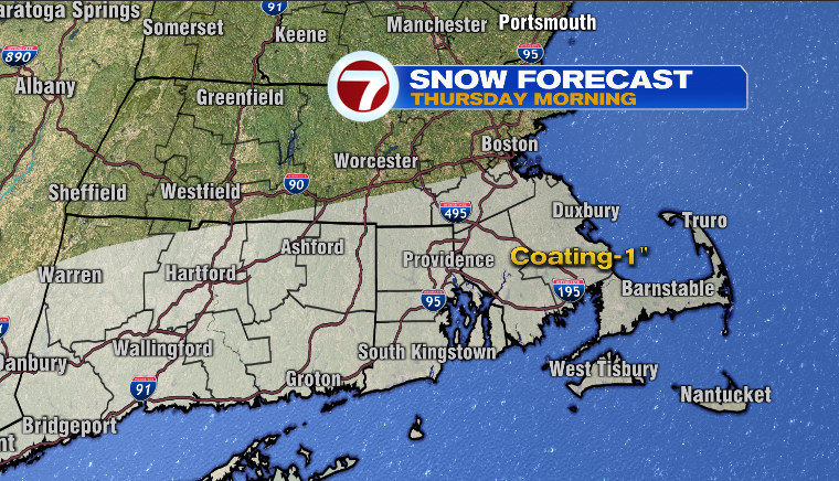
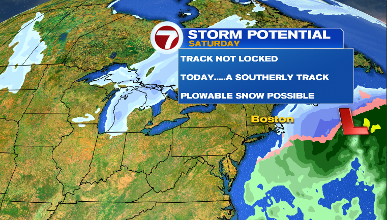
Not enough to plow but could be enough to create some slick spots Thursday morning. Sunny and cold for Friday and we’ll watch the possibility of another storm on Saturday. As of this blog (TUE Eve), it looks like a glancing blow..
More on this tomorrow-Thursday.
~JR