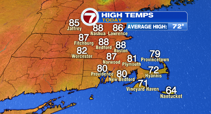
Another warm day in the books as temperatures across Southern New England soared into the 80s! But, as you may know by now, there’s more where this came from!
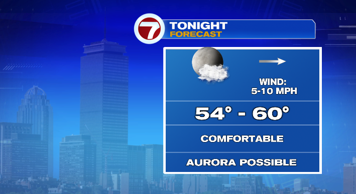
If you’re itching to stretch your legs after a day in the office, this evening will be perfect for it. Warm, with temperatures steadily falling into the 70s, and plenty of sun until the sun sets. Overnight we’ll be mostly clear, barring some high cirrus clouds moving in. It’s worth a mention, however, that where the sky is clear and light pollution is low, you may get a chance to see the Northern Lights! It’s not a slam dunk, but a small possibility we won’t count out for all the aurora-chasers out there. Lows will be in the 50s by the time we wake up on Friday morning.
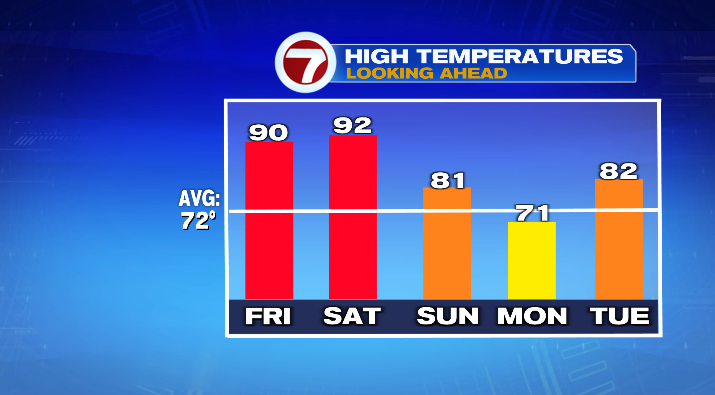
Friday will be partly to mostly sunny, and even warmer than Wednesday and today! Highs will be in the upper 80s and low 90s, especially inland. The coast will be slightly cooler, largely in the mid 80s. Humidity ticks up a tiny bit, but it’s still an overall dry feel. If you happened to take Friday off, it’ll be a beautiful day to spend by the water! Ocean temps may be chilly right now (largely mid 50s), but our coastal air temperatures in the 70s & low 80s will feel great with the sunshine.
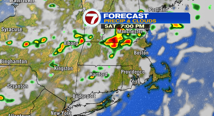
If you can’t get out of work Friday, Saturday will largely be another great day for the beaches! It’ll be hot again, with temperatures in the upper 80s and low 90s, much muggier, and partly sunny.
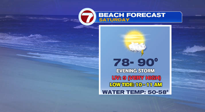
However, the caveat to this beach day is that we are keeping an eye on a few thunderstorms that could pop up largely after 5 PM. Make sure you’re keeping an eye on the sky (and the 7 Weather App on your phone), as one or two of these storms could be a little punchy!
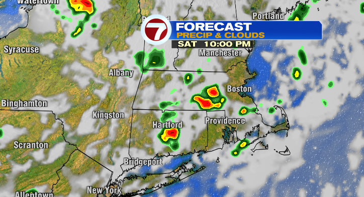
Sunday will be partly to mostly cloudy and cooler. Highs will be in the mid to upper 70s– still above-average, just not as hot as the previous days. Once again, we’re looking at showers and a thunderstorm or two as a front moves through New England. Most of the wet weather will be later in the day, but a few stray showers before noon aren’t out of the question either. It’s not a washout of a day, but if you’re trying to plan some time outside, I’d suggest making Saturday your day, simply because there are more consecutively dry hours, and temperatures will be toastier.

This system is gone by Monday, and it will give us a (temporarily) very different feel.

Highs will be in the upper 60s and low 70s, and we’ll be mostly sunny. Overall, a nice combo if you want to get outside! Just not mid-summer hot.
Tuesday we start the warming trend again– we’ll stay mostly sunny and highs will be in the upper 70s and low 80s. Right now, it looks like we’ll spend most of next week well above average!