

Good morning! Hopefully you have something planned outdoors today, because we’re waking up to the nicest day of our three-day weekend.
We started with a fall chill– some areas of the Bay State waking up in the 30s this morning, while areas along the coast (especially our urban heat island of Boston) were in the 40s.
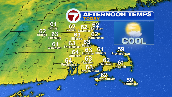
By this afternoon, we’ll largely in the low to mid 60s — close to average for this time of year.
Otherwise, we’ll have a light breeze and a mix of sun and clouds (mainly high clouds). Overall? It’ll be a great day to do some pumpkin picking, leaf peeping, apple cider donut eating… you get the picture. It’s a great fall day!
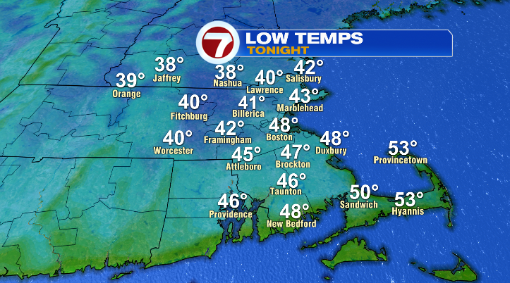
Overnight, we’ll back in the 40s, and parts of the Merrimack Valley could even wake up to the 30s. For that reason (and the light winds), parts of Hillsborough and Rockingham Counties are in a Frost Advisory from 2AM – 8AM on Sunday. Plant parents in the area: tonight would be the time to cover up your sensitive flora!
As for the rest of our Sunday? This is where things get a little funky thanks to the remnants of Isaias.
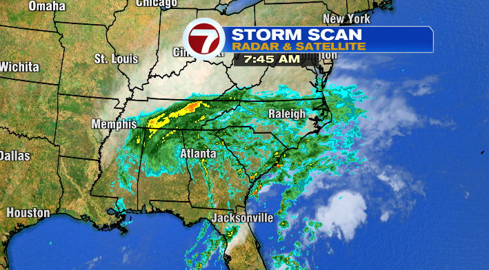
For those playing catch-up this morning, the storm made landfall as a Category 2 Hurricane at 9:30 PM on Friday night near Destin, FL. Now, what’s left of the storm is bringing driving rain through the midsouth and southeast. The storm will keep pushing north over the next 36 hours.
We’ll be mostly cloudy by late Sunday morning, and highs Sunday afternoon will be in the low to mid 60s once again.

As for the impending rain? Though timing is still a little tricky, we’ll most likely see the first showers between 3-6PM.
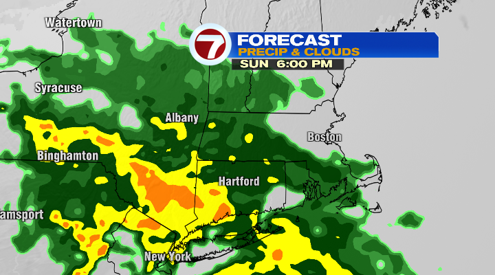
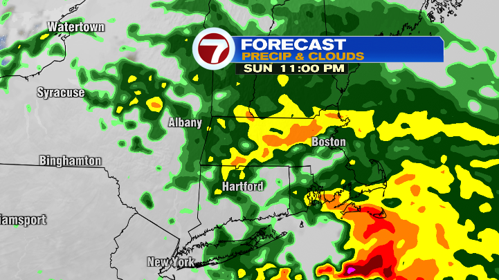
From there, showers become more widespread, until we wind up with rain overnight into Monday morning.
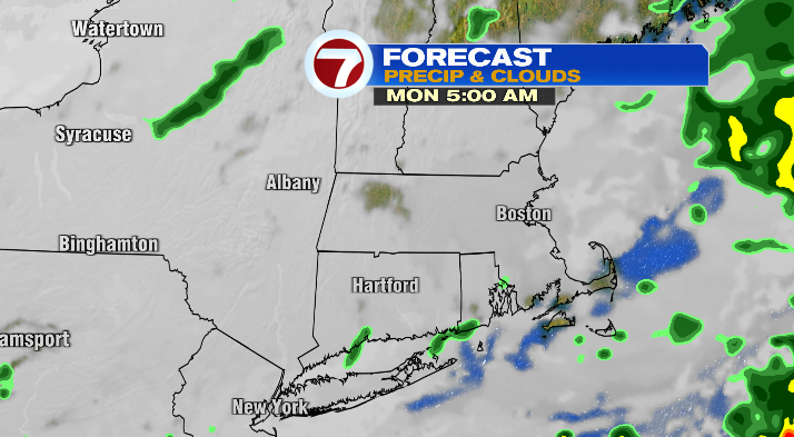
We’ll dial it back to spotty showers around sunrise, and the last of the raindrops will fade by noon, leading to a drier second half of our Monday.
Highs on Monday will be milder– in the mid to upper 60s.
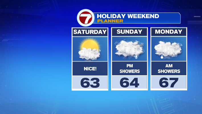
So, to summarize the three-day weekend, you’ll get the opportunity for outdoor time (sans rain) each day, but Saturday is, by far, the most agreeable in that regard.
We’ll have another round of rain– not because of a tropical system, but because of an area of low pressure moving in from the west– on Tuesday. The morning will start off dry, but we’ll see scattered showers by late afternoon.
After this system passes, we’ll jump into a sunnier, but MUCH cooler end of the week!