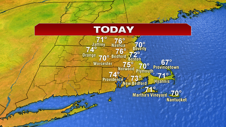
Nice weather with low humidity prevails today as highs head into the 70s. Lows tonight fall back into the 40s and 50s tonight. Tomorrow, highs near 70 with increasing clouds and even a few late-day showers south of the Pike.
Then, we turn our eyes to Dorian.
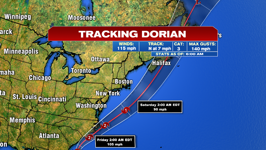
Dorian this morning is a category 3 hurricane that is approaching the Carolina coast and will come close too, if not making landfall across North Carolina tonight/early tomorrow. Hurricane winds, flooding rains and a storm surge are all concerns for that area.
We’ll focus on the track closely here too by Friday night and Saturday AM, as Dorian makes a pass just to our Southeast. How close it gets will dictate how much wind and rain we get.
As Dorian moves south and east of us, it starts to transition into an extratropical storm tomorrow night. That expands the heavy rain shield on the northwest side of the storm, while the hurricane force winds stay along and east of it’s path. If Dorian does track just southeast of Nantucket, it’ll act like a nor’easter for us with strong northeast to north winds (gusts 40-60mph) across Southeast Mass with a period of heavy rain there too. The strongest winds would be closest to the storm, i.e. Nantucket. A tropical storm watch is in effect for the Cape and the Islands for sustained wind potential of 35-45mph with gusts to 60mph. Again, most likely to see that is Nantucket.


Dangerous surf and high rip current risks will be with us this weekend, however, significant coastal flooding is unlikely. The astronomical tides aren’t all that high, and the strong winds won’t be prolonged and onshore long enough to pile up a big surge.