
It’s a big day for events across New England, but also in terms of the forecast as we’re watching the potential for some strong to severe storms later today!
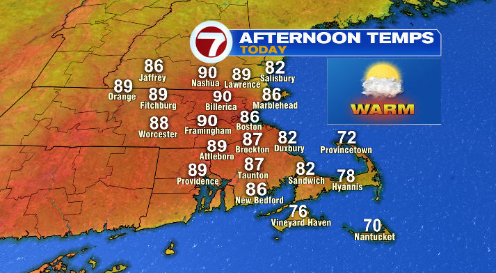
The good news is that it is NOT an all-day soaker or anything like that. In fact, most of our daylight hours are actually going to be nice and summery! Expect a warm, slightly muggier feel with temperatures in the 70s for the Cape, and 80s & low 90s otherwise. We’ll be partly sunny, with clouds continuing to filter in throughout the day.
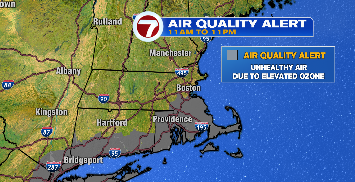
Just a note for those spending time outside in southeastern Massachusetts today– we have an Air Quality Alert in place from 11 AM to 11 PM for elevated ozone. If you have any respiratory issues and are sensitive to the air quality, be mindful about how much time you spend outside today!
If you’re heading to Boston Pride, expect a warm feel! Temperatures during the parade (11AM start-time) will be in the low 80s, but climb as the afternoon goes on!

It’s also a pretty great day, overall, to head to the beaches! That said, be mindful of the fact that rip currents at east-facing beaches in MA, as well as south-facing beaches in RI, as well as south-facing beaches are possible today.
Now, about the showers and storms– we have a chance of a stray shower or two in the afternoon.
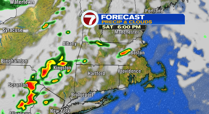
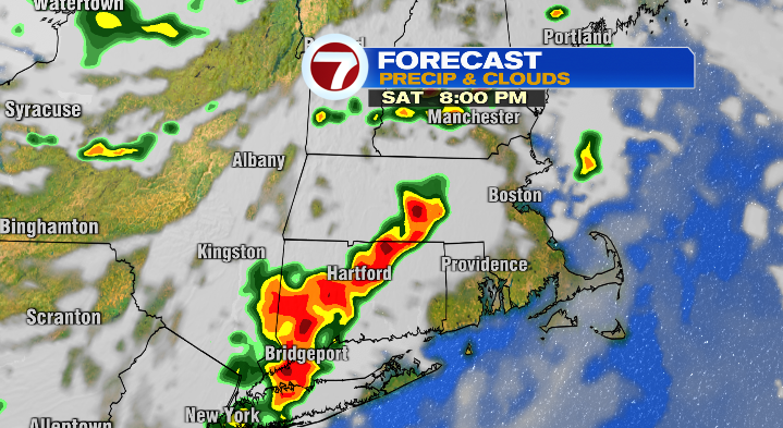
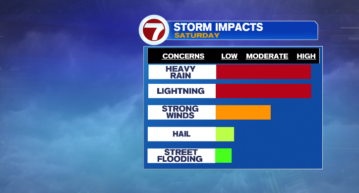
However, the storm activity holds off until closer to 5PM. Between 5-11PM, we could see a few storms become strong to severe, including the chance of heavy rain, thunder/lightning, gusty winds, and even some small hail possible. Hail has the lowest potential on that list, but it’s not out of the question.
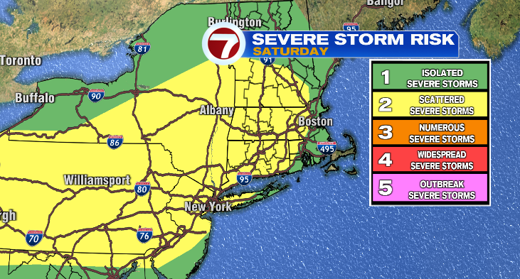
For this reason, the SPC (Storm Prediction Center) has placed New England in a Level 1 & Level 2 risk.
Make sure if you have plans on this Saturday evening that you’re keeping an eye on the sky (and the 7Weather app on your phone)!
Tomorrow, we’ll see a mix of clouds and sun, with clouds increasing in the afternoon. We’ll also see a few showers, and a thunderstorm or two possible as well. Storms don’t look severe, though we could see some gusty winds even still! Highs will be cooler, but still above the norm in the upper 70s and low to mid 80s.
The unsettled weather is gone by Monday! In fact, it may feel like a bit of jab from Mother Nature, because the fist day of the workweek will be absolutely gorgeous. Temperatures will be in the mid to upper 70s and we’ll be mostly sunny. It’s the only day in the 70s though, as we quickly heat back up into the 80s and 90s midweek.
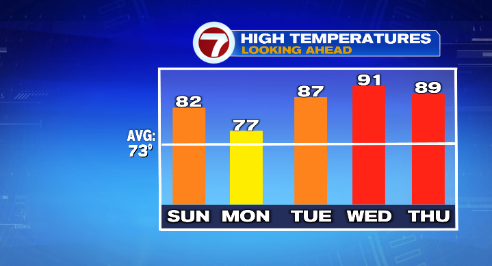
We’ll stay dry through Wednesday, though Thursday and Friday have a chance of a thunderstorm or two, particularly in the evening!