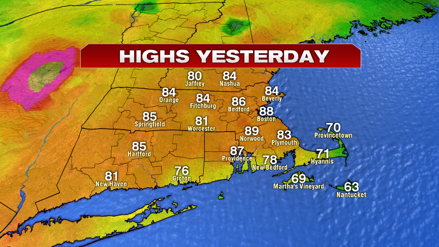
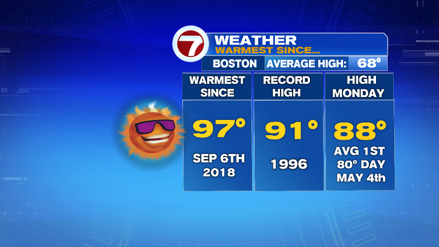
No doubt, we had a taste of summer yesterday as high temperatures warmed up into the mid to upper 80s with a bit of mugginess and some scattered late-day storms. With a high of 88 in Boston, it was about 20 degrees above average and just shy of the record high of 91.
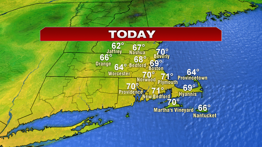
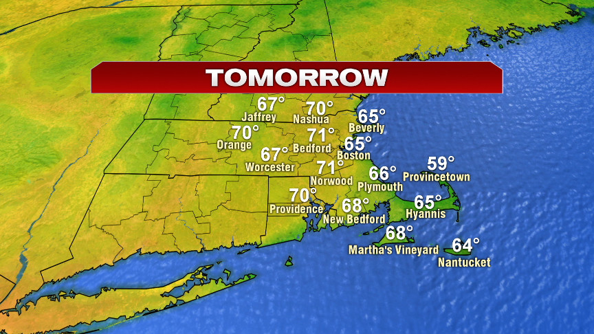
Behind those scattered storms, cooler and drier air made its way back in as skies cleared out last night. In the cold fronts wake, a return to more seasonable weather works in today with highs near 70. The breeze is gusty too with northwest winds about 15-20mph, gusting to 30-35mph. Overall, still a solid day. Tomorrow looks good too, low 70s inland, mid 60s at the coast as sea breezes kick in.
The next chance for showers/thunder rolls in Thursday evening and Thursday night. Right now, as we end the week and head into the Holiday Weekend, the forecast looks fairly decent too. While there’s the risk for a a batch of showers at times, those times as of now, appear to be Saturday evening and again late Monday. That’ll leave a good chunk of the weekend with dry hours. Temps are near 70 Saturday, 75-80 Sunday and in the 70s Monday.