

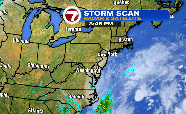
Hopefully you’ve enjoyed this beautiful fall-feeling day before things get a bit rough-and-tumble with this nor’easter.
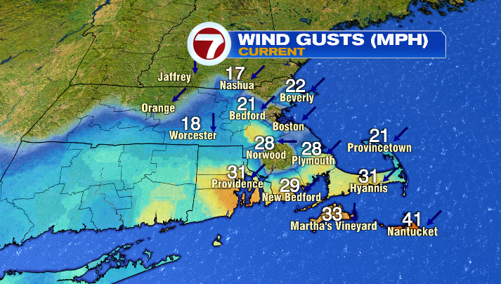
The winds and the waves are picking up, and there’s more where that came from!
Overnight we’re back into the 40s — still chilly for this time of year– and tomorrow we’re in the low to mid 60s again too.

Our storm really starts to take hold of the weather tomorrow though, as clouds move in and winds become stronger and stronger throughout the day.

Keep that in mind if you wanted to go to either of the Sox games during their double header. While it’ll be dry for game one (1:05PM first pitch), we could see a shower or two during the second game (6:05am first pitch). The wind will pick up and become very gusty, particularly during game two as well.
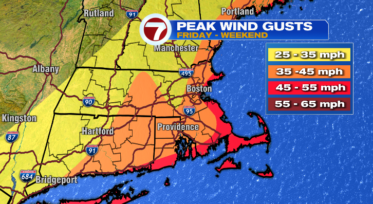
The wind is the biggest concern with this storm, and it may not be for the reason you think. While the numbers alone will be impressive, they won’t necessarily be unlike other storms we’ve seen before.
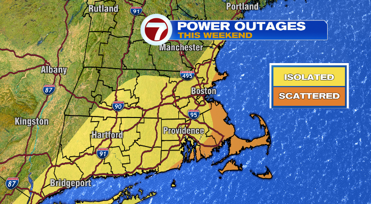
The bigger issue is that they’ll be howling while the leaves are still very much on the trees. This could lead to downed tree limbs and power outages, particularly along the coast.
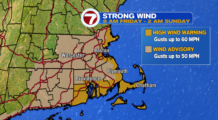
The worst of the wind will be Friday and Saturday, and though it’ll still be windy on Sunday, the numbers will taper slightly by that point. Highest gusts will be for the coast, where we could see wind gusts up to 60mph possible. The farther inland you go, generally speaking, the lower the numbers get. The exception is for higher elevations, like the Worcester Hills.
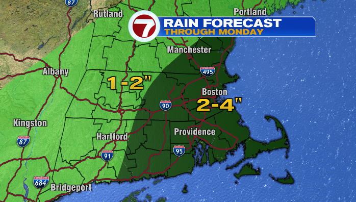
The timing on the rain is still a little unsettled, but the general idea is that southeastern Massachusetts will see rain first, likely by the evening on Friday. That said, rain really looks like it’ll move in, and become more widespread and heavier, as we get into Saturday. It’ll stay raining on and off through Sunday, tapering to showers on Monday. Right now, rainfall amounts look like they’ll be split, with Worcester County east seeing 2-4″, while areas west of Worcester County are in the 1-2″ range. While some of these numbers might seem big, the flood threat from the rain is actually low. This is because rain will be falling over a matter of days, not a matter of hours.
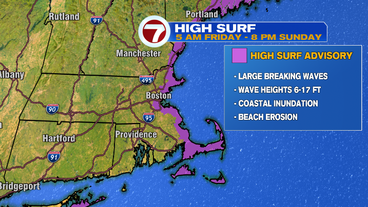
That said, we DO have a flood threat along the coast, as well as the threat of coastal erosion. This storm, as mentioned, is already pushing wave heights up, and they’ll keep going up Friday and Saturday (some areas could see wave heights above 10 feet). On top of that, the tides will be higher those days as well. That combo could lead to inundation for low-lying roads and properties right along the shoreline.
For what it’s worth, our weekend highs will be in the upper 50s and low 60s– still an October feel.
The storm pulls away on Monday. We’ll still have scattered showers around, and it’ll still be breezy. We’ll see some breaks in the clouds by Tuesday, and temperatures will become milder as well.