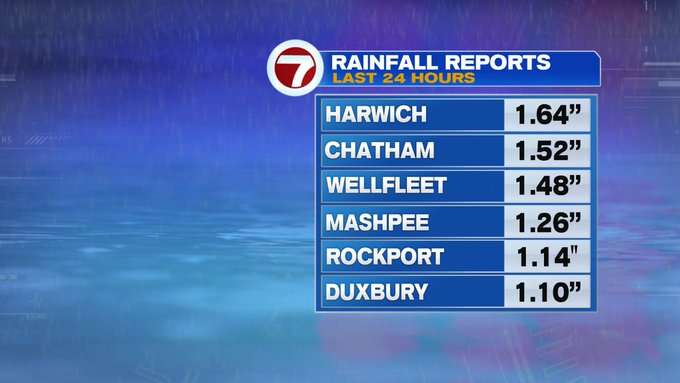
It was a wet and windy end to our week, with a few peak gusts in the upper 50 to lower 60 MPH range with a few rainfall totals over 1.5″ over the last 24 hours.

Will this dreary weather stick around for the weekend?
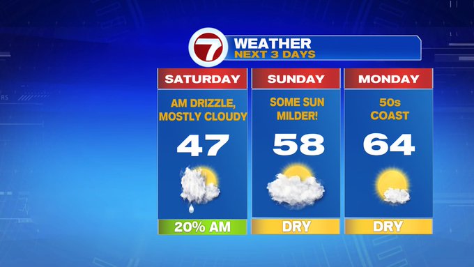
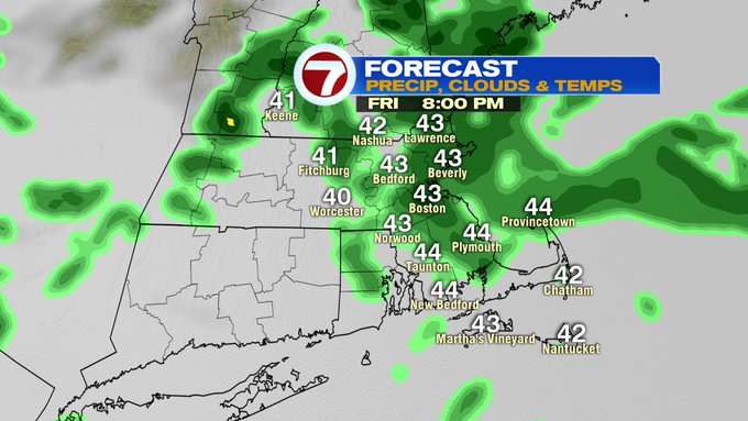
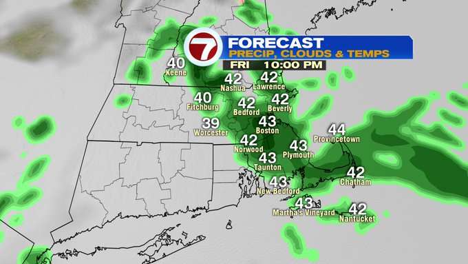
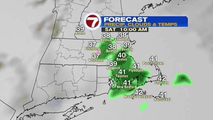
The showers stick around this evening and tonight before tapering to patchy drizzle Saturday morning.
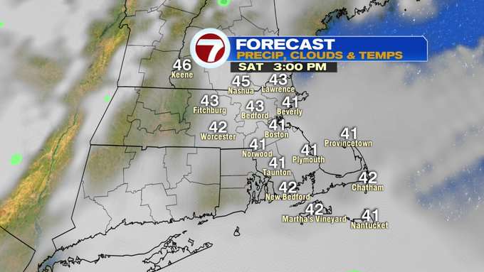
By Saturday afternoon, the showers subside, but the clouds are tough to push out. A glimpse sun is possible by the latter half of Saturday afternoon, otherwise we hold off on the sunshine for the second half of the weekend.
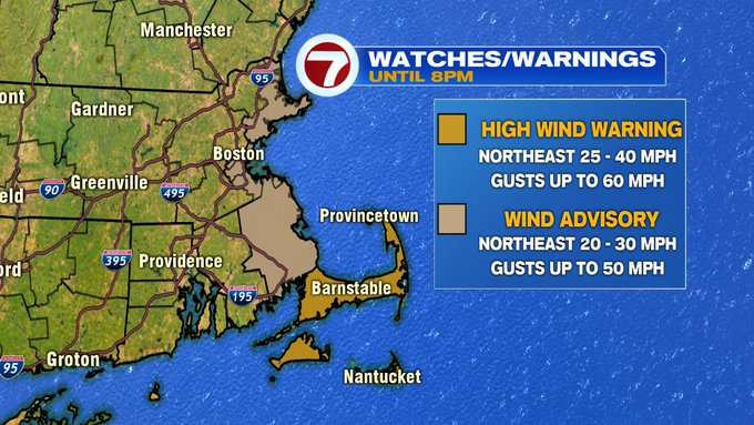
For this evening, a few advisories are still in effect. A Wind Advisory remains in effect until 8PM along the coast from Cape Ann to the South Shore and SE MA for gusts up to 50 MPH, with a High Wind Warning for the Cape and the Islands for gusts up to 60 mph.
Also for the Cape and the Islands, a Coastal Flood Advisory remains in effect from 7PM to 11PM this evening for some flooding due to battering waves and some isolated road closures due to flooding.

The pick of the weekend is Sunday, since it is drier and milder, but we’re still tracking mainly cloudy skies. Monday is even warmer under mostly sunny skies and highs into the 60s inland, 50s at the coast.

Tuesday is dry too before our next chance for showers returns midweek.

A few showers early Wednesday, and Thursday afternoon, with highs in the upper 40s to around 50 to round out the next work week.
