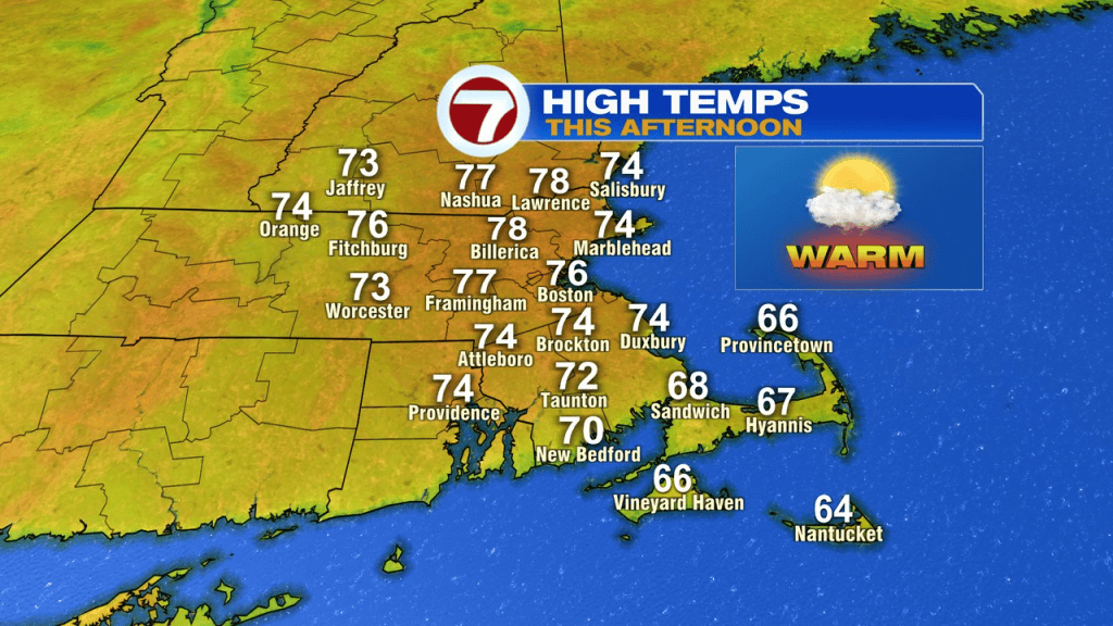
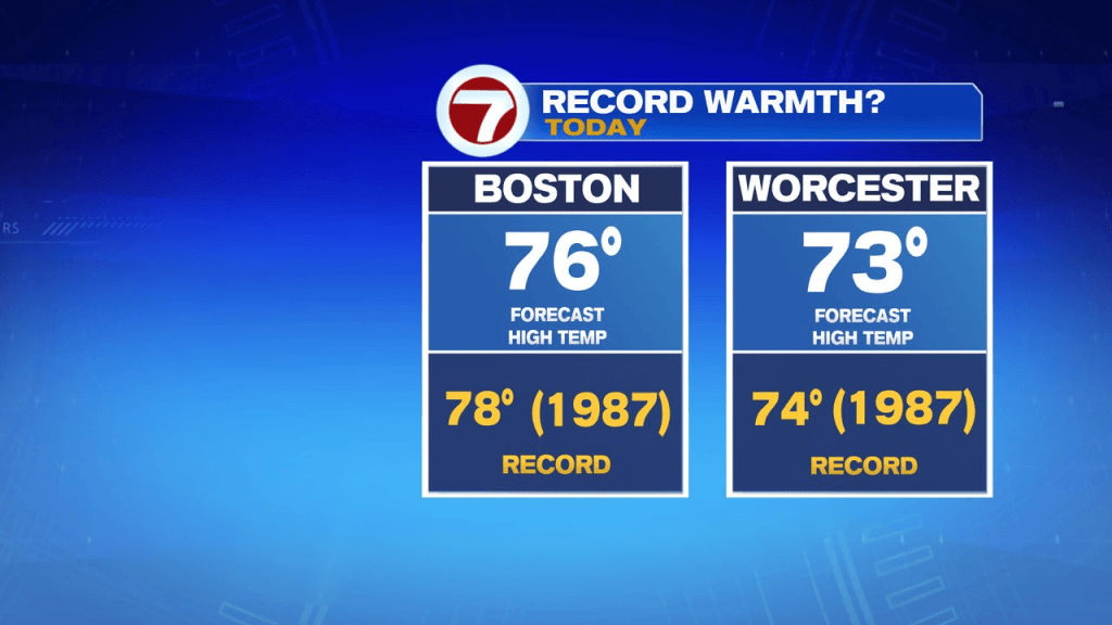
Another day, another round of unseasonably mild air in place as temps run around 20 degrees above average today. The record highs for today stand at 78 in Boston and 74 in Worcester. Both cities will be close. It’ll be a nice day overall with mainly sunny skies and a southwest breeze that’ll gust to around 20mph.
Tonight’s mild too, with temps running in the 50s to near 60.
Mild air remains tomorrow with temps running in the lower to mid 70s for eastern Mass and mid to upper 60s across central Mass, where more clouds advance in and a few spotty showers are possible in the afternoon.
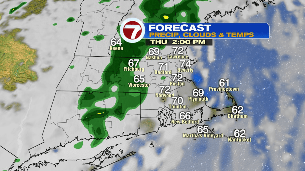
Tomorrow night, into Friday, it’ll be mild and muggy with rounds of scattered showers/embedded downpours moving in. The cold front will clear the coast late Friday night, into Saturday morning. Along that front, there will be a band of locally heavy rain. We’ll watch to see if that sets up across Southeast Mass, or just remains offshore.
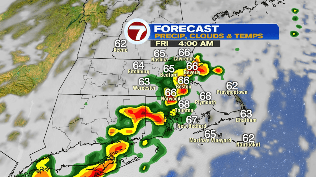
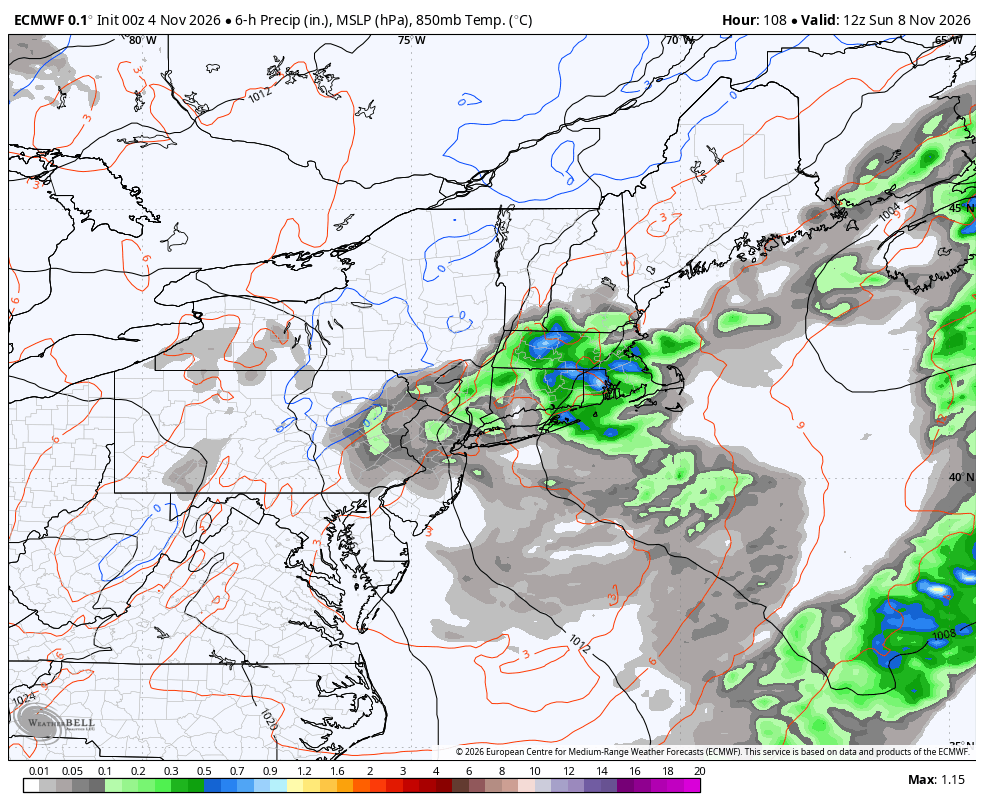
Saturday will have a few showers near the coast early, and more shower late in the day across the interior. That will leave a good deal of dry hours in the mix too, so it’s not a washout. In fact, the highest chance of wet weather is Saturday night. That round tapers off early Sunday. Sunday midday-afternoon is likely dry and cool with temps holding in the 50s. More seasonable for the time of year.