What a day we had yesterday with temps in the 50s and quite a bit of sunshine and light winds. Now, only if we could keep that around for the rest of the week! Of course, being February and being New England, that’s a tall order to ask.
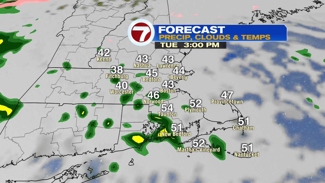
We’ll start off today with locally dense fog near and south of Boston. With temps near/below freezing, watch for a few early morning icy spots before temps jump into the 40s by midday. As clouds thicken up, temps are stubborn to warm much this afternoon. Near and north of the Pike, we stay in the 40s, although across Southeast Mass, temps bounce into the low to mid 50s. Rain showers arrive around 1-3pm and continue to increase in coverage area late this afternoon and this evening.
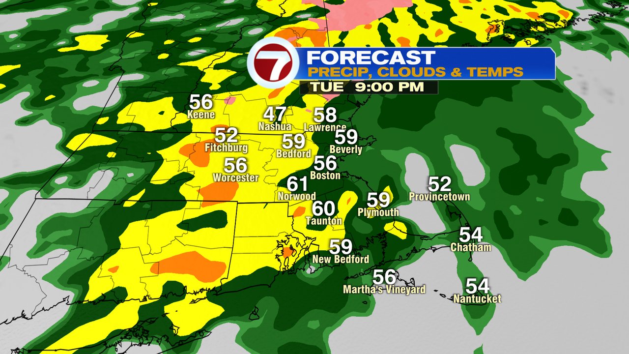
Tonight is mild, windy and wet with widespread rain and localized downpours.
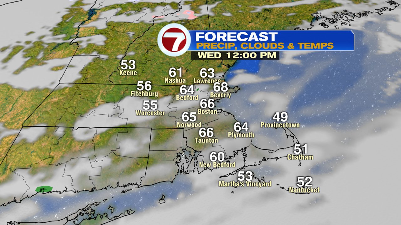
Showers taper off early tomorrow morning and as breaks of sunshine emerge, temps jump to 65-70! Close to record highs for the date. Those warm temps peak around noon, before the cold air starts to race in during the afternoon and early evening.
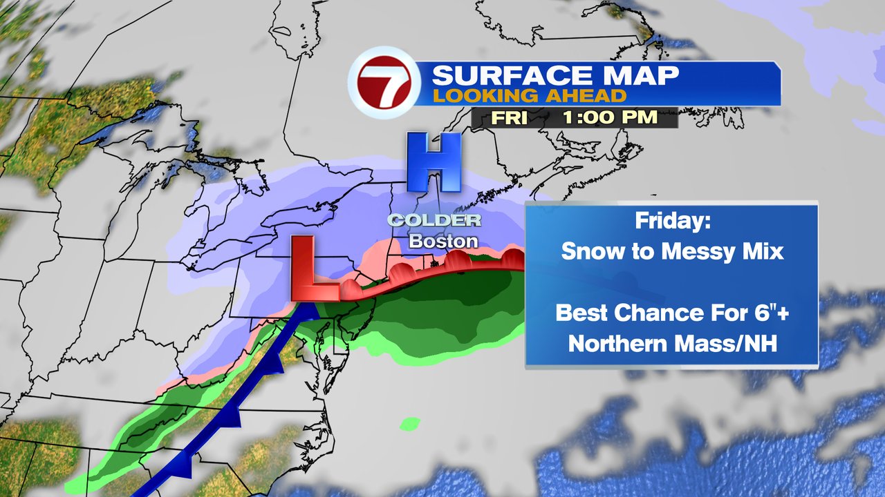
Much colder air is in place Thursday into Friday and that’s important to the forecast as we track snow, ice and rain on the way. Looks like snow breaks out predawn Friday and has the potential to produce 1″/hr rates during the morning commute. Where it stays snow the longest, is where is accumulates the most. The potential is there of 6-12″ of snow, where it stays mostly snow. The highest risk for that is northern MA and NH, but even near/around the Mass Pike, it’s possible. If the changeover to sleet/frz. rain is quicker, we’re still dealing with several inches of snow before a bunch of sleet/freezing rain and rain weigh the snow down. Either way, Friday looks messy. Snow/mix/rain tapers off by early evening, clearing out for the rest of the weekend.