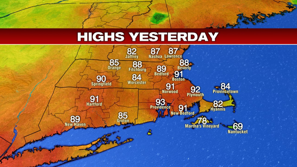
91 was good enough to tie the record for the date in Boston yesterday, marking the 2nd day of record heat and the 3rd time since Sunday Boston cracked the 90 degree mark. That summer heat, now long gone on this Thursday morning.
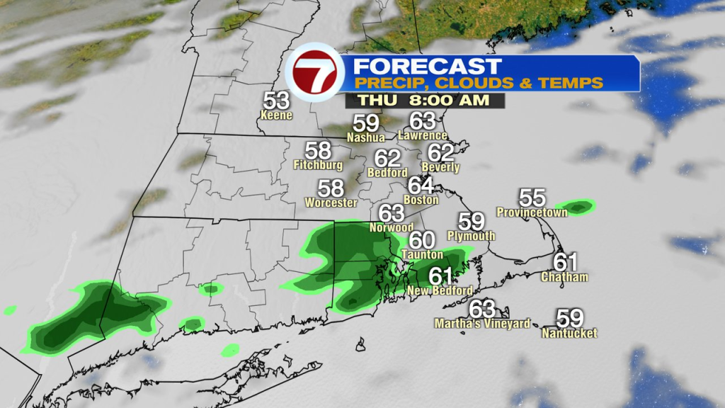
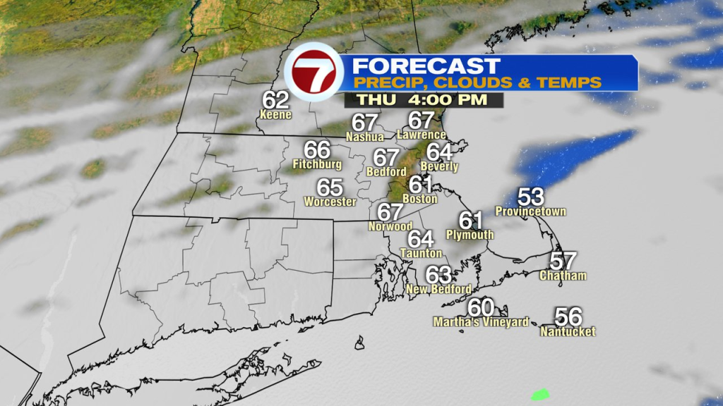
Winds have shifted to the north, draining in much cooler air and much lower humidity as dew points fall back into the 30s today. We will have a lot of clouds in the mix through the day, and even a few early sprinkles/light shower near and south of the Pike. By mid to late morning, spotty light showers still extend across Southeast Mass and RI. Mainly dry air prevails this afternoon with temps in the mid 60s to 70 inland and near 60 along the coast.
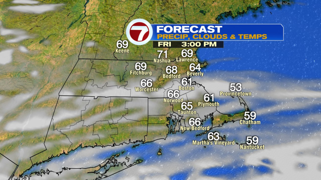
Skies clear out tonight and temps fade fast, back into the low to mid 40s by daybreak tomorrow. The bounce back is nice tomorrow, mid 60s to near 70 inland while holding near 60 at the immediate coast.
Holiday Weekend…
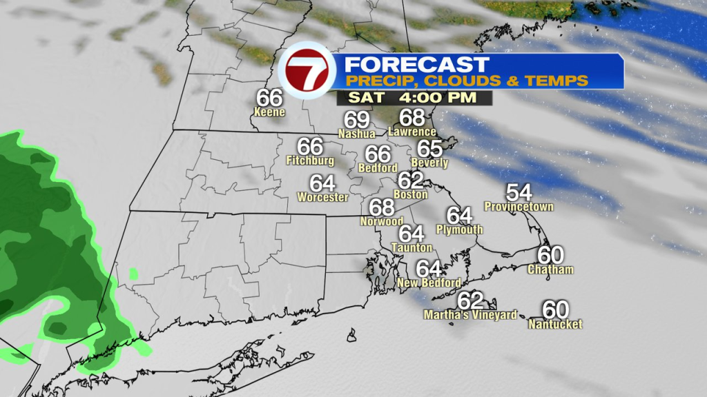
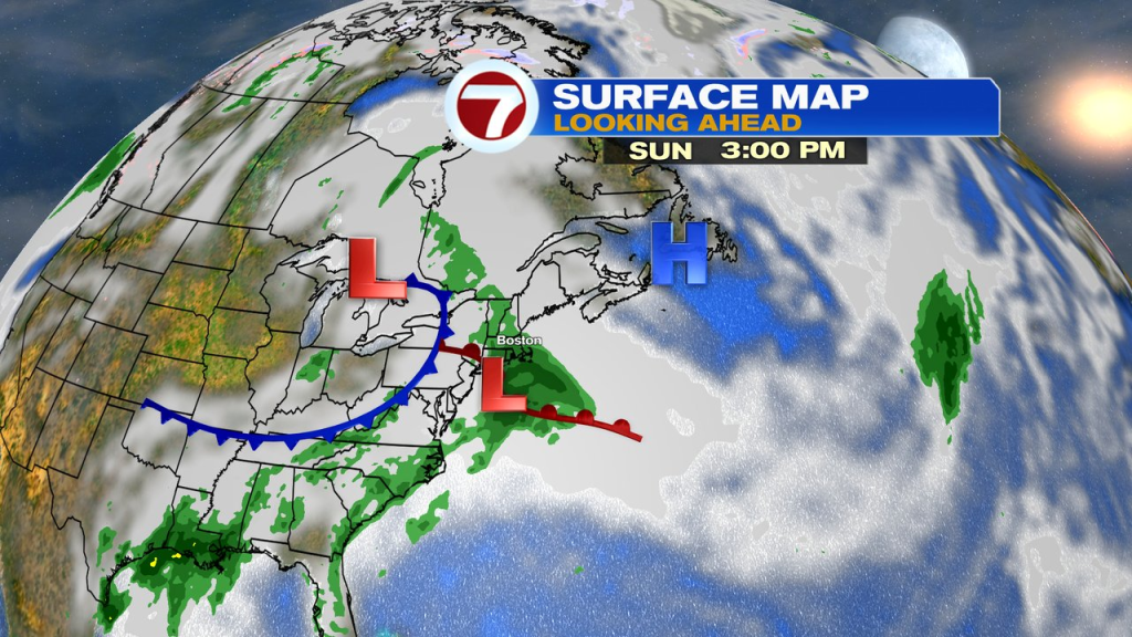
Alright, not the best but not a washout either. Clouds thicken Saturday with mainly dry weather and temps in the mid 60s. Sunday does feature the highest chance for showers and rain cooled air with temps stuck in the 50s to near 60.
Monday is a bit better again with some scattered leftover showers, but dry periods too with highs in the 60s to low 70s.
Go figure, we’re back to the 70s to near 80 by Tuesday and Wednesday.