Happy Monday! It wasn’t the best weekend weather-wise, but it certainly got a whole lot better today! We’ll get more sunshine on Tuesday with summer-like high temperatures before we cool back down later on this week.
First, evening temperatures tonight will cool from the 60s to the 50s with overnight lows in the upper 40s and low 50s. Skies will stay clear overnight and the wind will die down as well. However, right away on Tuesday the wind will come back. Skies will be sunny again with warm highs in the upper 70s and low 80s!
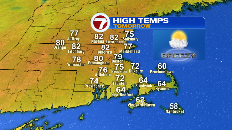
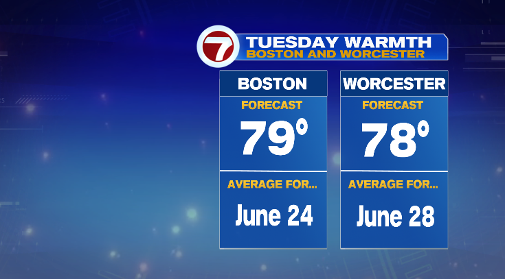
These are the types of temperatures we typically see in June, by the way.
Winds will gust to over 30-40 mph so hold on to your hat! At least it’s a warm breeze.
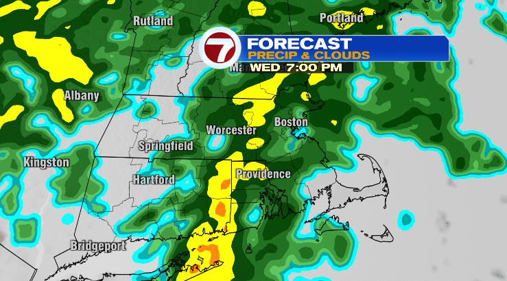
Wednesday, we start off in the upper 50s with highs near 70 degrees. Skies will be partly to mostly cloudy with a chance for some evening showers.
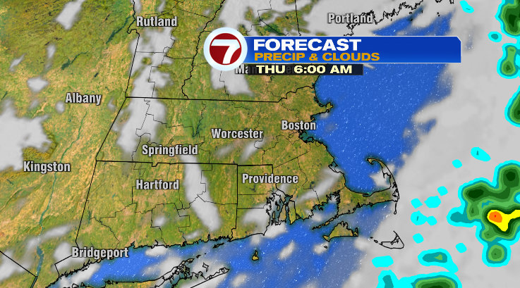
Those rain chances continue overnight and into early Thursday morning. The rest of Thursday, except for some showers on the Cape, looks drier and partly sunny. Highs will be a bit cooler in the mid 60s after a morning dropping down to the low 50s.
Friday, the cooling continues! We start off in the low 40s with highs in the low 60s. Skies look bright but it’ll be windy again.
Saturday: low 40s to near 60 degrees with mostly cloudy skies and a chance for a few showers. Sunday is Mother’s Day! The day looks fantastic with a sun/cloud mix and highs near 70 degrees. Next Monday we’ll start the week with showers. Stay tuned!