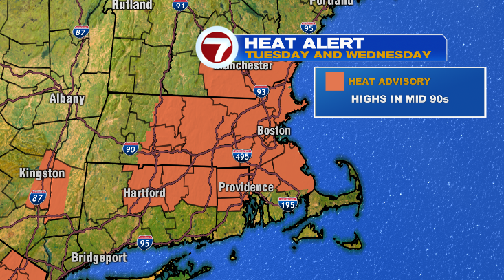
Happy Tuesday! WOW. What a summer (spring?) scorcher it was today. We’ll have more of the same tomorrow before a big cooldown later this week.
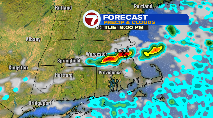
Highs today jumped into the mid 90s which was record-breaking here in Boston. We still have a chance for some spotty showers and thunderstorms the rest of this afternoon and this evening. Talking temperature, this evening we’ll cool pretty quickly down to the 70s with overnight lows in the 60s.
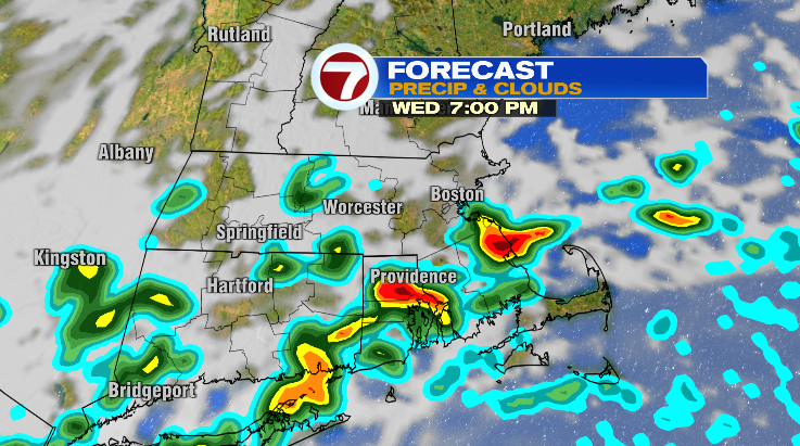
Your Wednesday starts off with plenty of sunshine and warm temperatures. We’ll jump from the 70s to the 80s back into the 90s Wednesday afternoon.
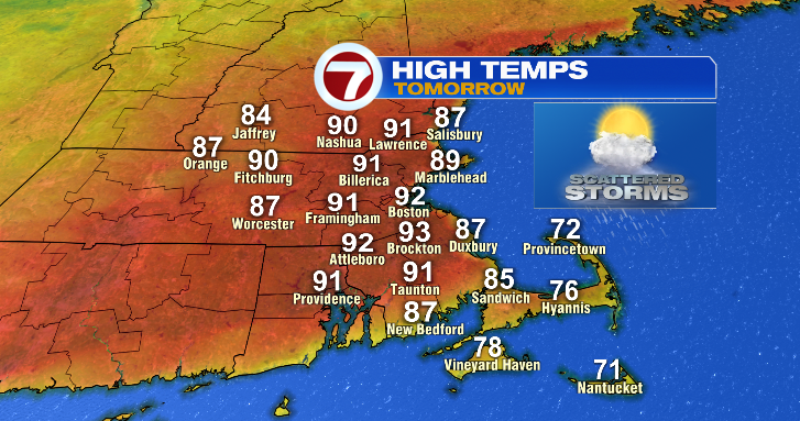
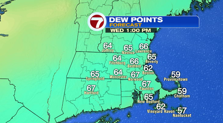
Highs in the low 90s with dew points in the 60s will make it feel like the upper 90s during the warmest part of the day.
In the afternoon and evening, again, we’re tracking another chance for showers and thunderstorms. A few may become strong to severe so stay weather aware.
After Wednesday…it’s back to business as usual! Temperatures will cool down in a big way back toward average for this time of year. Thursday looks partly sunny with highs in the upper 60s. Same with Friday.
I wish I had better news for the Memorial Day weekend. Right now it looks like Saturday will be the pick of the weekend with highs in the low 60s with rain chances holding off until the evening. Sunday will feature spotty showers and the low 60s. Monday: few showers and upper 60s. We’ll be watching that rain chance as the week progresses. Stay tuned!