

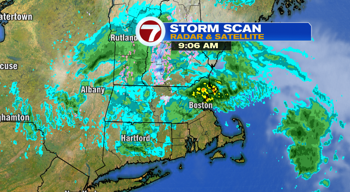
It’s been a stormy start to the weekend, and we’re not even close to done just yet!
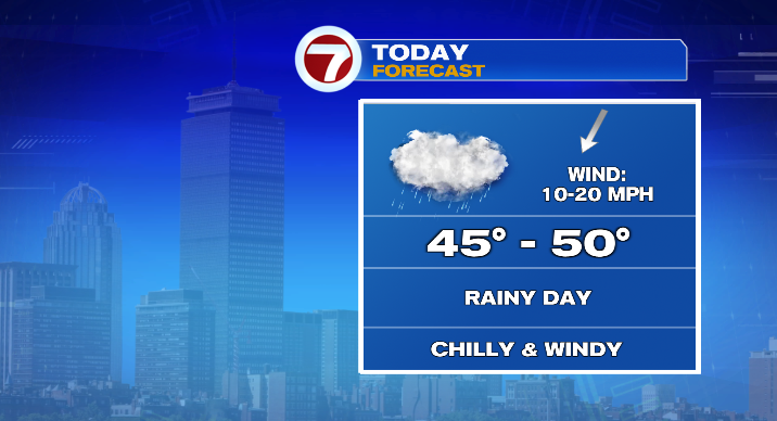
As a storm moves south through New England, we’ll have more rain, wind and March-like temperatures. Let’s start with the timing and the rain. Showers and some heavy rain will come in waves from north to south, and leave in the same direction. That means, the further north you live, the earlier you saw the rain this morning, but the sooner you’ll see the rain leave this afternoon.
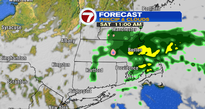
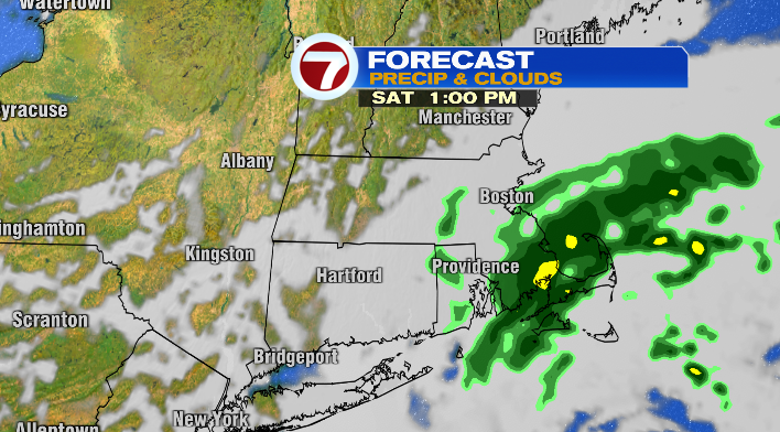
In fact, folks in areas like Worcester County could even see some sunshine before sunset.
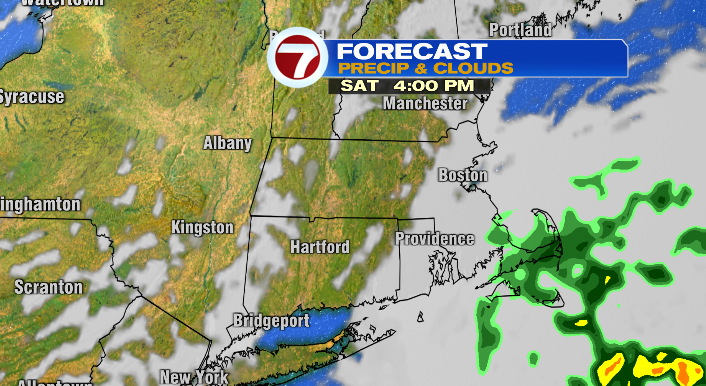
On the flip side, if you’re on the South Shore, South Coast, Cape & Islands, the rain takes longer to reach you, but won’t be gone until 3-5 PM or so, and the clouds will take longer to break as well.
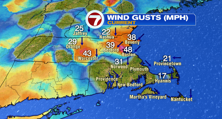
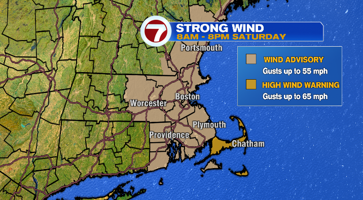
Now for the wind. We’ve already seen gusts in the 20s, 30s & 40s. But with the strength of this storm, we could see more up to 55 mph for most of the coast, and 65 mph for the Cape and Nantucket.
For that reason, we have a Wind Advisory and a High Wind Warning until 8 PM this evening. We could even see a few power outages because with the potential of winds blowing weak tree limbs onto power lines.
Finally, the chill. Temperatures early this morning were largely in the low to mid 50s. Not the worst start for this time of year.
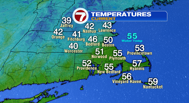
But as the cold air associated with this storm kicks in, temperatures go down instead of up. We’ll be in the 40s for most of the afternoon.
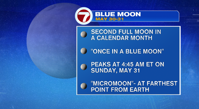
If there’s a bright side to this forecast, it’s that the storm is gone and clouds clear in time for us to see the only blue moon of 2026! It will rise tonight, and peak illumination will be at 4:45 AM tomorrow morning! It will be a micromoon, meaning it’ll look smaller than normal, as the moon is at or near apogee, its farthest point in orbit from the earth.
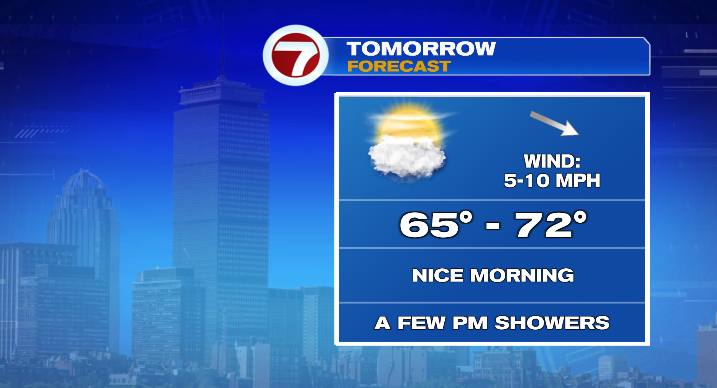
On the note of tomorrow morning… it’ll be beautiful! It’ll be a cold start with temps in the 40s. However, we’ll have some beautiful sunshine as well, and by the afternoon, temperatures will reach the mid to upper 60s and low 70s– not far from normal! That said, clouds increase in the afternoon and we’re keeping an eye out for a few spotty showers as well.
We’ll keep a few showers around on Monday, though they’ll stay spotty. Temperatures will be cooler as a front comes through with highs in the low 60s. We’ll keep a shower around on Tuesday, with a mix of clouds and sun and a shower or two remaining.
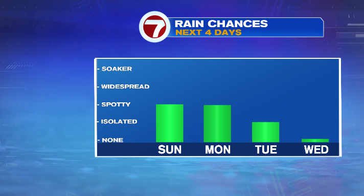
The weather finally takes a turn on Wednesday! We’ll be mostly to partly sunny, and the chance of a shower is incredibly slim. Highs will be in the upper 60s. Thursday is mostly sunny and even warmer, with highs in the mid to upper 70s!