It was another gorgeous day across the region with low humidity, highs into the upper 60s to low 70s at the coast, to mid 70s inland under mostly to partly sunny skies.
Through this evening and into the overnight, we’ll see increasing cloud cover with lows only dipping into the low 60s.
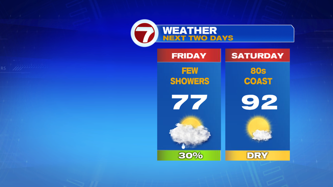
By Friday morning, a few showers could be dotting the radar, with some scattered rain by late morning and into the early afternoon. By Friday evening, the bulk of the rain should be out of here.


Highs tomorrow will stretch into the mid to upper 70s.
After a mainly cloudy and wet end to the week, the summer heat and slight humidity returns this weekend. We’re talking highs into the 90s with dewpoints into the 60s, making the heat index values nearing triple digits, which is extreme. Here’s a look at the forecasted heat index for Saturday at noon.

Be sure to take plenty of water breaks for any of your outdoor plans.

Both weekend days feature sunshine and highs into the 90s, with Sunday being the hotter of the two.


The 90s are sticking around even into the first few days of the next week.

