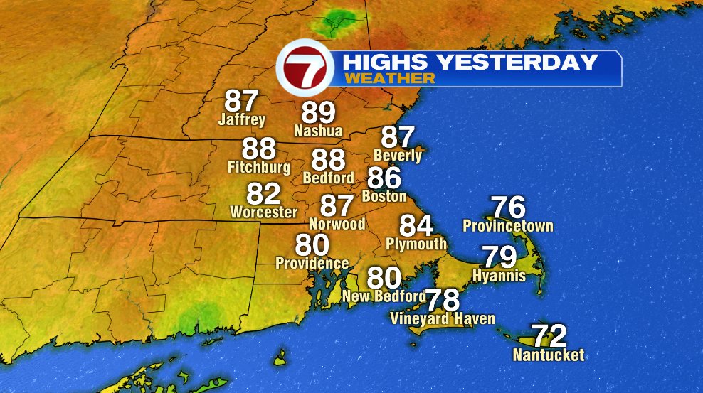
This weekend has been our return of summer in southern New England. Yesterday tied the record in Boston with the high hitting 86°.
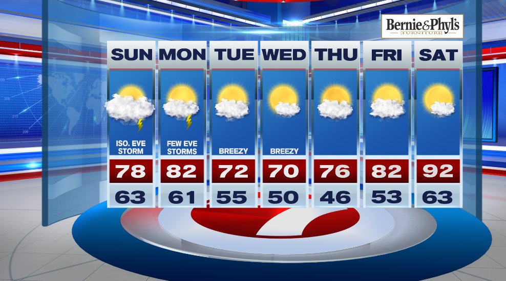
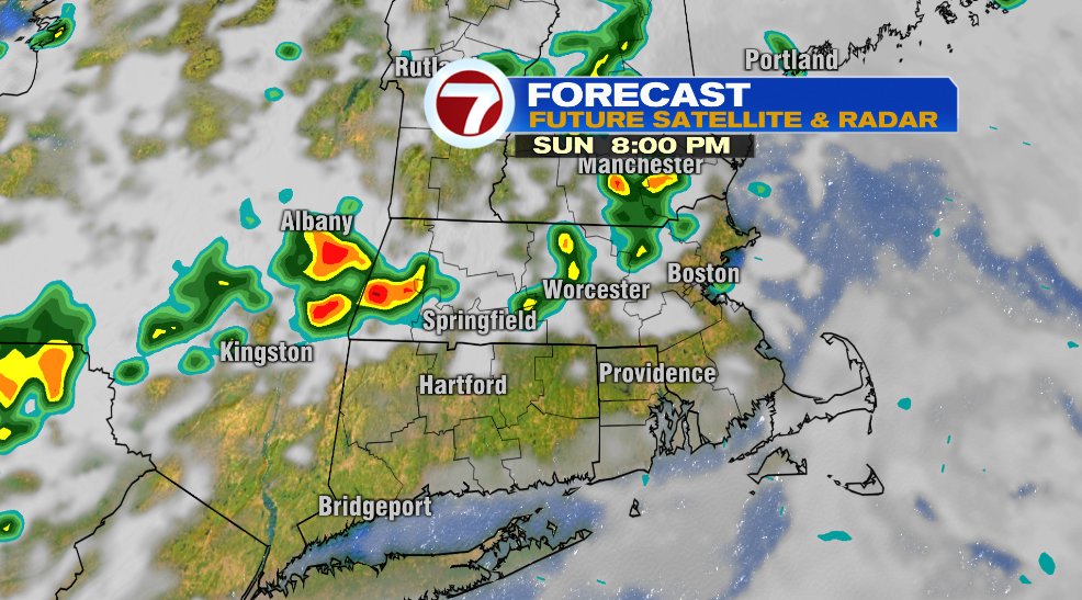
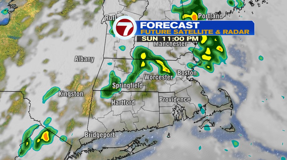
Today will feature more clouds which will limit our warming a bit, but temperatures will still be ten-ish degrees above average. It will be humid again as well. There’s a very small chance of an isolated storm later this evening.
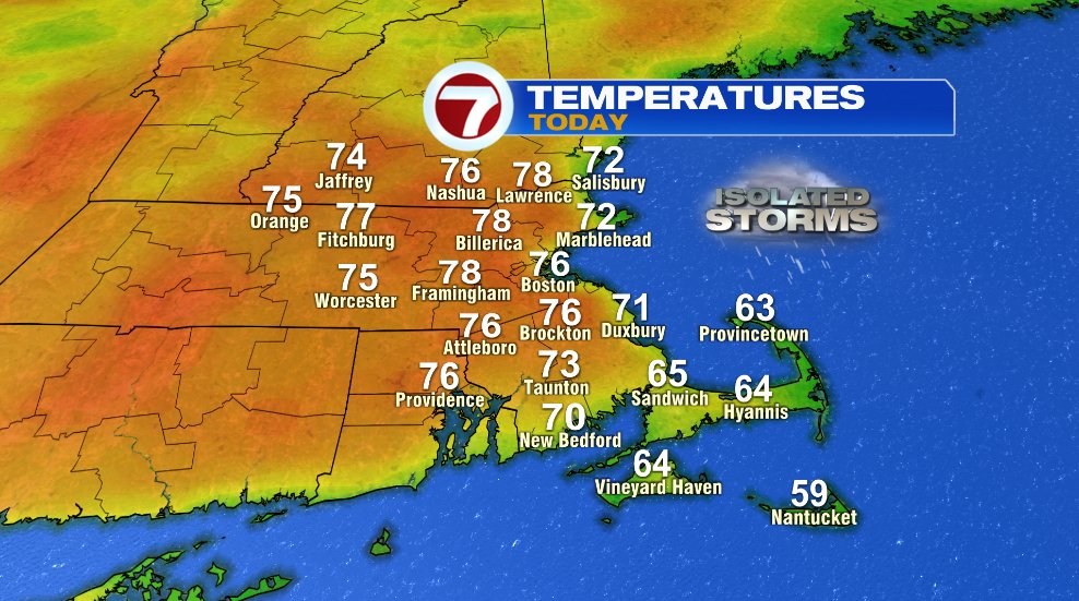
That chance of a thunderstorm is not until later in the evening and early overnight, but it’s spotty. Not everyone will see rain or a thunderstorm, but keep it in the back of your mind if you’re outside later today.
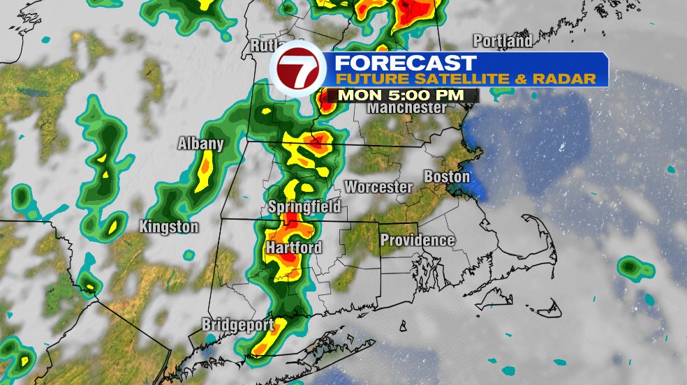
Tomorrow morning will continue the pattern of the last few mornings with clouds and fog to start and developing sunshine later in the morning hours. Temperatures on your Monday will head back to the lower 80s with the humidity lasting another day. A cold front will come through Monday evening, which again will give us another chance of storms.
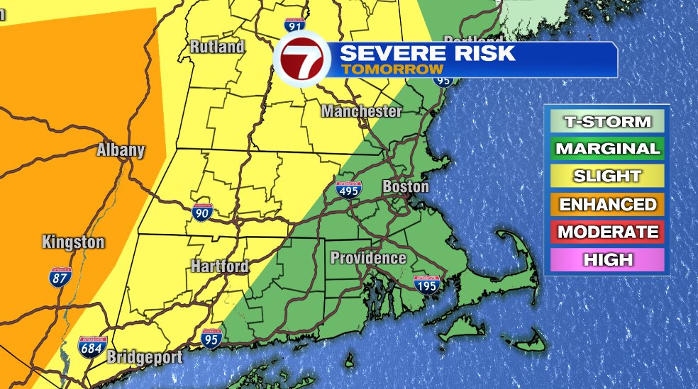
With the heat and humidity in place, there is a possibility of a few of these storms being strong or even severe. The best chance of severe weather is well to our west in New York state and that chance stepping down as you head east. The slight chance (yellow) which is west of 190 is the best chance in our area. The question will be how will the line holds together as it makes it’s way east toward the coastline. The main risk would be damaging wind gusts and hail.
That cold front will cool us off for a few days but the heat is not done yet. It looks like it comes roaring back again next weekend!