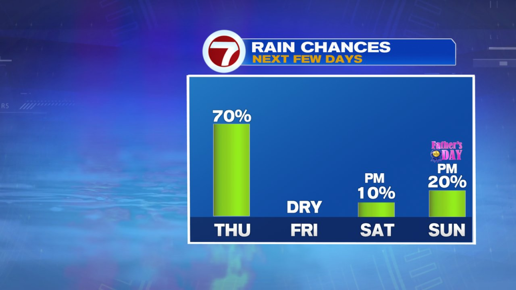
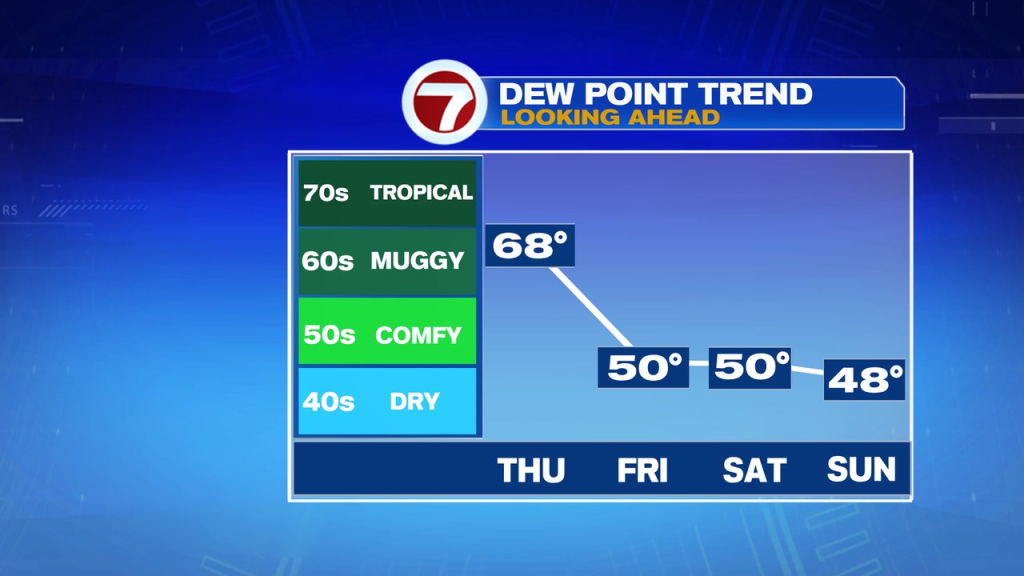
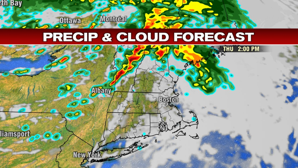
It’s a milder and muggier start to the day with a warm front lifting through, producing some showers as well. Batches of showers will be in and out through the morning to about lunch time. There after, we’ll catch more dry breaks early to mid afternoon with some sun trying to reappear at times too. At this point, temps head up into the mid 70s to near 80 as dew points surge well into the 60s.
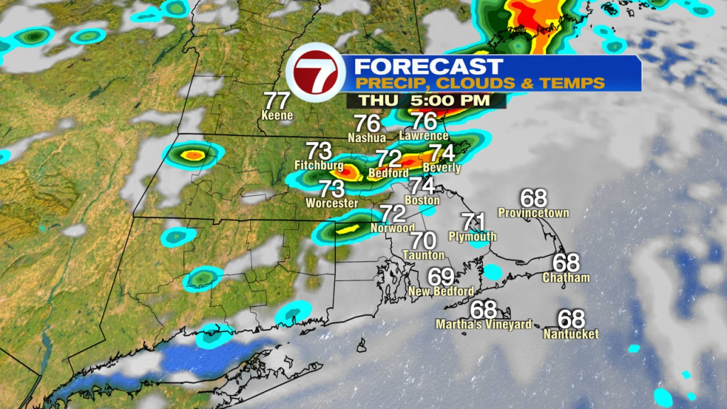
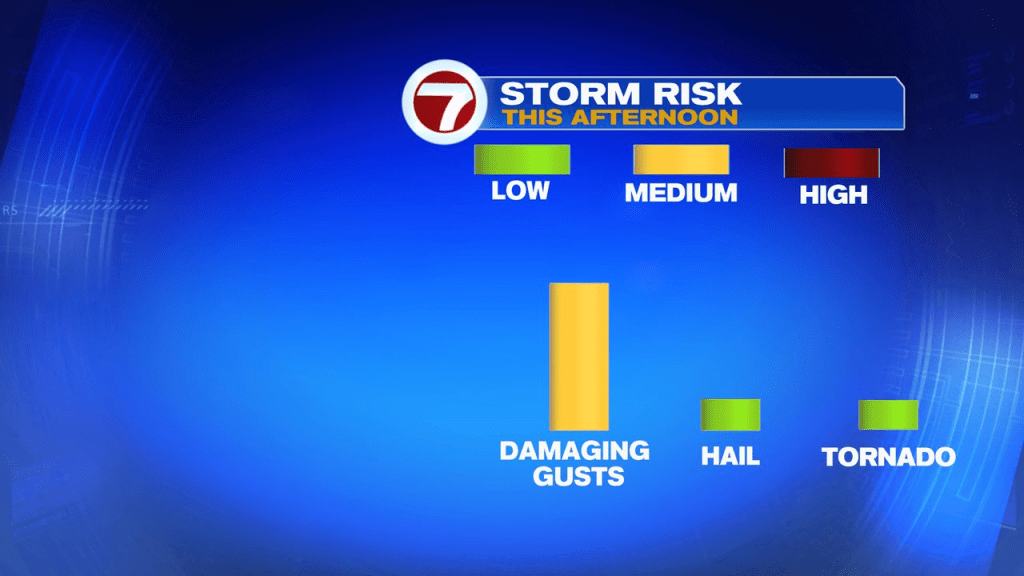
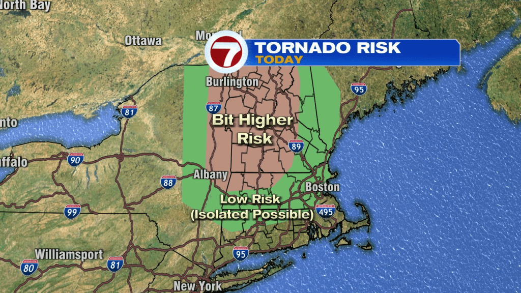
Mid to late afternoon, a round of scattered storms drop in from west to east. These storms have the potential to be locally strong to severe with damaging wind gusts as the main risk. With that said, there’s enough rotation/spin to the atmosphere, that we’ll have to watch the potential of any severe storm also producing an isolated tornado. The risk is low, but non zero. That chance is a bit better across interior New England too, vs eastern Mass. The lowest severe risk today is Southeast Mass. The main timeframe to watch is around 3-7pm from west to east.

Once the cold front clears the coast this evening, the humidity will drop back off as we dry out. That’ll set the stage for a fantastic finish to the week with temps in the lower 80s and lower humidity tomorrow. That low humidity continued into the weekend. It’ll be breezy too tomorrow and again on Saturday. While a pop-up afternoon shower can’t be ruled out over the weekend, much of the time is rain-free. Sunday has the better chance for the brief passing shower.