

Clouds thicken through today with with some spotty showers northwest of Boston at times. The rain that falls tonight is light, so won’t amount to much, but overall it will keep a cool, damp feel to the air for towns and cities across northern Mass and NH. Highs range from the mid 40s northwest of Boston to the mid 50s south of the city.
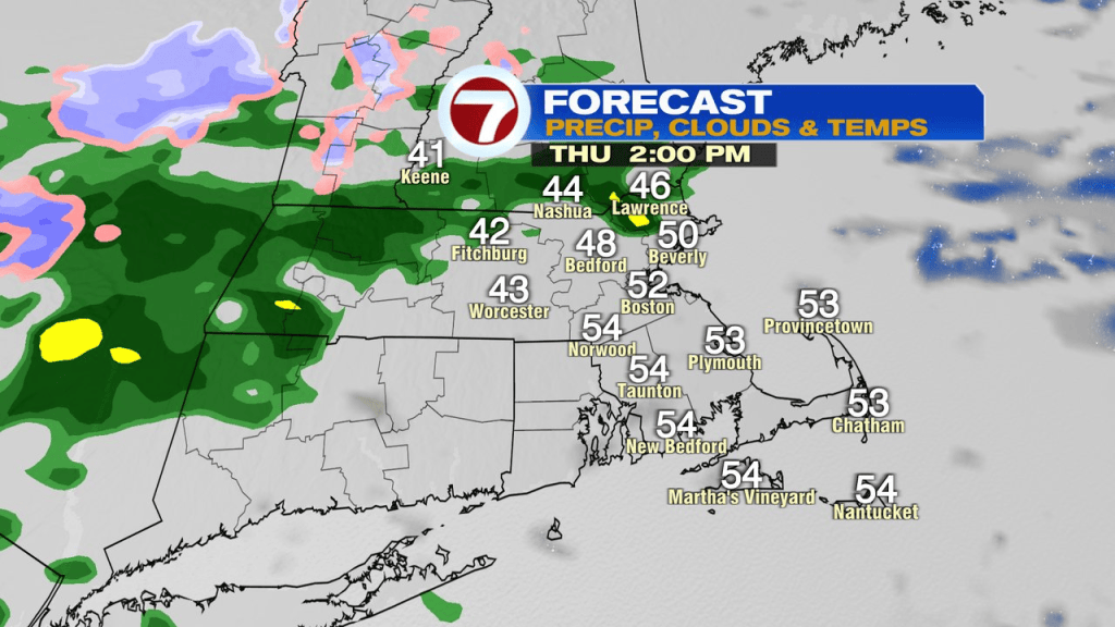
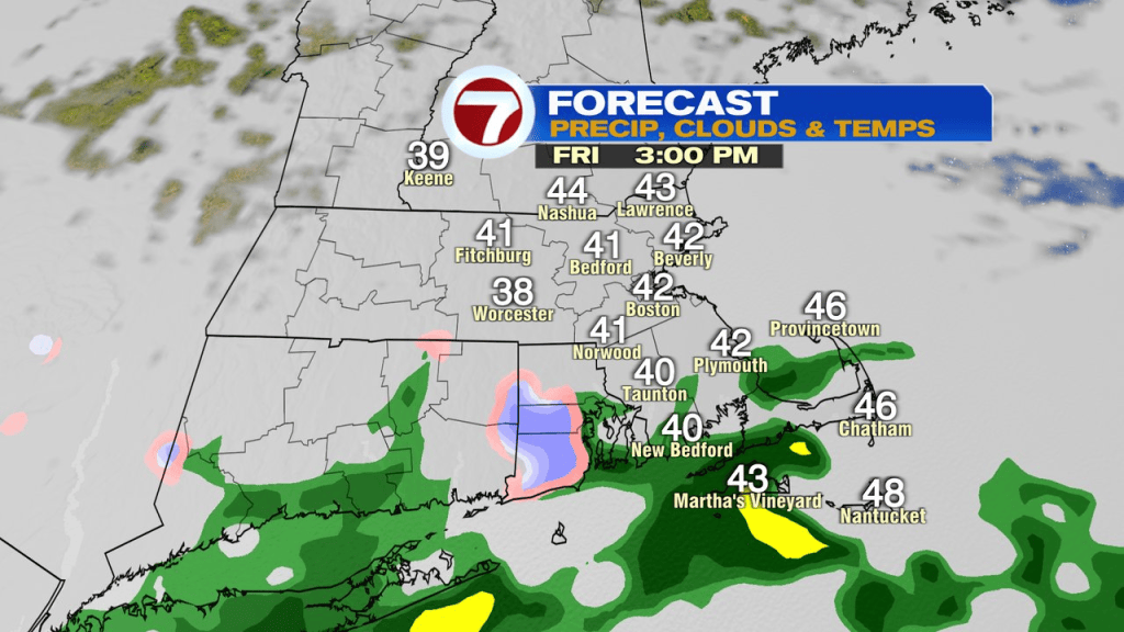
As an area of low pressure develops south of New England tonight, rain becomes more widespread. As colder air starts to drain into this system as well as being brought down from aloft with heavier precip, some wet snow starts to mix in across the higher terrain. First across the Greens and Berkshires, then by early tomorrow morning, some wet snow mixes in across the Worcester Hills. While we’ll catch some wet snow in the mix across the interior tomorrow morning, with temps staying above freezing and the ground being warm, it won’t be much of an accumulation issue. Just a sign of the seasons changing and a long way away from the 70s of last week. The best shot of a few inches of snow will be the highest terrain in western New England.
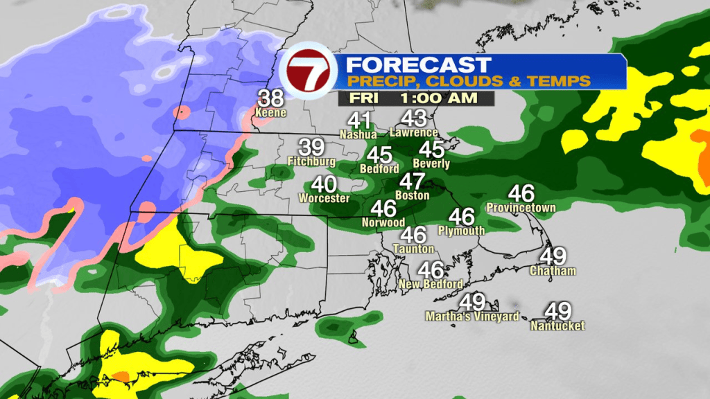
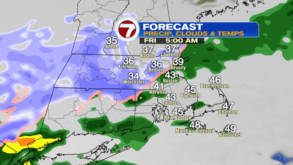
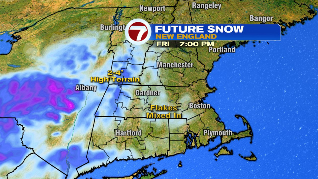
By midday tomorrow, showers that are leftover are mostly south of the Pike as some drier air tries to push in.
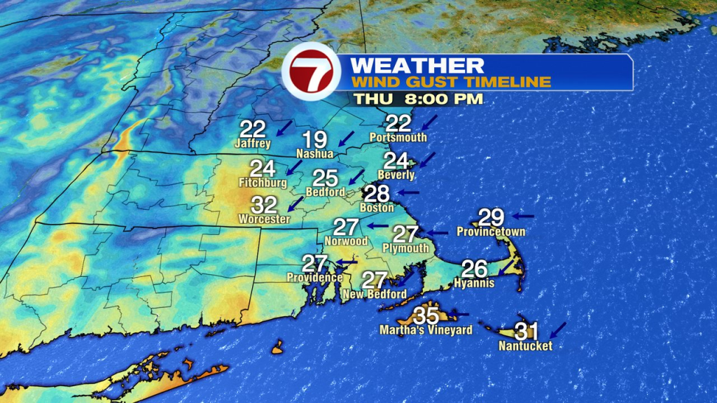
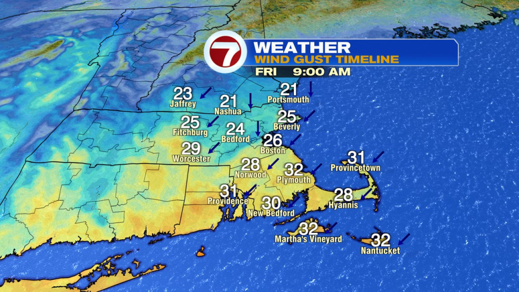
A gusty breeze picks up tonight into tomorrow too, with gusts pushing 25-35mph out of the northeast. Strongest across Southeast Mass.
The weekend looks cool overall, but we dry out. Mid 40s Saturday, upper 40s Sunday.
Next week looks to be off a nice and bright start. By Wednesday, temps nudge back to near 60.