Happy Saturday! It wasn’t the warmest day today, but at least it was dry! We can’t say the same for the rest of your holiday weekend.
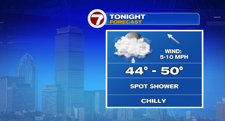
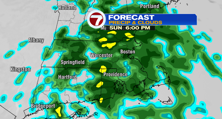
Overnight we’ll be cloudy and cold! Lows will drop to the mid to upper 40s and we cannot rule out some spotty sprinkles. Otherwise, to sum up your Sunday? Wet and cold. Central Massachusetts will see rain as early as 6-8 a.m. while eastern Massachusetts will see it begin in the hours after. It will be a soaker of a day, not allowing for much of a warm-up.
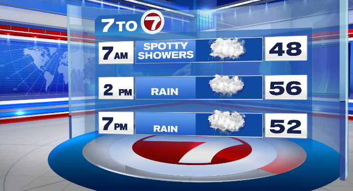
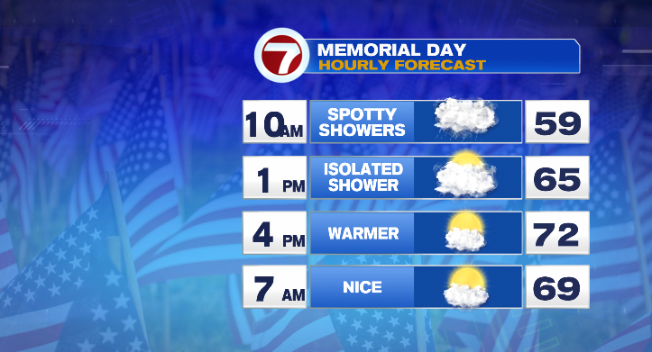
Temperatures will stick to the 50s most of the day. Unfortunately, it’ll be an inside kind of day. Showers will continue overnight into Memorial Day morning.
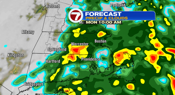
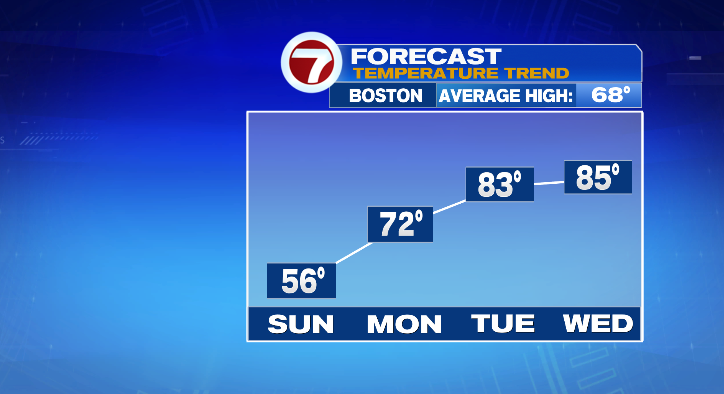
Showers will exit toward the early afternoon, though, and that’s when we’ll see that big improvement! The later-day partial sun will warm us from lows near 50 degrees to highs in the low 70s.
After Monday…the warmth is ON! Tuesday starts off in the low 50s but some sun will warm us all the way into the low 80s! That looks like one of the best days this week. Wednesday will be very warm, too. The morning starts in the low 60s with highs in the mid 80s along with a chance for some showers and thunderstorms in the afternoon and evening.
Thursday is one of the better days this week, too! It looks mostly dry right now with just a low-end chance for a spot shower in between partly sunny skies. Lows start in the upper 50s but highs will be comfortable in the upper 70s. We’re watching some rain chances Friday or Saturday. Stay tuned!