

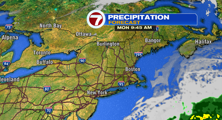
Happy Sunday! Wow! It was a cold one this morning with lows down to the 20s and 30s. It’ll be another cold night tonight, with a bright and fall-like feel ahead for your Monday.
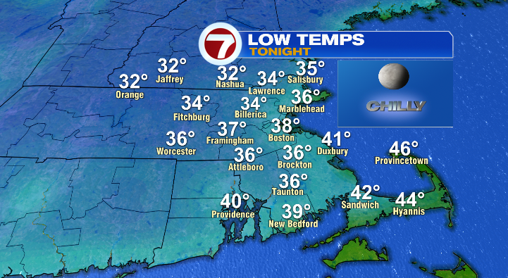
First, most of us will settle into the 30s tonight with a few 40s here and there, especially closer to the Cape. Skies will be clear.
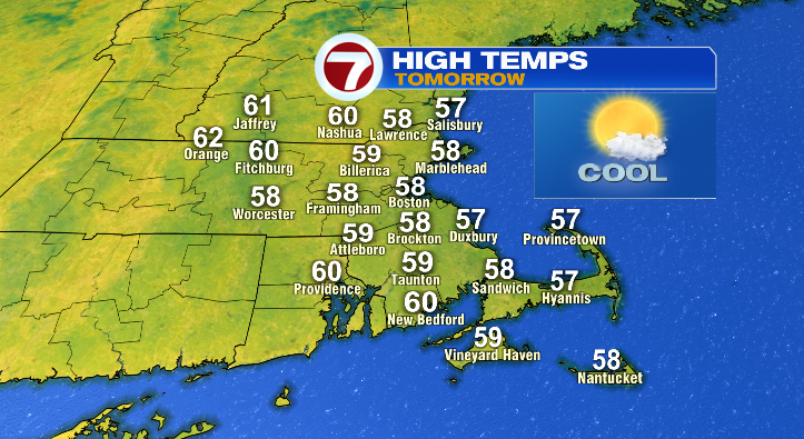
Monday will be pretty bright for much of the day. A few clouds could roll in near coastal areas late in the day, but still, plenty of dominating sun. The sun will warm us up to the upper 50s to near 60 degrees. It won’t be windy, too!
Monday night, increasing clouds with lows in the 30s and 40s. Tuesday, partly cloudy with highs in the upper 50s and low 60s. A nice day!
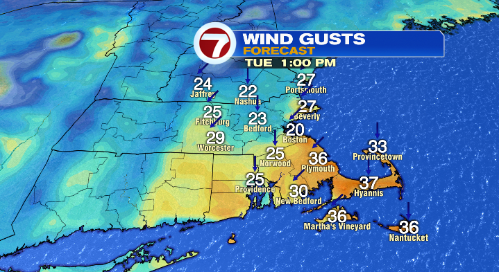
There will be a bit of a breeze, and an offshore storm could bring a spot shower to the Cape/islands.
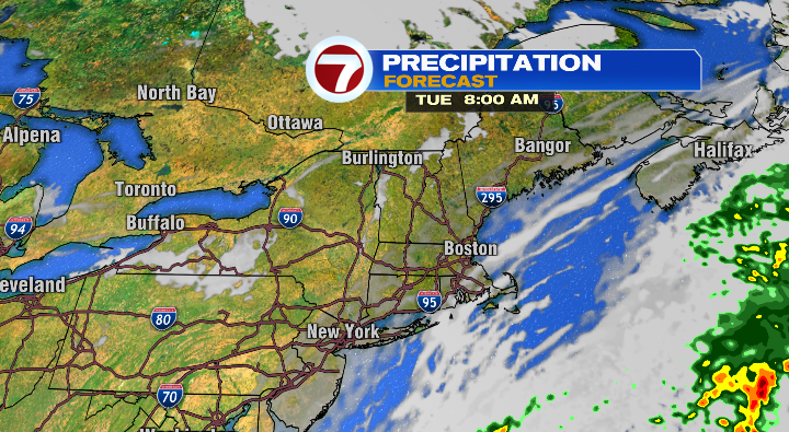
Wednesday will be a similar day. More cloud coverage east, brighter west. Lows will start off in the 30s and 40s with highs in the mid 50s.
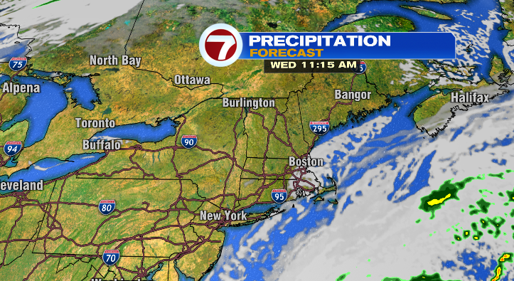
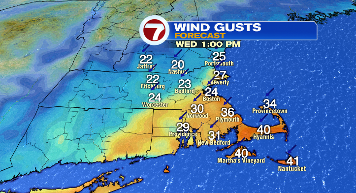
Again, the offshore storm meandering around could bring another spot shower to the Cape and islands. Otherwise, you’ll notice the breezy conditions, especially in the afternoon.
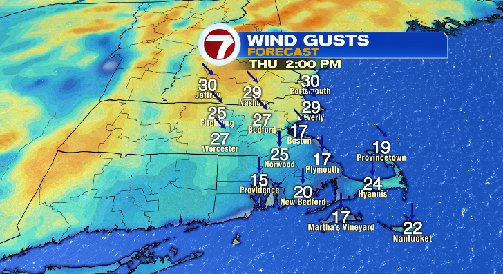
Thursday’s morning lows will again tumble to the 30s and 40s with afternoon temperatures reaching the the upper 50s and low 60s. Skies look partly cloudy, and the breeze will stick around.
Friday’s morning lows will be the same with cooler afternoon highs in the low to mid 50s. Skies look bright! Next weekend: mostly sunny, lows in the 30s with highs in the 50s.