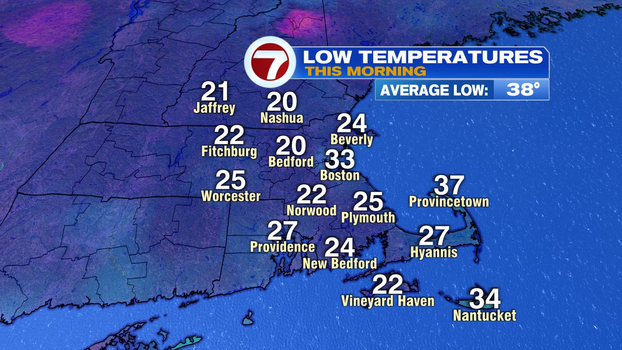
Yikes! Feel the chill in the air this morning? Certainly it was hard to avoid noticing the cold as we head out to school or to work. Maybe a few extra minutes to warm up the car is in store? Temps start near 20 in the colder suburbs this morning and in the low 30s in Boston, so it is indeed one of the colder starts, if not the coldest start of the day for many so far this season.
Sunshine is with us this morning, but clouds thicken this afternoon as highs head for the low 40s. Winds are lighter too, so that’s good.

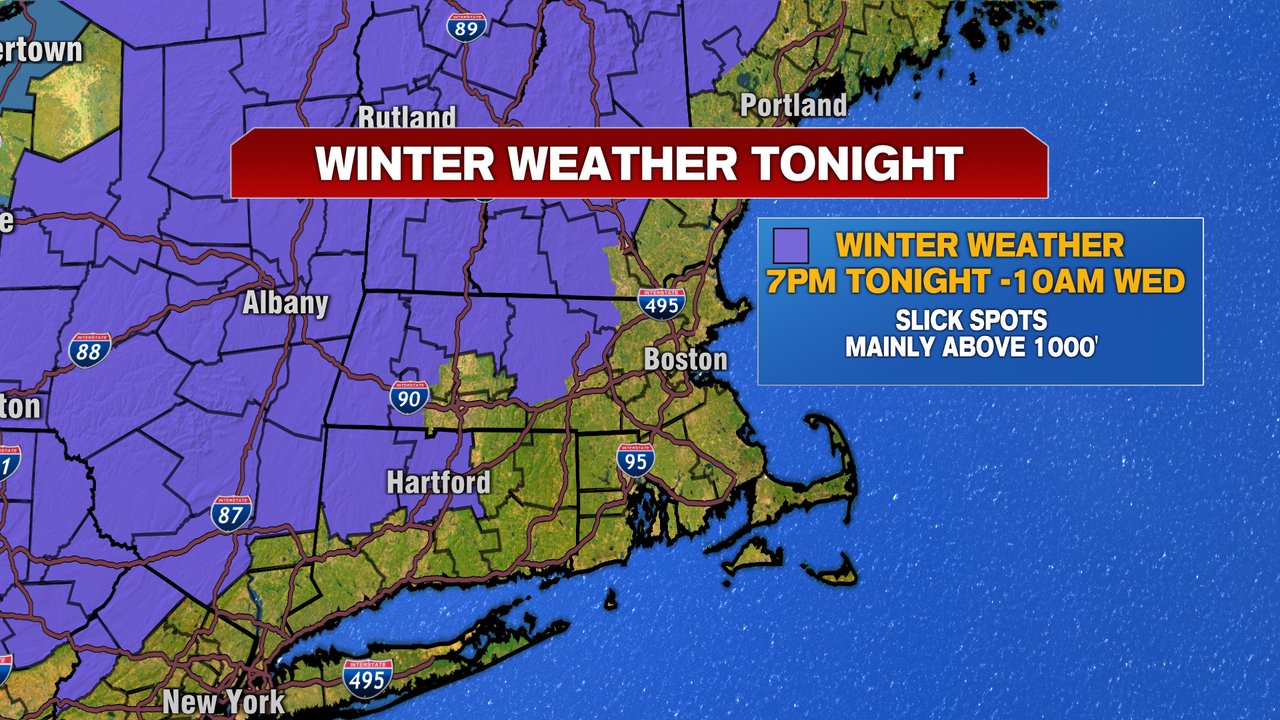
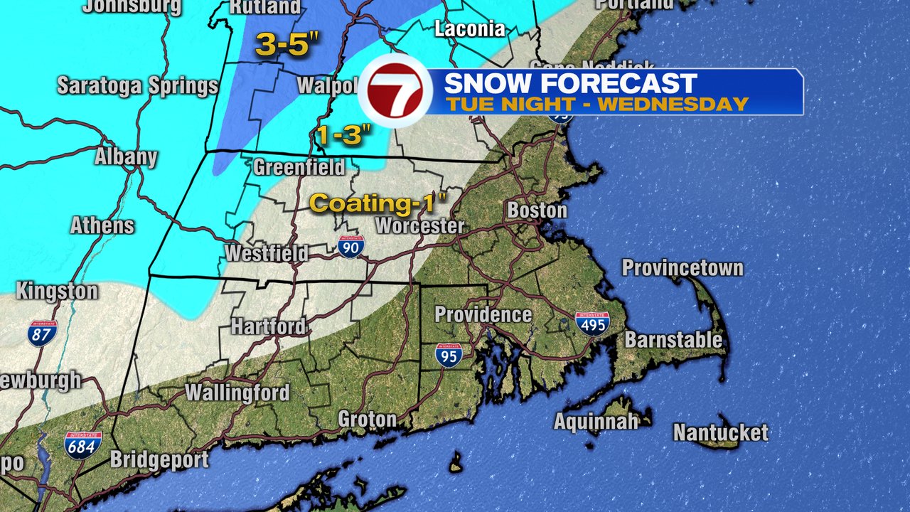
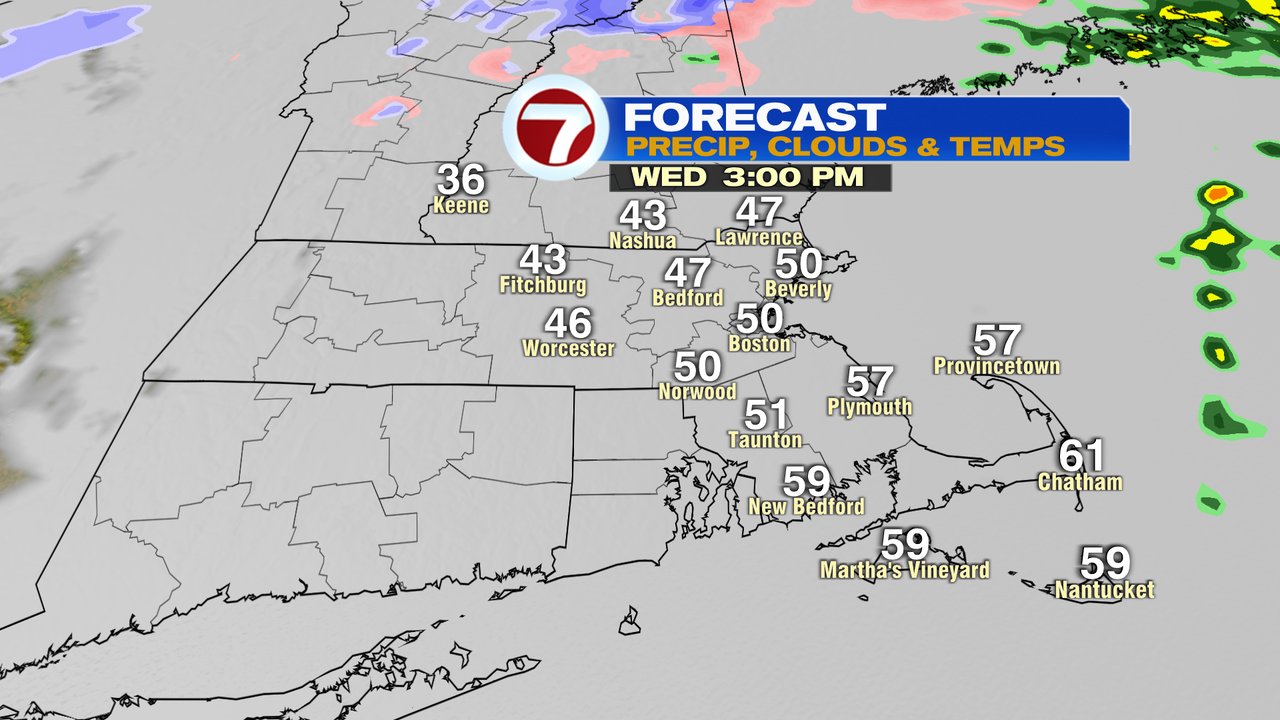
Alright, how bout that snow in the forecast? While we’re good through the evening commute, we will track some rain and snow moving in after 8pm. While we’ll have some wet snowflakes in the mix across MetroWest, the best chance for slushy coatings will be northwest of 495, with the best chance for an 1″ of wet snow, across the higher terrain of central and northern Worcester County. In northern Worcester County, we’ll likely see a brief mix with freezing rain too before all rain by daybreak tomorrow. East of 495, it’s mainly just a cold rain overnight.

Showers will keep the roads wet for the morning commute tomorrow, but we’ll dry out in the afternoon. Temps near 60 across the Cape, near 50 in Boston, and near 40 in the Worcester Hills. It’ll be the warmest day of the 7 day.

Thursday – Sunday will be chilly as a cold pattern prevails. A few scattered flurries or spot snow shower are possible Thursday and Friday, but much of the time will be dry. Temps run in the low 40s by day, low 20s by night.