

After a smattering of showers over the last couple of days, for outdoor activities you have planned today, the forecast is an easier one… perfection.
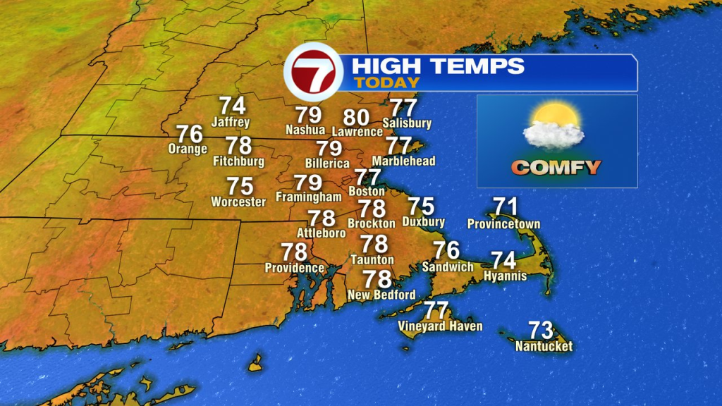
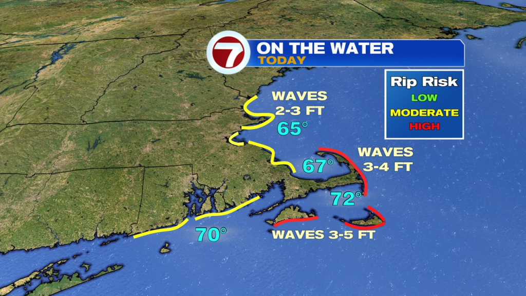
While a chill is in the air early this morning, the full on sunshine and low humidity to kick off the day, will allow for temps to rise quite quickly. Afternoon temps run 75-80 after starting the day in the 40s and 50s. Beach temps run mid to upper 70s too, and if you’re heading to the coast to soak up some sun, just keep in mind the rip current risk is elevated.
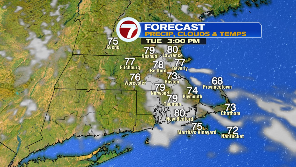
Temps tomorrow rebound to similar levels, but we’ll have some more clouds in the mix. Winds do flip to the east/northeast in the afternoon, so expect a bit of a cool down near the coast.
Wednesday, we’re right back into the upper 70s. Humidity comes up a bit too.
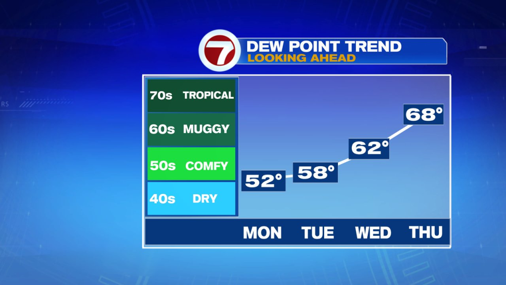
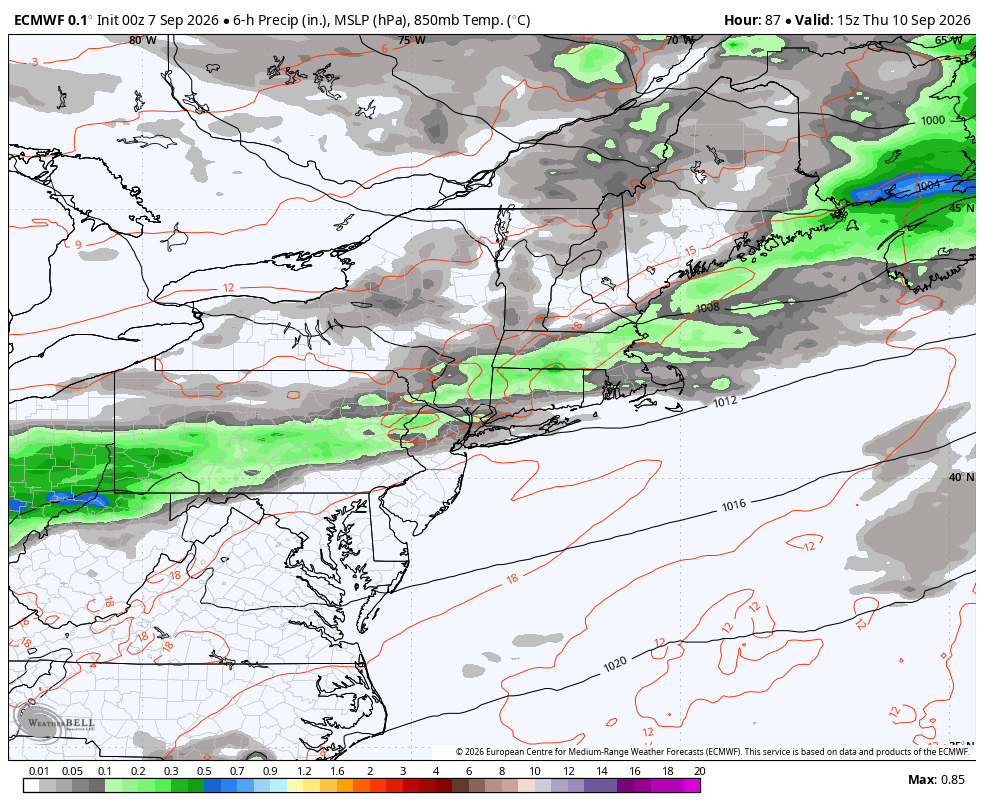
Wednesday night into Thursday that we track a few showers moving through. Don’t expect much rain from them, generally under 0.25″ for most. Thursday will be warm and humid too with highs in the 80s and dew points well into the 60s.
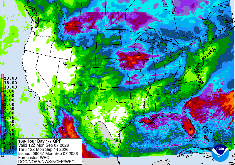
The map below shows generally less that 0.25″ expected for most southern New England locations over the next 7 days. Pretty paltry numbers for sure.
As a front slips through late Thursday/Thursday night, humidity drops off again, and that’ll set the stage for a classic September feel to the air for Friday and Saturday with highs in the low to mid 70s and cool overnights.
By Sunday, temps bounce back into low 80s.