With a coastal storm developing to our south, we’ll watch more clouds mix in today and a busy breeze continue to develop. The strongest winds will be across Southeast Mass, where gusts run 35-45mph, strongest across the Cape and Islands. Temps today run in the mid to upper 50s as we stay dry.
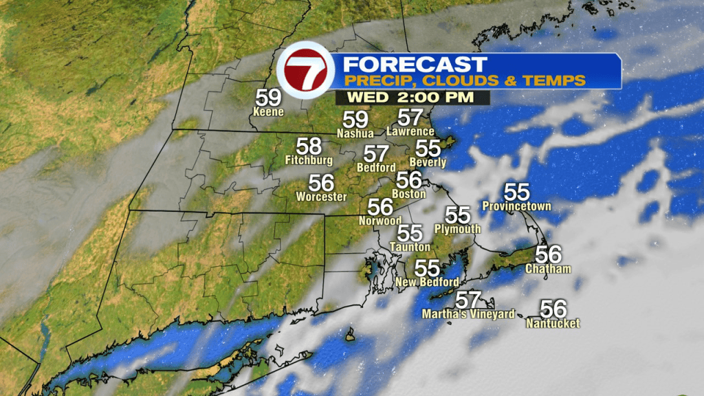
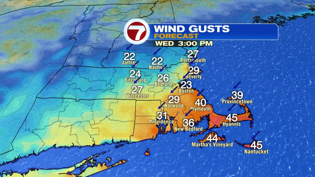
Fortunately, with this storm, it’s just a glancing shot for us as very strong winds and heavy rains miss offshore. Below you can see the bigger picture as the storm makes it closest pass.
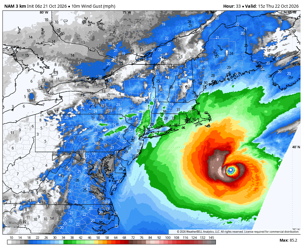
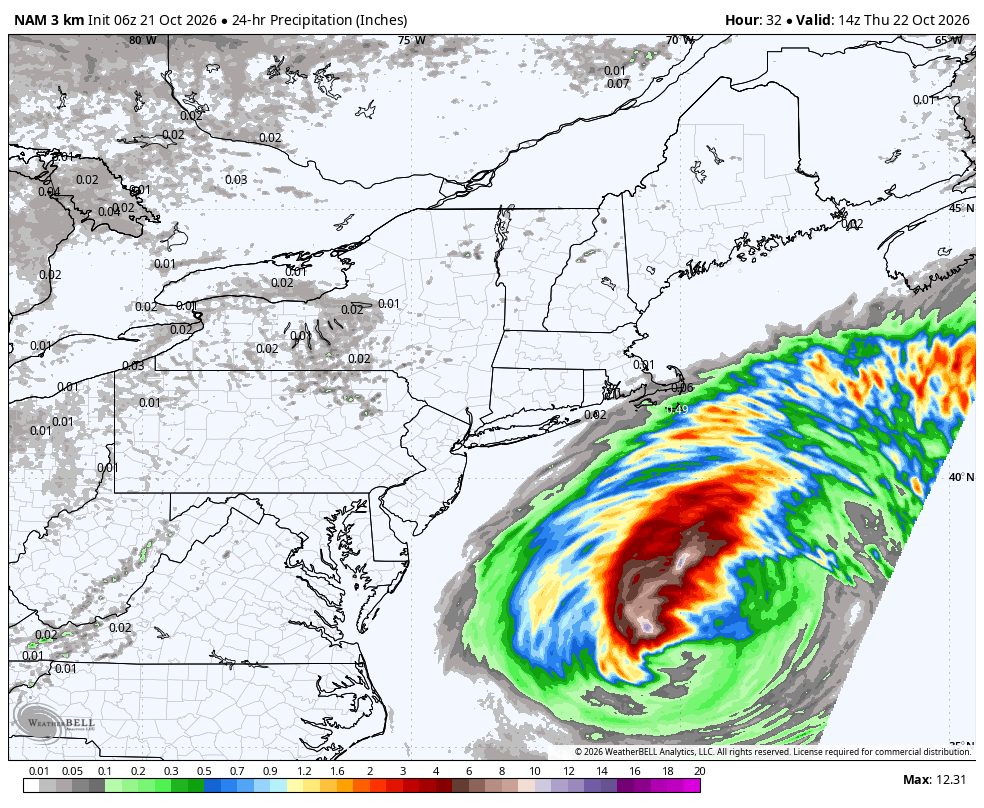
Most of us stay dry tonight with lows in the upper 30s northwest of 495 to the low 50s across Southeast Mass. Winds still gusts 35-45mph across Southeast Mass, strongest across the Cape and Islands again. That’s also where showers try to pivot on in with the best chance for steadier rain across Nantucket. Northwest of the Canal, most locations stay dry.
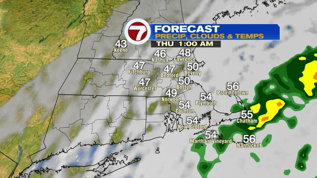
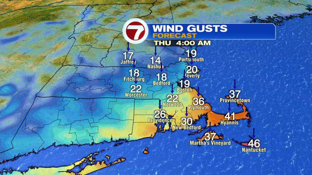
Any shower action across the Cape tapers off early tomorrow morning. Winds stay gusty through the day across the Cape and Islands, 35-45mph. With sunshine returning tomorrow, especially midday, into the afternoon, temps run into the low to mid 60s.
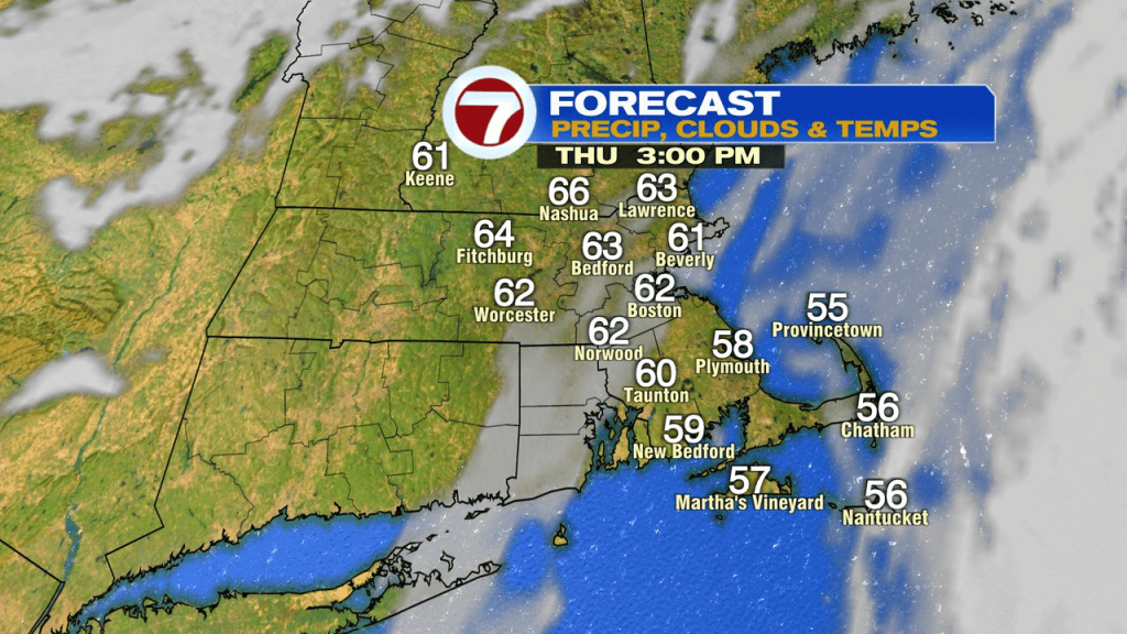
Friday will be cooler and a bit breezy with gusts running around 20mph. We’ll catch a lot of sunshine as high pressure builds in and then builds over us for the weekend. The weekend looks great too. Sunshine wins out with light winds both Saturday and on Sunday. Great for those late season tee times, ball games, pumpkin patches or apple orchards. Enjoy!