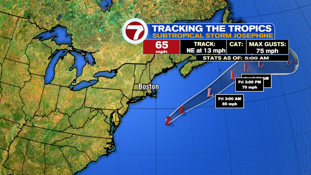
As the coastal storm to our south developed yesterday, some tropical characteristics started to mix in thanks to the center being over the Gulf Stream. Thus, the National Hurricane Center tagged it with the name subtropical storm Josephine. For practical purposes, it doesn’t mean anything for our forecast, as its playing out as expected. The expected track of the low is below…
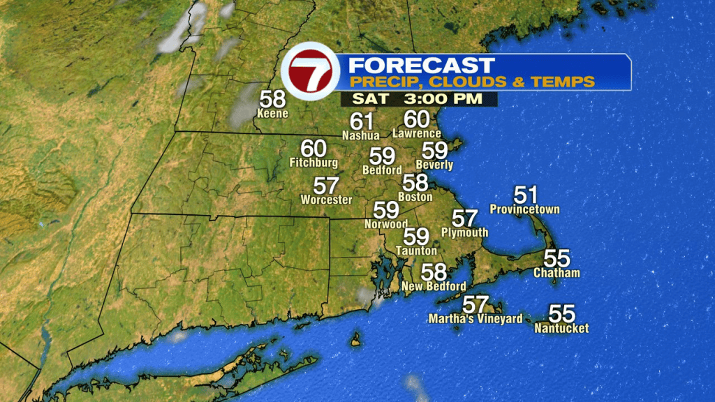
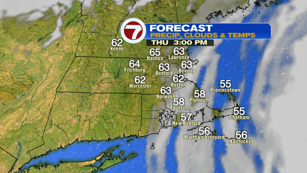
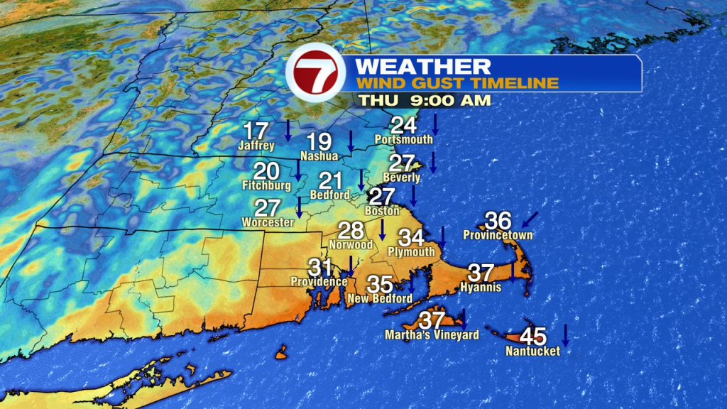
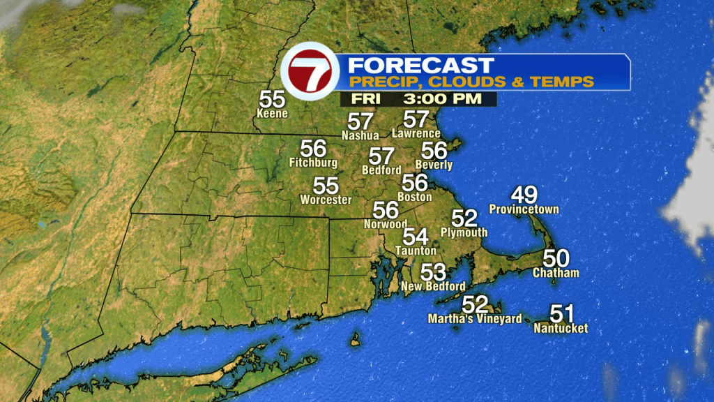
While a few showers sideswipe the lower Cape and Island this morning, most of the moisture has stayed offshore with the biggest impacts from the storm being high surf and gusty breezes. Winds today will continue to gusts 35-45mph across Southeast Mass, strongest over the Cape and Islands. Skies are brightest this afternoon northwest of Boston, and that’s where it’ll be the mildest. Temps this afternoon range from the mid 50s to mid 60s, the breakdown is below.
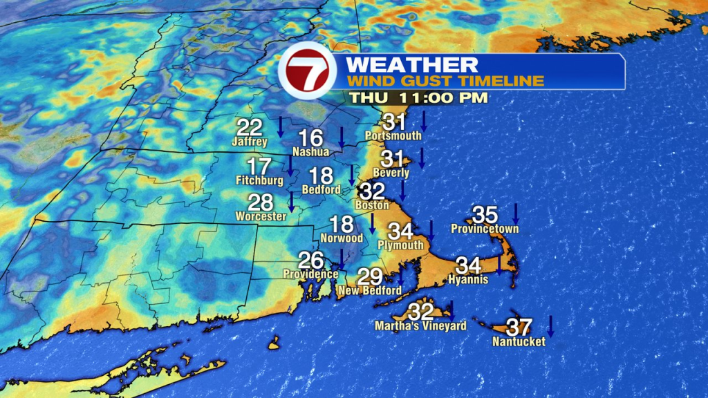
Gusty winds remain this afternoon and linger into the night along the coast.
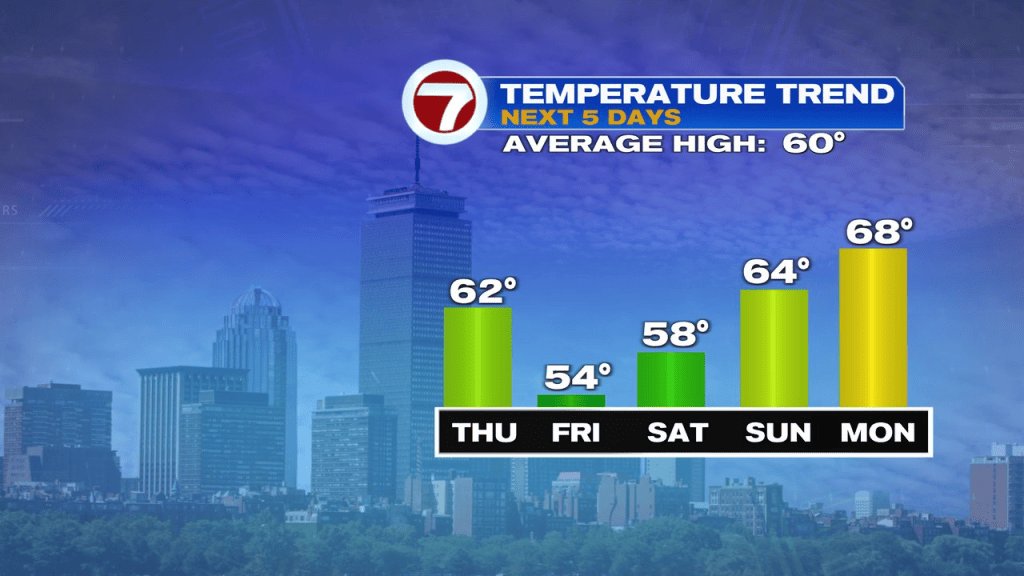
It’ll be bright, but cooler tomorrow. Winds gusts 15-25mph, added a bit of a chill, but the breeze will be lighter compared to recent days.
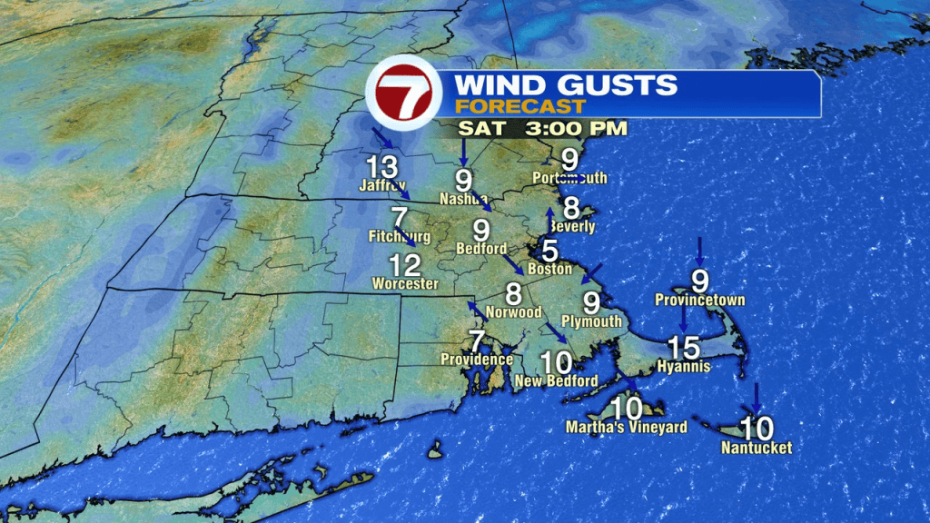
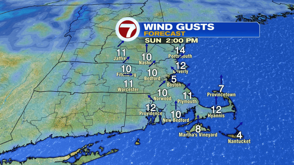
The weekend forecast looks great. Yes, chilly starts with areas of frost in the mornings, but we’ll run in the upper 50s Saturday afternoon and mid 60s Sunday. Both days have very little wind.