A heat advisory is up, so is a flood watch for this afternoon into tonight.
As temps take off today, we’ll head for the low to mid 90s for many this afternoon. Those temps, combined with dew points in the 70s will push the heat index in the mid 90s to near 100, prompting the heat advisory.
Not only do we have high humidity near the surface, we’ll have a lot of water vapor through the low and mid levels of the atmosphere too. That will help fuel tropical like downpours in the scattered storms that get going. With rain rates of 1-2″/hr, any storm will be capable of producing localized street/poor drainage flooding, and that’s why the flood watch is up for some. A few of the storms that get going will be capable of strong winds too, so one or two of the storms could go severe as well.
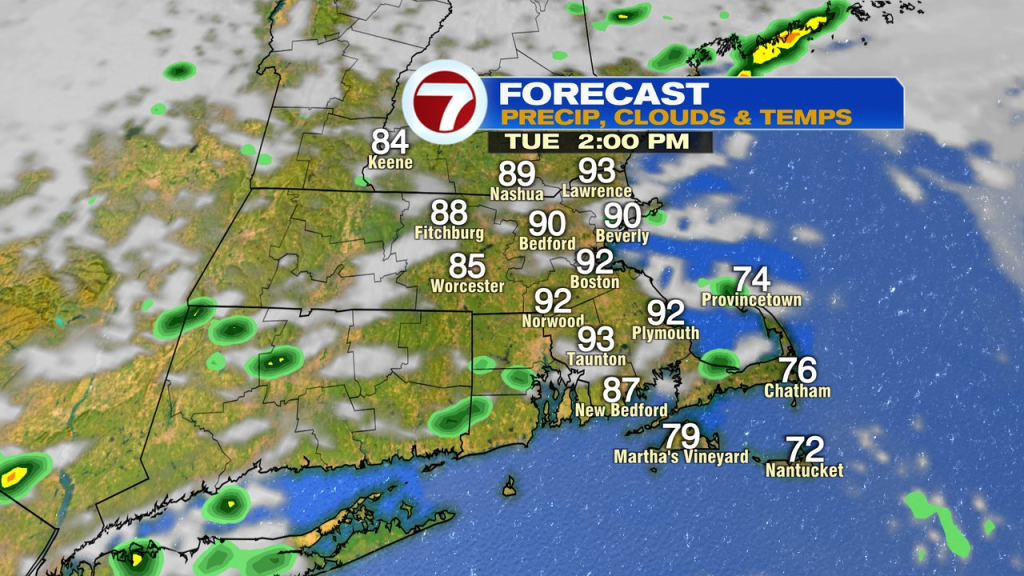
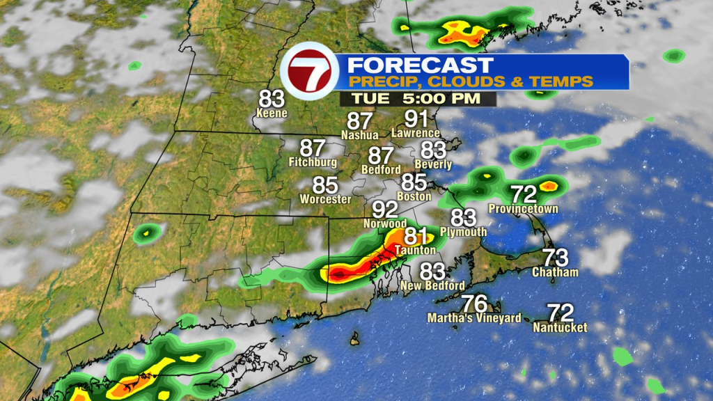

Scattered showers and storms linger tonight with mugginess remaining in place.
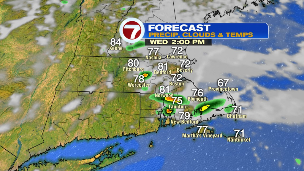
Tomorrow, it’ll be noticeably cooler, especially near the coast with temps in the low to mid 70s at the coast to the low 80s inland. We’ll still tack some scattered showers/storms that are hit or miss across the area.
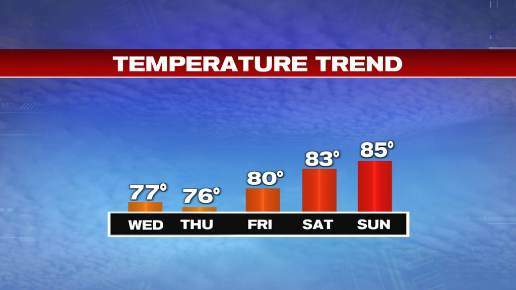
Temps hold in the 70s to low 80s Thursday and Friday with a few isolated showers/storms at times.
The weekend still looks mainly dry, warm and humid. Low to mid 80s Saturday, mid 80s Sunday.