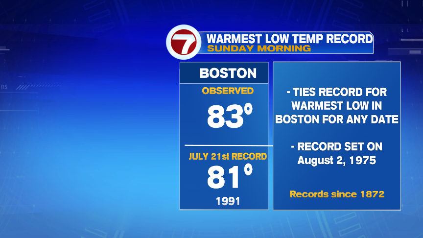
High heat over the weekend did fall just shy of 100 in many towns and cities as highs headed up into the mid to upper 90s for most. 97 on Saturday and 98 on Sunday were the official highs in Boston. While the daytime highs fell just shy of the records, the oppressive humidity in place did allow the nighttime lows to stays really elevated, allowing Boston to tie it’s warmest low temperature on record at 83.
Today, the heat and the humidity won’t be as high as temperatures get capped in the 80s and dew points hold in the 60s. We will track rain however, with the most widespread showers and storms to roll in here late-day and into this evening.
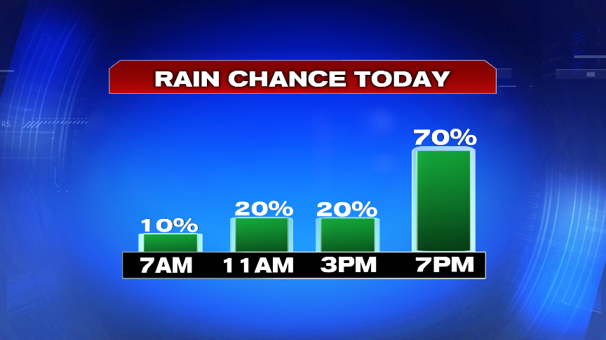
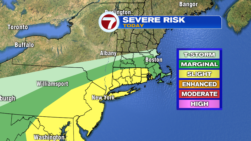
The main risk with the showers and storms this evening will be localized downpours that produce a quick 1-2″ of rain. In those downpours, localized poor drainage/street flooding is possible. A few storms near and south of the Mass Pike could be strong with gusty winds too, with the highest chance of a severe storm, capable of damaging gusts, across RI and CT.
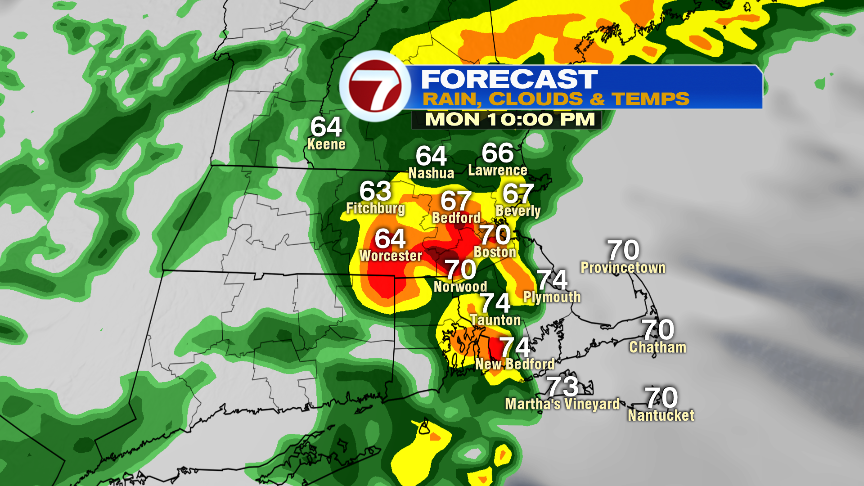
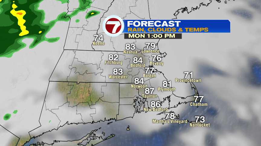
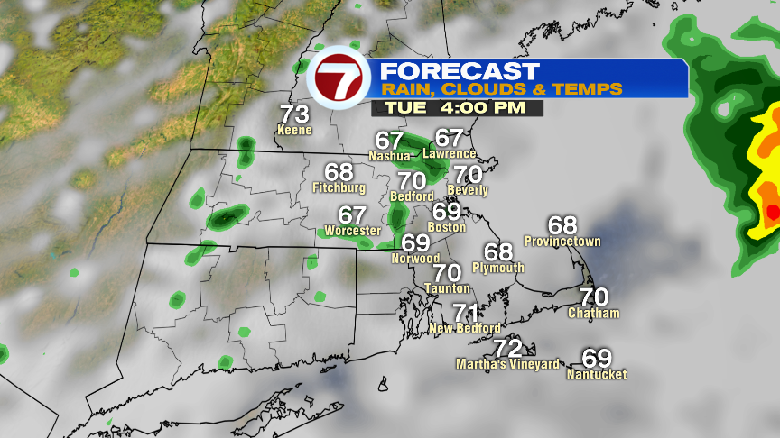
Rain is steadiest and heaviest tomorrow morning across Southeast Mass before showers become just isolated in the afternoon as some dry air punches in. Temps tomorrow will be much cooler… only in the lower 70s!
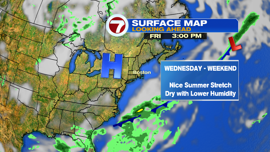
The rest of the weekend, into the weekend looks great with highs 75-80 Wednesday and Thursday, near 85 Friday and 85-90 degrees over the weekend. Low humidity prevails mid week with just a modest increase in humidity by the weekend.