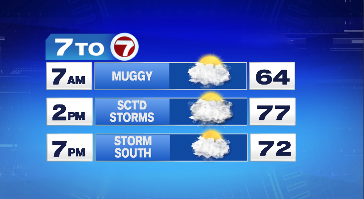
Temperatures were warm today but not hot. The same will be true tomorrow. In fact tomorrow will be similar to today. It will be mostly cloudy with a few breaks in the clouds from time to time. Temperatures will hit the upper 70s and a few isolated showers and storms will be possible — especially from about 2pm to 7pm. So keep the umbrella with you if you’re out and about but there’s a good chance you won’t even touch it.
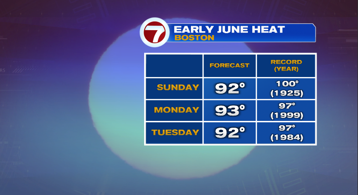
Once the storms move out tomorrow it’s all about the heat setting up for the weekend and early next week. Temperatures will climb to the upper 80s on Saturday then it looks like 90 or better Sunday, Monday, and Tuesday. While it is hot and the heat is arriving a little earlier than usual, it’s not record setting heat. We’ll likely see low 90s across the area those days but the records are in the upper 90s and even 100° on Sunday.
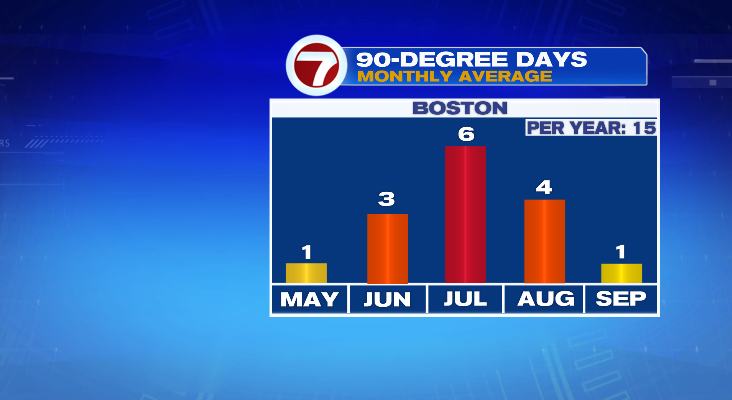
Having 90 in June, or even May for that matter, is not unusual by any stretch. In fact, we average 1 day a year in May — we had 2 this year. And we average 3 days in June.
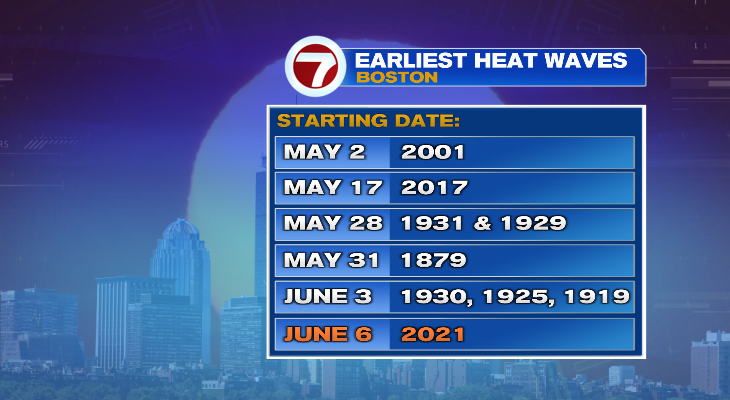
What is a bit unusual is stringing together three in a row this early. We may just hit our average for the entire month by June 8th (Tuesday). And if that did happen we would have a top 10 earliest heat wave for Boston. There have been a few in May in the past, but a lot of them happened during the Dust Bowl years.
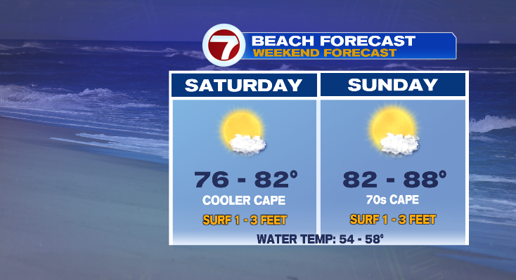
So with the heat this weekend will provide great weather to spend time at the beaches. A southwest wind will keep the Cape (and Cape beaches) cooler, but most beaches on the eastern shoreline of Massachusetts should see temperatures near 80 on Saturday and in the 80s on Sunday.