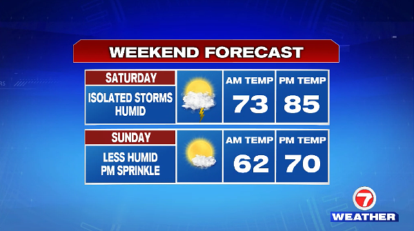
For your Friday evening, the humidity is sticking around (as it lingers into the first half of the weekend, too). Plus, we do not see much relief in temperatures overnight as lows only slide into the upper 60s to low 70s.
A few spotty showers are possible after sunset tonight, these will be mainly isolated around 9PM.

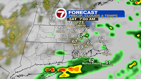
By Saturday morning, we still have a few lingering showers, with the heaviest rain remaining just off the South Coast and clipping the Cape and the Islands.
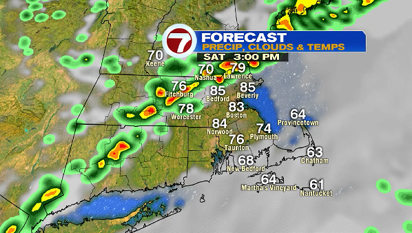
We will likely have another round of rain by Saturday mid-afternoon, with some embedded downpours and thunderstorms as temperatures warm up into the low to mid 80s. Be weather aware for your Saturday afternoon plans.
This line will be ahead of a cold front that will sweep through, allowing for less humid and drier air to filter in by Sunday.


A noticeably more comfortable feel to the air returns Sunday and lingers into Monday and Tuesday.

For the allergy sufferers, with a few rain showers expected Saturday, mainly dry conditions warrant higher pollen counts into next week.

After a brief break from the humidity Sunday and Monday, temperatures and dewpoints start to rise by midweek with the next chance for showers returning next Thursday.