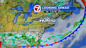
After a humid, cloudy and damp start to our Thursday, we’re now under mostly sunny skies through the evening and slightly cooler conditions at the coast due to an onshore breeze and lower humidity.
The reason for the slight cool down (and lower dewpoints)? The cold front that brought a few thunderstorms late last night and a few showers earlier today before the front completely moved out.
For this evening and through the overnight, expect dewpoints to keep dropping as drier air from Canada continues to sink southward into southern New England. Mostly clear skies with some areas of patchy fog (especially closest to the coastline) is possible as temperatures slip back into the 50s.

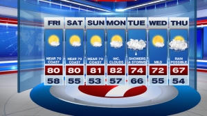
Friday features mostly sunny skies with highs stretching into the mid-70s to just about 80°.

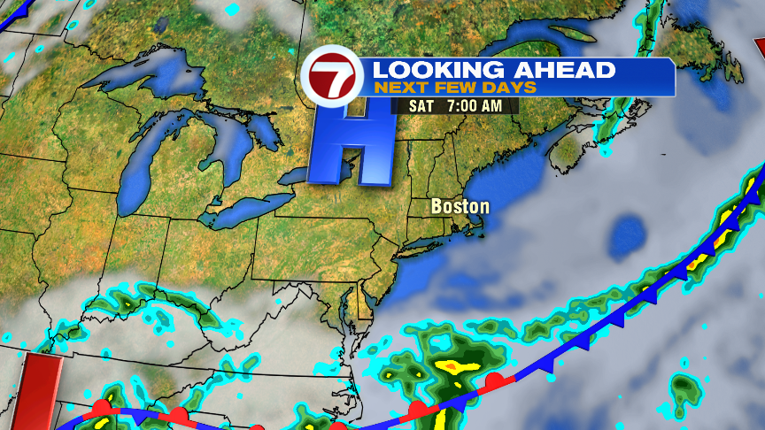
Get the sunscreen (and the shades) ready for tomorrow, Saturday and Sunday, because high pressure is overhead for the next three days, giving us quiet and sun-filled weather, just in time for the weekend.


Picture perfect for any of your outdoor weekend plans, including the home series at Fenway Park (don’t forget about the double header on Saturday, Sox fans!).

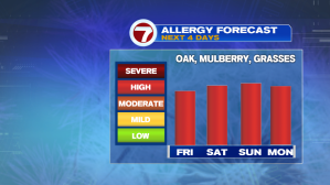
The only thing that could put a damper on the weekend forecast is the pollen count. Sneezing and itchy eyes might be a trend Friday through early Monday. Rain returns late Monday into Tuesday, which should bring some relief.