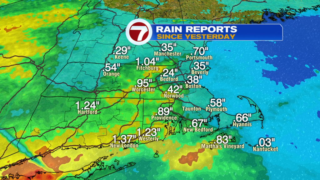
We need the rain, but we also need to work on our timing. While we’ve had some great late-Spring/Summery days at times around here, this weekend was not one of them. As many communities picked up 0.50-1.00″ of rain through this morning, it also came in with a chilly ocean breeze and temps stuck in the 50s.
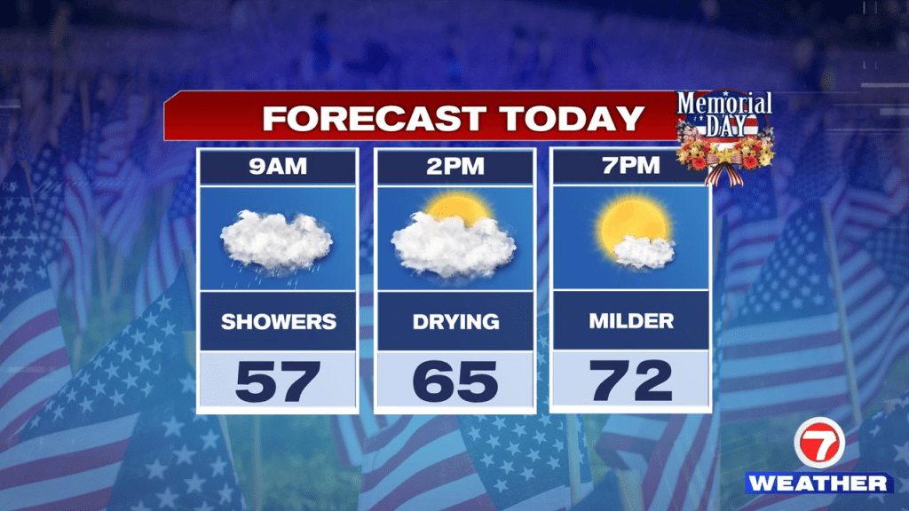
While we pick up where we left off yesterday, we do start to transition out of this damp and dreary pattern this afternoon. Go figure, just in time for folks to wrap up the long weekend and settle back in for a new work or school week ahead.
Rain today tapers off late morning to early afternoon (11am-2pm), from northwest to southeast. As it does so, some breaks of sunshine return, and that send temps up into the 70s. We need patience to get there, but get there we will. Temps max out around 5 or 6pm for many of us today.
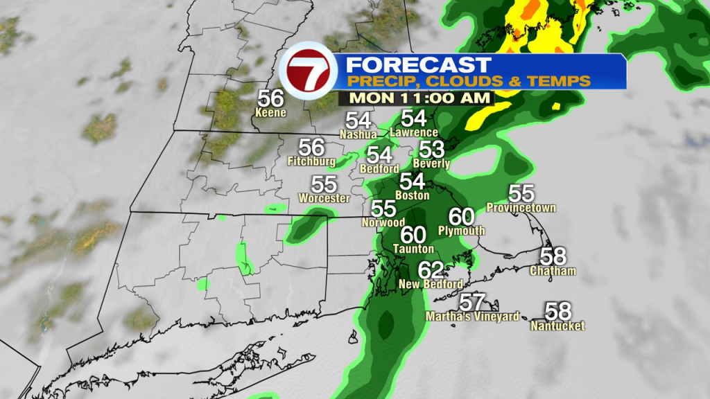
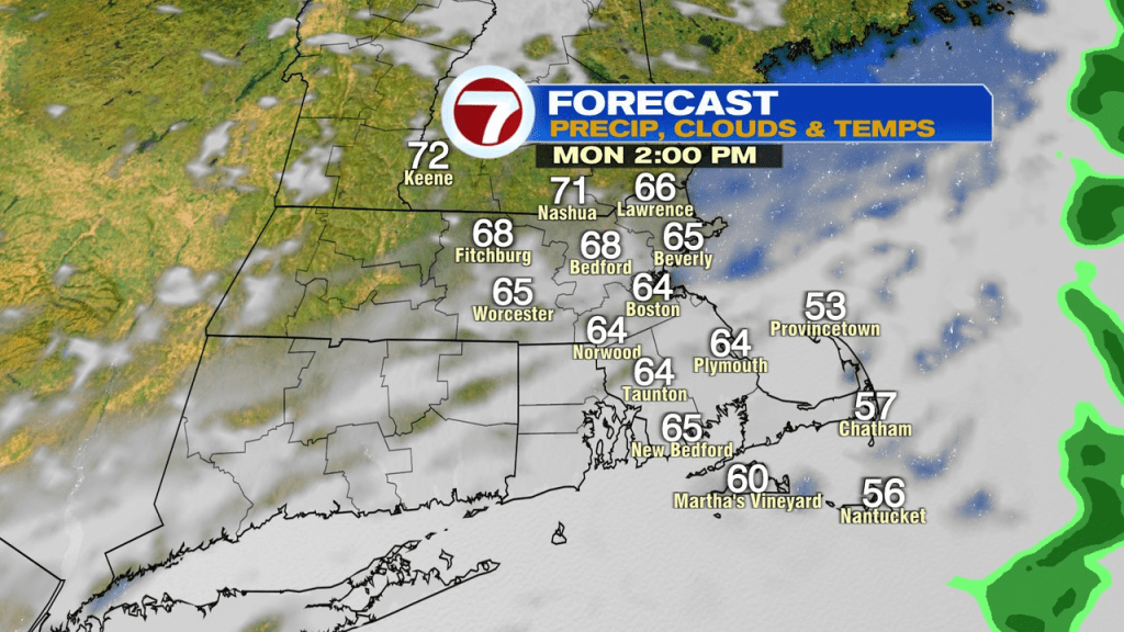
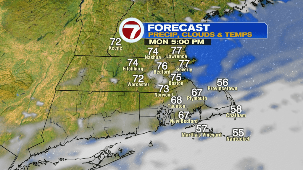
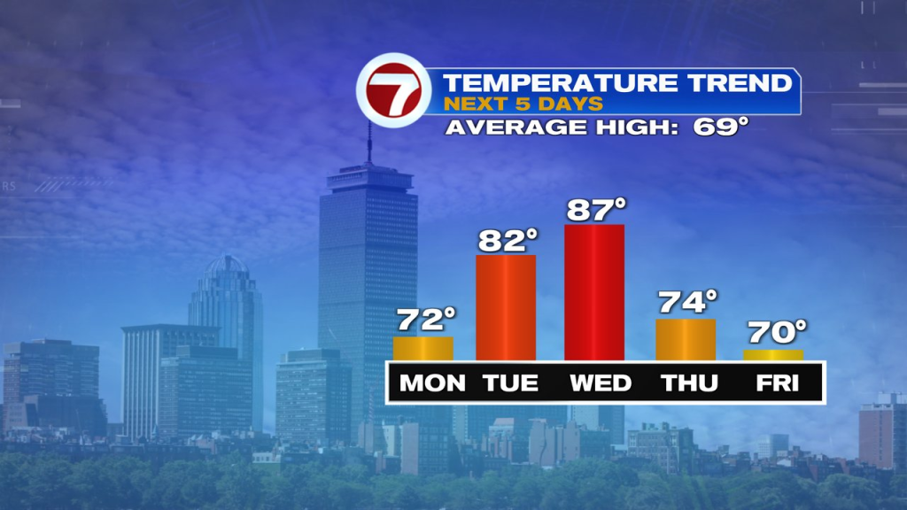
Ok, back to school, back to work, and back to summer weather tomorrow. Temps reach the low to mid 80s under a mostly sunny sky.
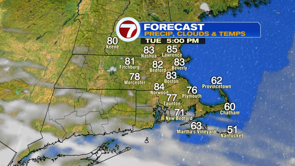
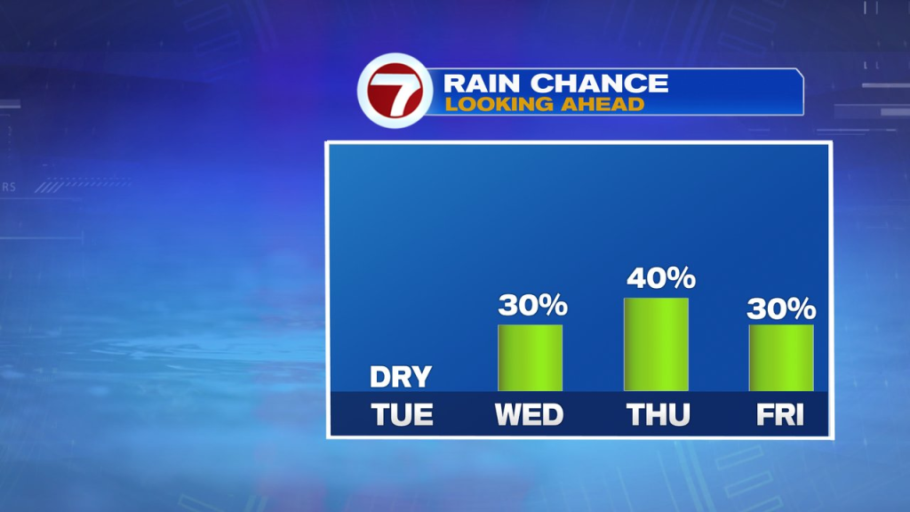
It’ll be warm again Wednesday, mid to upper 80s. As a cold front approaches from the northwest, a few scattered showers and storms break out ahead of it and along it in the afternoon and evening.
On the other side of the front, we’re cooler, more seasonable Thursday and Friday. There will be the chance for scattered showers to pop in the afternoons as some cold air aloft helps drive some instability for them.