June 1st has a lot of meaning in the weather world. Meteorological spring is in the review mirror and we kick off meteorological summer! Hurricane season officially begins in the Atlantic Ocean, and it’s the somber anniversary of the Springfield tornado.
Meteorological Summer
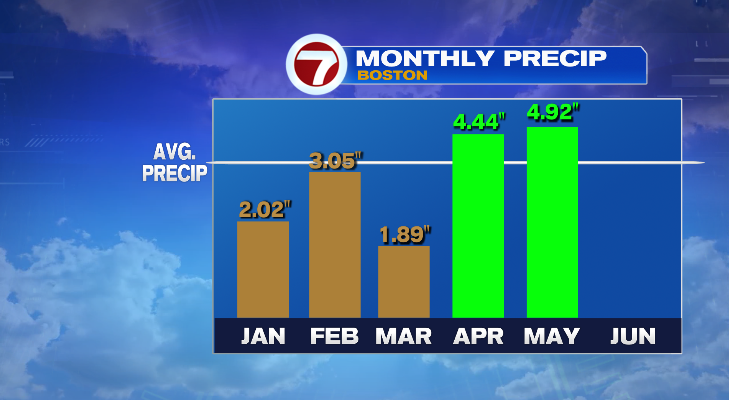
While Memorial Day weekend marks the unofficial start to summer, it certainly didn’t feel like it this year. In fact we saw so much rain that it pulled our monthly rain total and seasonal spring total to the surplus! Which is a much different trend than the first three months of the year. Two thirds of rain in May coming in the last 6 days of the month.
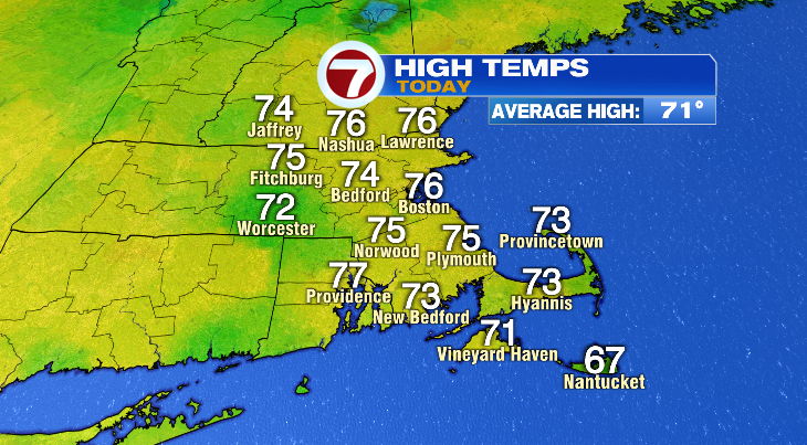
Today though, felt much more summer like. Temperatures finally climbed above average, hitting the 70s across the board. Our average high is 71°.
Hurricane Season Begins
June 1st also kicks off “official” hurricane season but there’s nothing that actually keeps hurricanes in the dates set by what “hurricane season” is. It officially runs June 1st to November 30th. But it’s really not that uncommon to get a storm to develop in May.
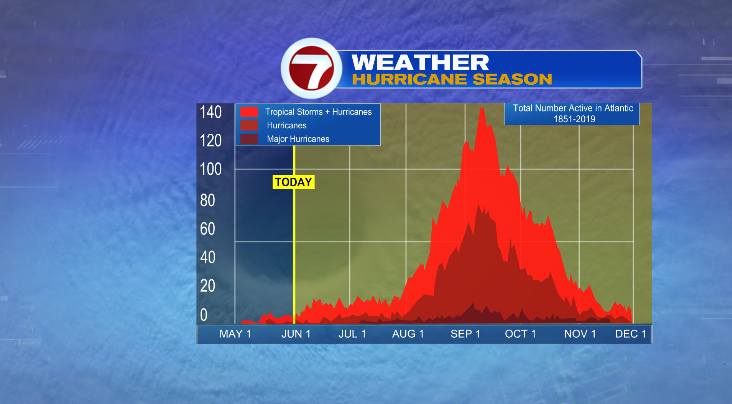
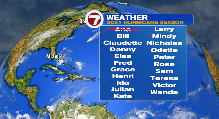
You see that in the graphic above. Storms, while limited, certainly do occur in May. And while the season kicks off in June, the storm activity remains fairly low until August 1st and that’s when things tend to take off. In fact we already had our first storm of the year and that was a May storm. Tropical Storm Ana was basically a non event and just swirled out at sea, but was our first storm nonetheless. Next up is Bill.
The forecast from the National Hurricane Center is once again calling for an above average season. Now, they did go so far as to say that this season will not be as bad as last year’s record setting season but it does look like the number of named storms (which includes tropical storms), the number of hurricanes, and the number of major hurricanes (those that reach category 3 strength) will be slightly above the climatological averages.
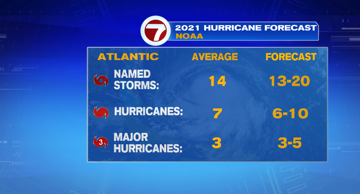
But keep in mind no matter what the forecast calls for, it only takes one. Granted our risk in New England is lower than places like Florida or the Gulf Coast but we’ve seen some in the past. While weak, we did see two move through New England last year — Isaias and Fay. And New England is way over due for a land falling hurricane, so just keep the guard up when we go deep into hurricane season.
Springfield Tornado Anniversary
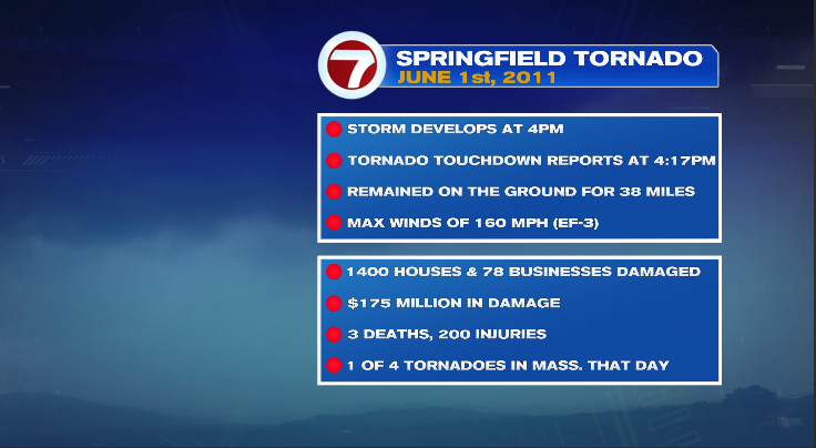
Can you believe it’s been 10 years since the Springfield tornado moved through western and central Massachusetts? The storm dropped a tornado in Westfield and it remained on the ground for 38 miles, traveling past Sturbridge before lifting.
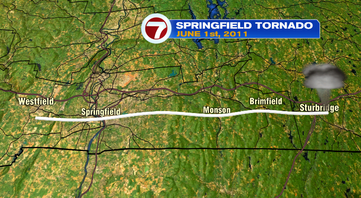
The storm left scars on the ground that could be seen from satellite images for years to come. Only recently did new growth start to fill in and remove those. It also left scars through several towns where homes and business were destroyed. The tornado reached EF-3 status with winds of 160 mph. It caused $175 million in damage, destroying 1400 homes and 78 businesses. It was one of 4 tornadoes that developed in Massachusetts that day.