
We have a lot to talk about as we plan out this Memorial Day weekend, especially considering Mother Nature has thrown a few curveballs our way.
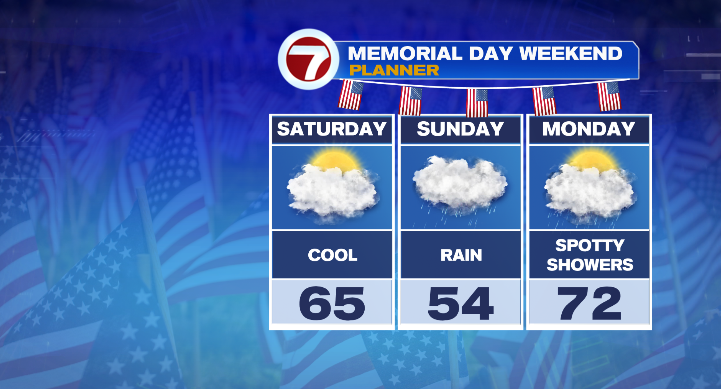
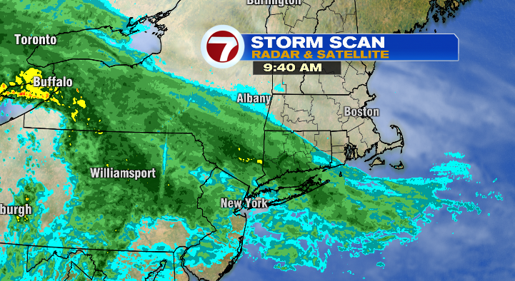
Let’s start with today, which while mainly dry, is rather cloudy. It’ll be cooler than average as well, with high temperatures largely between 60 and 65 degrees. We’ll likely see a few drips and drops after sunset, but showers largely wait until around 5/6 AM Sunday to impact us.
That said, wet weather is the name of the game just about all day on Sunday. Showers become widespread by mid-morning, with rain staying relatively steady through the afternoon.
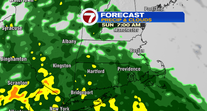
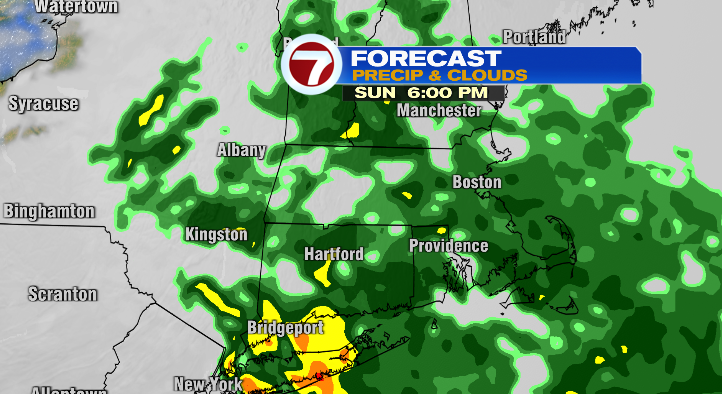
We’ll even have some pockets of heavy rain at times, largely in the evening, as well as a potential rumble of thunder late in the evening too. On top of that, it’ll be windy and chilly for this time of year. Highs will only be in the low to mid 50s! If you have any indoor plans, Sunday is the day for them.
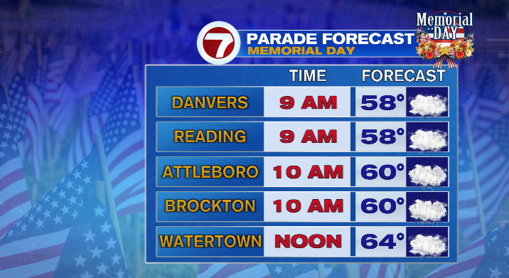
As for Monday– Memorial Day– we’re looking at a few, spottier showers, largely before noon, as the last of this storm moves east.
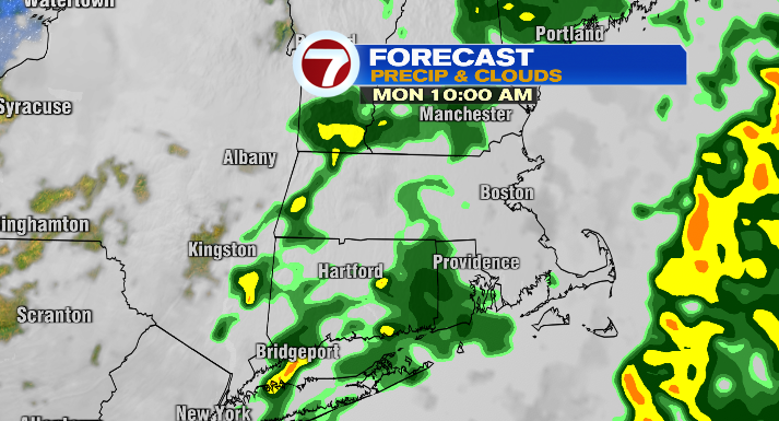
Keep that in mind if you are in, or attending, any Memorial Day parades that start before noon. You’ll want to bring an umbrella or rain jacket if you really don’t like getting wet. That said, the showers we see on Monday will not be nearly as widespread or long-lasting as Sunday’s rain. Temperatures will be much milder though, with highs in the upper 60s and low 70s!
Of course, there is a warm-up in the forecast… it’s just after everyone goes back to work. We’ll be partly sunny on Tuesday with highs in the upper 70s and low 80s, while Wednesday will be in the low 80s.
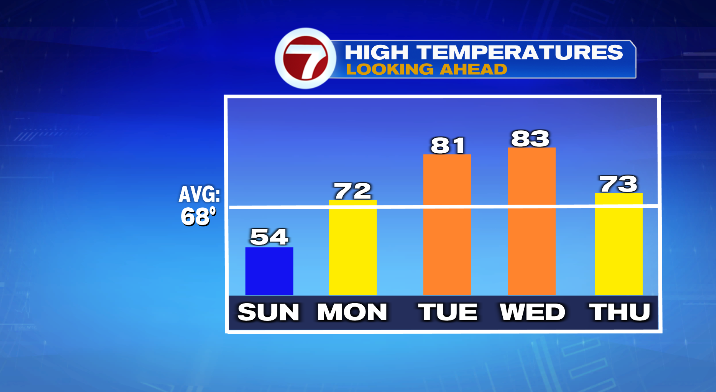
We’re looking at an isolated shower or two on Wednesday evening, as well as a shower or two possible Thursday as well.