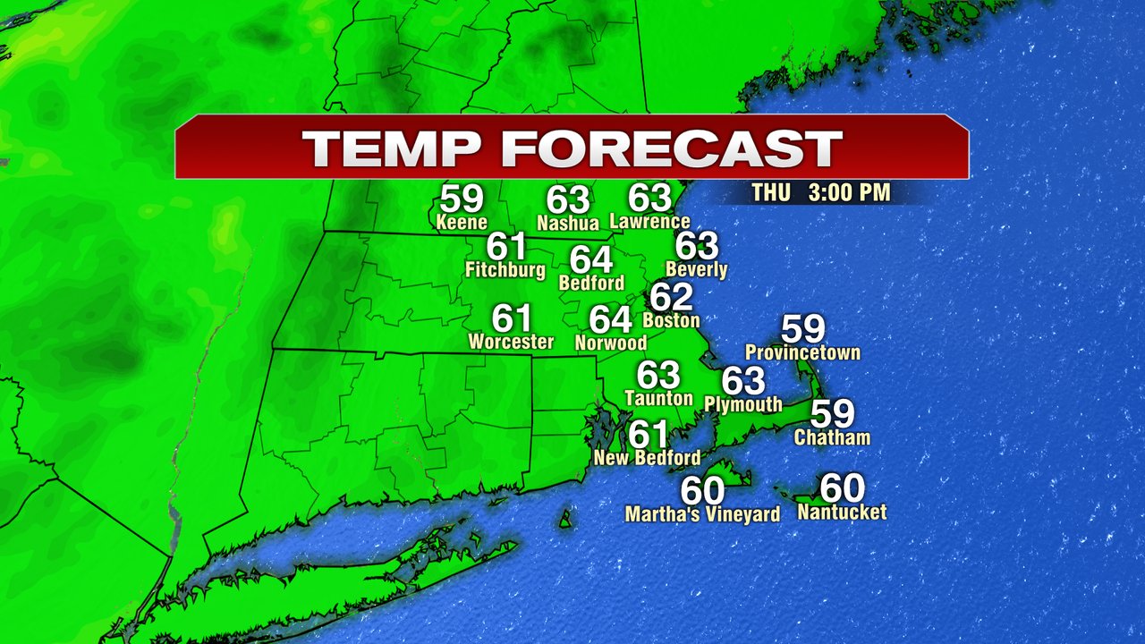
Notice the difference? While it’s not warm outside, it certainly is a bit milder than yesterday morning and that’ll be a good base for us to have temps jump up into the low to mid 60s this afternoon. We’ll stay dry as well with a good amount of sunshine sticking around. The only downside, gusty breezes prevail, 20-30mph out of the southwest, although from that direction, it helps drag in that milder air.
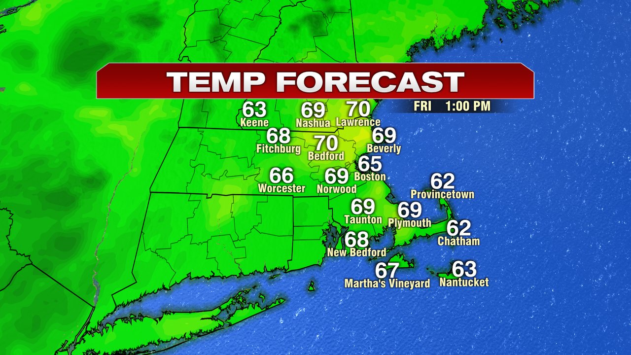
Tomorrow is very warm, near 70. The trade off is that more clouds stream in and eventually, we start tracking some rain by sunset, allowing for much of the day to be rain-free. The wet weather that starts to move in here will be from the remnants of Nicole, which make their way up the east coast. Rain is widespread tomorrow night with embedded downpours, rumbles of thunder and gusty winds. That continues into Saturday morning, before tapering off by noon. Expect 0.5-1.5″ of rain across the area with some locally higher totals possible across the interior. Wind gusts peak Saturday morning, with gusts 40-50mph across Southeast Mass with the strongest gusts along the South Coast. Inland, gusts 25-40mph will be common. By Saturday afternoon, we’re dry and still mild with temps in the low 70s.


Sunday will be much cooler, near 50, with mostly cloudy skies and a spot shower. Chilly air holds on for much of next week with another round of rain likely Tuesday night/Wednesday. The higher terrain across the interior may even see some snow mixed in pending the track!