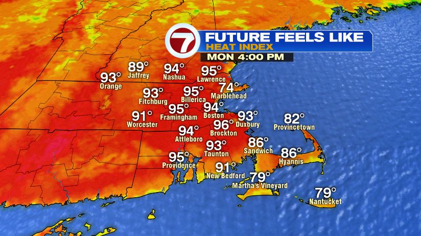
The heat is on! A heat advisory is in effect for much of the area today for feels like temperatures will into the 90s! That heat advisory continues through Tuesday where feels like temperatures could get close to the triple digits! Be sure to take it easy if you’re outside, drink plenty of water, find some shade, and just slow down.

Air temperatures today will climb to the low 90s — cooler across the South Coast, Cape, and Islands. Feels like temperatures will hover between 93 – 98 for many. Tomorrow is the peak of the heat. Air temperatures will hit the mid 90s with feels like temperatures close to 100 degrees. We’ll likely tack on one more 90 degree reading on Wednesday before storms roll through and break the heat.

Here’s a snapshot of afternoon heat index values today and tomorrow:

We’re one day in already to (what will likely be) our third heat wave. Boston’s tally is at 11 with inland areas pushing 20! With three more this week, inland areas will get there this week.

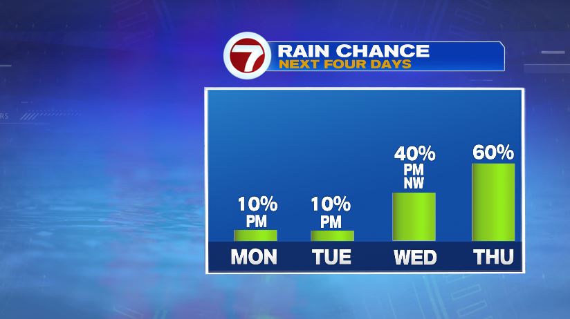
So no shortage of heat, but what about rain? That’s a definite shortage! Rain chances today and tomorrow are super small but not zero. A pop up storm is possible but most will stay dry. It’s similar to what we had this weekend, where only a couple of towns saw rain with most of us not even knowing it happened. Rain chances will increase Wednesday and Thursday.
And talk about a deficit! Most towns running between 5″ and 10″ below average for the year to date numbers! Norwood is doing a little better with the flooding rains at the end of June. But even despite that, lacking in the water department.
