Friday brought a few spotty showers, but those will continue to fade by sunset. This evening, we’ll see a gradual clearing of the skies, allowing temperatures to drop.
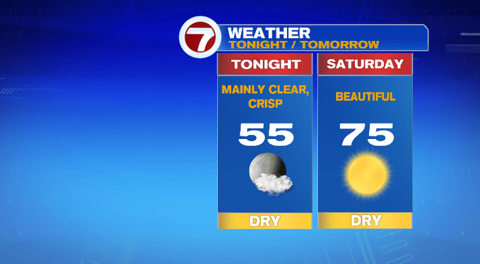
Overnight lows could dip into the low to mid 50s for much of the region — it will certainly feel more fall-like out there early tomorrow morning.
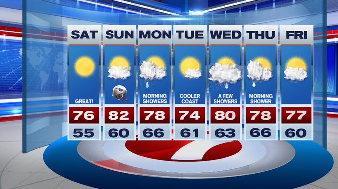
Temperatures will quickly rebound under sun-filled skies Saturday with highs into the mid 70s.
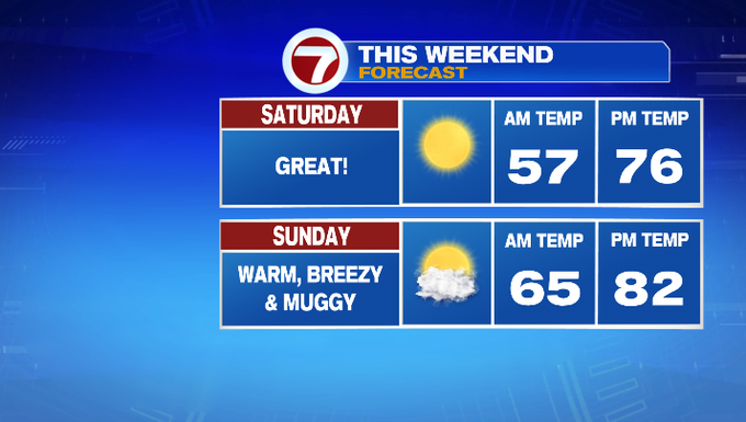
Sunday is slightly warmer than Saturday, along with an uptick in that humidity, too. Highs on Sunday will stretch into the low 80s with winds out of the SSW 10 to 20 mph.
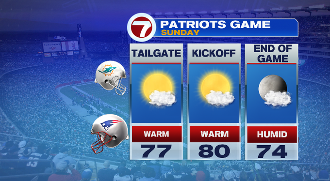
If you’re heading to the season opener at Gillette on Sunday, temperatures will be around 80 by kickoff and fall back into the mid 70s by the end of the game.
Both weekend days are great for your outdoor plans, whether you’re trying to soak up some of the last weekends at the beach, or heading to the apple orchard.
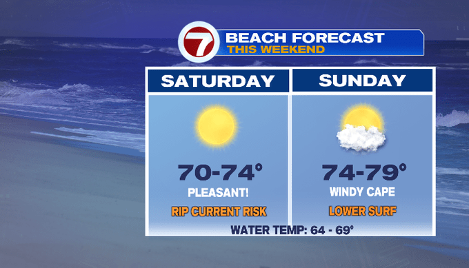
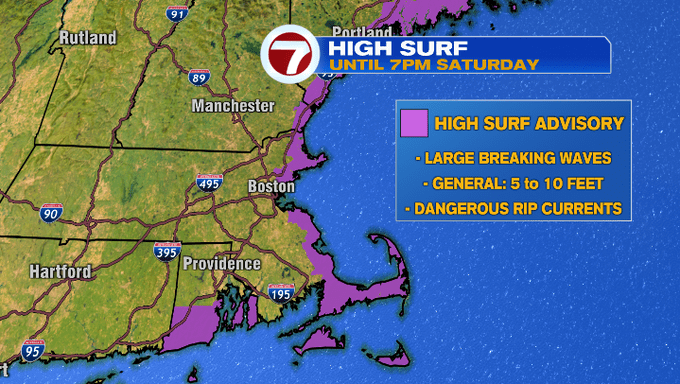
However, if you are heading to the beach this weekend, just be aware that we have a High Surf Advisory in place as a result of the swells from Hurricane Larry churning up our surf and producing large breaking waves (some from 5 to 10 ft) along with dangerous rip currents.
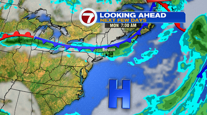
A cold front dives south early Monday producing a few showers Monday morning. Tuesday is the pick of the week with lower humidity and mostly sunny skies. Wednesday brings a chance for a few showers, but we’re not tracking a washout. It ultimately depends on the timing of fronts midweek to determine when we’ll see the showers.
At the time of writing this blog, the showers look to be bookended Wednesday and lingering into early Thursday. In the meantime, stay tune for any changes as we get closer.