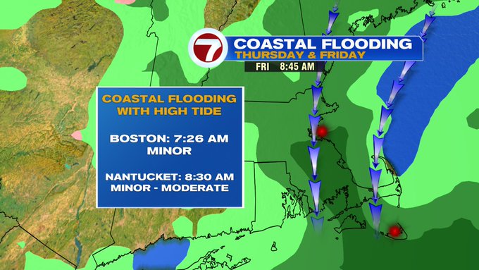
An ocean storm will remain out to sea, but provide a glancing blow to southern New England (especially those closest to the coast) through Friday night.
The main impacts with this storm will be gusty winds, rain, and coastal flooding around high tides.
As of Wednesday evening, a High Wind Watch has been issued for the Cape and Islands through Friday evening for gusts up to 60 MPH possible.

A Coastal Flood Watch has also been issued for the eastern coastline of Massachusetts as well as the seacoast of NH for Friday morning’s high tide from 6AM – 10AM (due to the onshore wind component of this system, coupled up with the high tide).

Minor flooding possible along the eastern coastline, for Nantucket minor to moderate flooding possible.
As for the gusty winds, here’s the timeline:


As for the timing of the rain, it looks that early Thursday morning, we have a few rain showers closest to the coast, these become isolated by midday, then ramp up by Thursday evening and Thursday night. Friday morning features a few isolated downpours along the Cape and SE MA, otherwise a steady rain expected. Friday evening is when we see the showers lighten up, and eventually move out just in time for the weekend.


How much rain are we talking over the next two days? We’re looking at anything from an inch to an inch and a half across the Bay State and southern NH, with the higher amounts concentrated on SE MA and the Cape and Islands.

We’re tracking a warm-up through the first weekend of April, with highs into the 50s both days (besides the coast, which will be slightly cooler both weekend days). 60s return Monday, then we fall back into the 50s through the middle of the next work week, with dry conditions returning after a wet end to our week.


