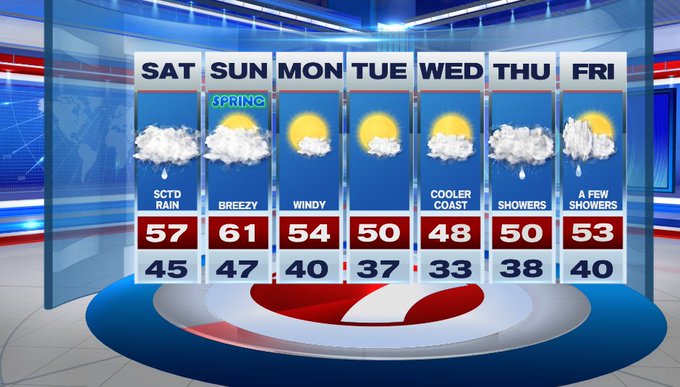
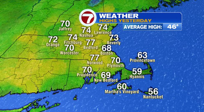
I hope you got to spend some time outside yesterday when highs stretched into the upper 60s to 70s along with the sunshine because today it’s back reality, with fog and periods of rain and highs in the 40s to 50s.
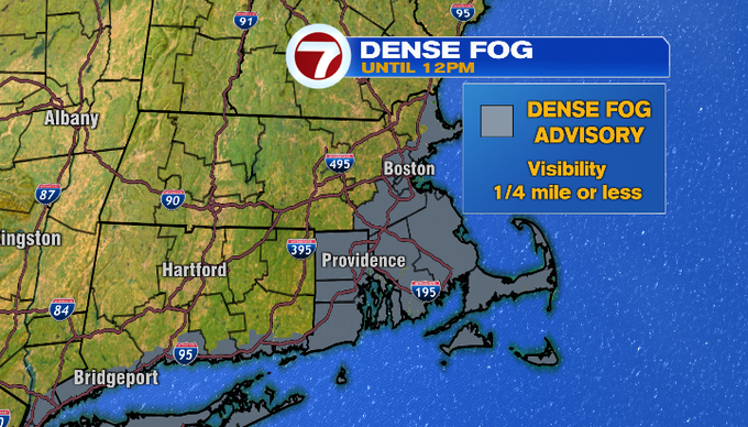
Speaking of fog, we have pockets of low visibility which has resulted in a Dense Fog Advisory for portions of eastern and southeastern MA along with the Cape and Islands until 12pm.
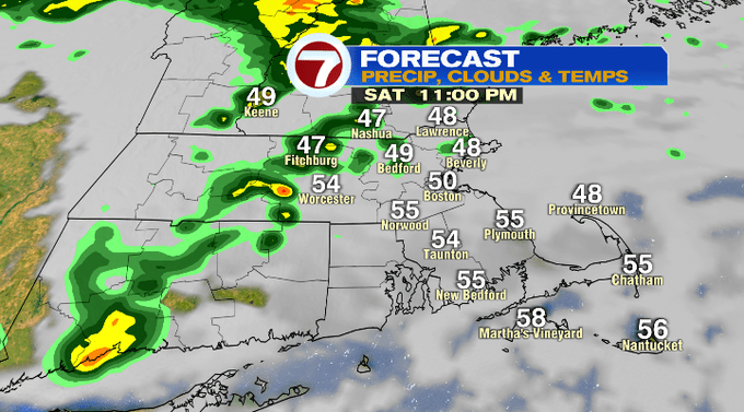
As for the rain, we have two rounds of showers with embedded downpours. That first round is with us for the morning and early afternoon before that departs off the coast. The second round doesn’t slide in until later this evening (after 7pm) and will swing in from west to east.
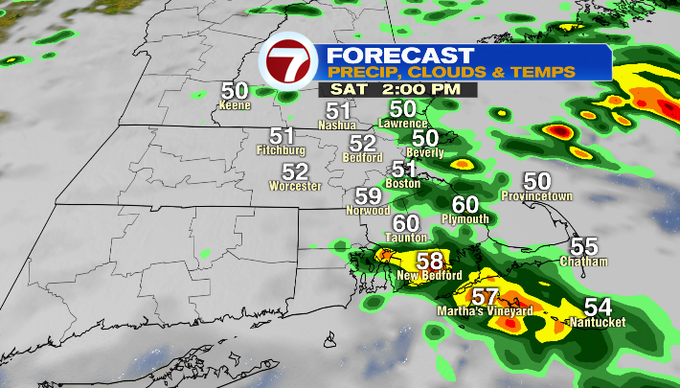
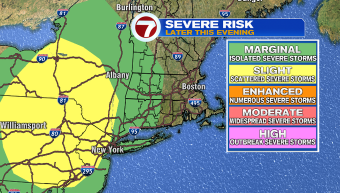
That second line could contain some embedded thunder and stronger storms, however, the better chance for strong to severe storms will be to our west in upstate NY and portions of PA and NJ where the Storm Prediction Center has planed under a Slight Risk.
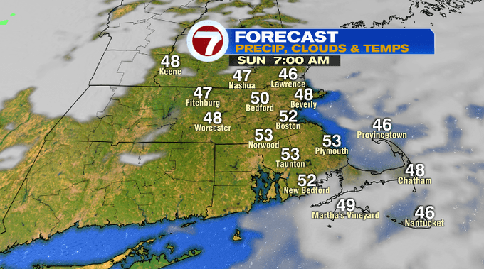
Those showers move out after midnight and we could have some fog overnight. It should be a mainly clear start to our Sunday morning before more clouds build in for the afternoon.
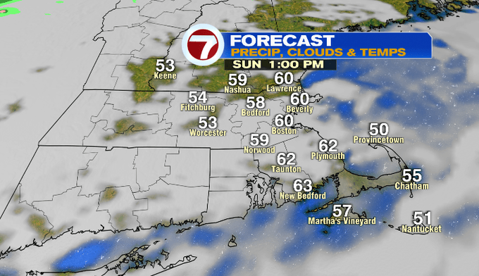
Sunday is the pick of the weekend with a mix of sun and clouds and highs around 60°.
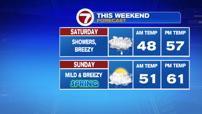
It will be breezy, but a nice day for your outdoor plans including the St. Patrick’s Day parade in Southie.
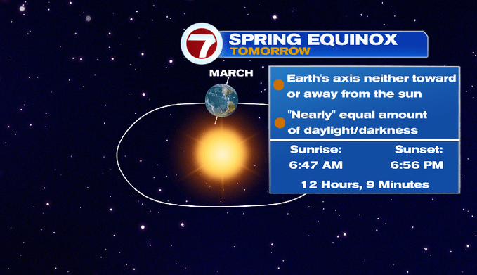
Also, the Spring Equinox is tomorrow. Equinox means nearly “equal” day and night. It’s also known as “astronomical spring” and correlates to the sun’s rays focused on the equator as the Earth’s axis is neither tilted toward or away from the sun. Spring officially begins at 11:33am Sunday.
For the work week, it will be mostly sunny and windy Monday. We’ll have increasing clouds Wednesday ahead of our next chance for showers Wednesday night through Thursday. A few showers could linger into Friday.