

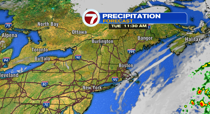
Happy Monday! It was a bright and fall-like day today. We’ll continue to have similar days ahead this week with a few more clouds for some and a bit of a breeze.
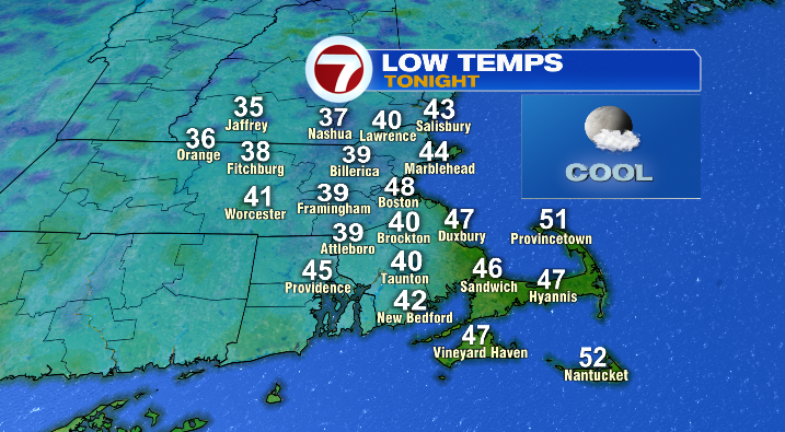
First, an offshore storm will bring more cloud coverage tonight to southeastern Massachusetts, with partly cloudy conditions elsewhere near the coast and clearer conditions farther inland. That means overnight lows will vary greatly as clouds act like a blanket at nighttime and keep temperatures more mild. Most get down to the 30s or 40s with lows on the Cape/islands much more mild:
Highs on Tuesday will be pretty similar to today, overall in the upper 50s and low 60s.
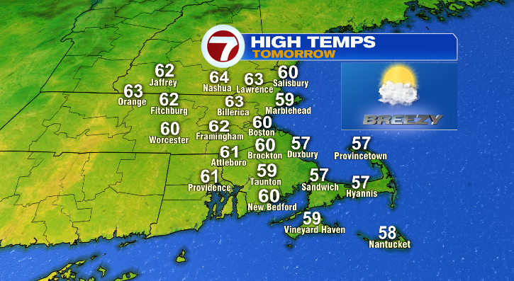
Cloud coverage, again, will be greatest the farther south and east you are.
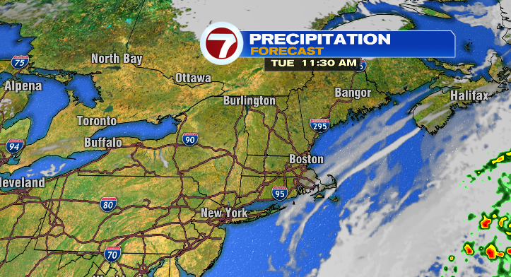
Otherwise, it’ll be breezy for everyone but downright windy on the Cape. Wednesday looks similar, but cooler. Cloud coverage looks greatest along the coastline and in southeastern Massachusetts, with brighter conditions the farther north and west you go.
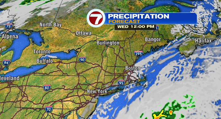
Lows at the coast will be more mild in the 40s with lows farther inland in the upper 30s and low 40s. Highs will only reach the mid to upper 50s, and the breeze will be churning. It’ll be even more windy on the Cape.
Thursday morning will vary. Lows stick to the 40s at the coast with inland morning temperatures in the upper 30s and low 40s. At least afternoon highs will be warmer in the low 60s. Skies look partly sunny, and it’ll still be a bit breezy.
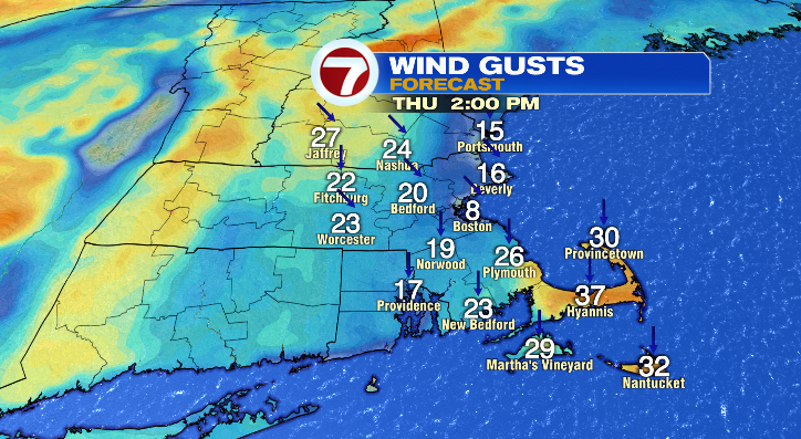
Friday morning lows start off in the upper 30s and low 40s with another slight cooldown in the afternoon to the low to mid 50s. At least the sun will be out! The breeze will still be around, though.
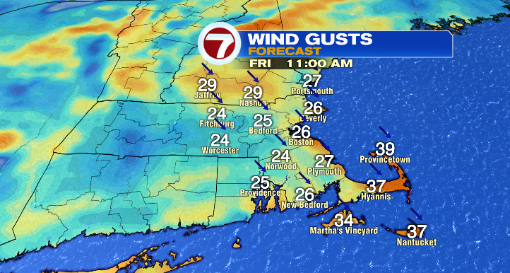
This weekend looks amazing! Most importantly: we ditch the wind. Saturday: low to mid 30s inland to start, upper 30s and low 40s at the coast to start the day. Highs will jump to the mid to upper 50s with mostly sunny skies. Sunday morning, mid to upper 30s inland and upper 30s/low 40s at the coast in the morning. The afternoon looks warm and bright! Highs will jump to the low to mid 60s. Enjoy it!